TopoQuest Logo
Do you find TopoQuest useful?
Help keep TopoQuest running and adding new maps/features by donating!
Bitcoin:  19c7KJd3qBynnjoSw5npx9KScwjBe4ifkT
Litecoin:  LXs6TkuXGGXo1vDsWCkWVdjQX94eUKd6ui
Home View Maps Find Maps Find Places Resources & Links


Lac du Flambeau SW, Wisconsin Topographic Map

USGS Map Title: Lac du Flambeau SW, WI
USGS Map MRC: 45089G8
DRG (GeoTIFF) Download: o45089g8.tif


Neighboring USGS Topographic Map Quads:


  Pike Lake, WI  
45090H1
 

  Lac du Flambeau, WI  
45089H8
 

  Fence Lake, WI  
45089H7
 

  Pike Lake SE, WI  
45090G1
 

  Lac du Flambeau SW, WI  
45089G8
 

  Mercer Lake, WI  
45089G7
 

  Thunder Creek, WI  
45090F1
 

  Pier Lake, WI  
45089F8
 

  Burrows Lake, WI  
45089F7


Map MRC Location:

N46°
W90°
N46°
W89°
H8 H7 H6 H5 H4 H3 H2 H1
G8 G7 G6 G5 G4 G3 G2 G1
F8 F7 F6 F5 F4 F3 F2 F1
E8 E7 E6 E5 E4 E3 E2 E1
D8 D7 D6 D5 D4 D3 D2 D1
C8 C7 C6 C5 C4 C3 C2 C1
B8 B7 B6 B5 B4 B3 B2 B1
A8 A7 A6 A5 A4 A3 A2 A1
N45°
W90°
N45°
W89°

Lac du Flambeau SW, WI USGS 1:24K Topographic Map Preview:
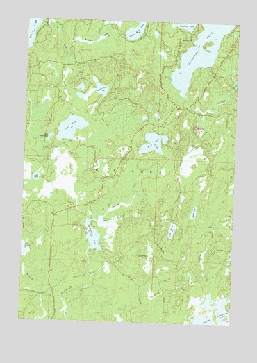
Lac du Flambeau SW, WI USGS Topographic Map
Click on map above to begin viewing in our Map Viewer.

This topographic map contains these locations and features:
Feature Name Type Latitude Longitude GNIS ID View Map
Baycat LakeLakeN45.8462°W89.9554°1561324View Map
Buckskin CreekStreamN45.8702°W89.9818°1578876View Map
Camp Fifteen SpringsSpringN45.7766°W89.9249°1562606View Map
Diamond LakeLakeN45.8748°W89.9075°1579127View Map
Great Bass LakeLakeN45.8708°W89.9365°1579361View Map
Lake MarieLakeN45.7885°W89.9111°1569036View Map
Lake SixteenLakeN45.7790°W89.9987°1580425View Map
Langley CreekStreamN45.7633°W89.8874°1567836View Map
Little Stone LakeLakeN45.8261°W89.9855°1568429View Map
Lost LakeLakeN45.8093°W89.9925°1568671View Map
McGrass CreekStreamN45.7916°W89.9604°1569226View Map
My LakeLakeN45.8749°W89.9492°1577441View Map
Pine LakeLakeN45.8247°W89.9239°1571499View Map
Smith LakeLakeN45.7961°W89.8985°1574306View Map
Spring CreekStreamN45.7580°W89.8921°1574624View Map
Squirrel Hill Lookout TowerTowerN45.8313°W89.8990°1581345View Map
Squirrel LakeReservoirN45.8687°W89.8948°1580522View Map
Stone CreekStreamN45.8747°W89.9913°1580537View Map
Stone LakeLakeN45.8301°W89.9731°1574925View Map
Swamsauger LakeLakeN45.7853°W89.9578°1575157View Map
Town of MinocquaCivilN45.8221°W89.8865°1583727View Map
Yukon CreekStreamN45.8375°W89.8952°1577120View Map

Note: Coordinates in the location and feature list above are referenced to NAD83 datum.


Copyright (C) 2008-2025 Ryan Niemi / Sunset Dynamics ... All Rights Reserved