TopoQuest Logo
Do you find TopoQuest useful?
Help keep TopoQuest running and adding new maps/features by donating!
Bitcoin:  19c7KJd3qBynnjoSw5npx9KScwjBe4ifkT
Litecoin:  LXs6TkuXGGXo1vDsWCkWVdjQX94eUKd6ui
Home View Maps Find Maps Find Places Resources & Links


Mercer Lake, Wisconsin Topographic Map

USGS Map Title: Mercer Lake, WI
USGS Map MRC: 45089G7
DRG (GeoTIFF) Download: o45089g7.tif


Neighboring USGS Topographic Map Quads:


  Lac du Flambeau, WI  
45089H8
 

  Fence Lake, WI  
45089H7
 

  Woodruff, WI  
45089H6
 

  Lac du Flambeau SW, WI  
45089G8
 

  Mercer Lake, WI  
45089G7
 

  Hazelhurst, WI  
45089G6
 

  Pier Lake, WI  
45089F8
 

  Burrows Lake, WI  
45089F7
 

  Harshaw, WI  
45089F6


Map MRC Location:

N46°
W90°
N46°
W89°
H8 H7 H6 H5 H4 H3 H2 H1
G8 G7 G6 G5 G4 G3 G2 G1
F8 F7 F6 F5 F4 F3 F2 F1
E8 E7 E6 E5 E4 E3 E2 E1
D8 D7 D6 D5 D4 D3 D2 D1
C8 C7 C6 C5 C4 C3 C2 C1
B8 B7 B6 B5 B4 B3 B2 B1
A8 A7 A6 A5 A4 A3 A2 A1
N45°
W90°
N45°
W89°

Mercer Lake, WI USGS 1:24K Topographic Map Preview:
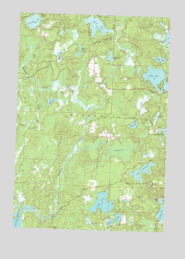
Mercer Lake, WI USGS Topographic Map
Click on map above to begin viewing in our Map Viewer.

This topographic map contains these locations and features:
Feature Name Type Latitude Longitude GNIS ID View Map
Bear LakeLakeN45.7656°W89.8015°1561387View Map
Bellmore LakeLakeN45.8507°W89.8414°1561545View Map
Blue LakeLakeN45.8392°W89.7580°1561944View Map
Bobcat LakeLakeN45.8503°W89.7574°1561990View Map
Caps CreekStreamN45.7638°W89.8704°1562712View Map
Franklin LakeLakeN45.8702°W89.8639°1565261View Map
Garth LakeLakeN45.7611°W89.7513°1565433View Map
Howards CreekStreamN45.8305°W89.8557°1566768View Map
Kaubashine CreekStreamN45.7944°W89.8279°1567363View Map
Kitty CreekStreamN45.8072°W89.7674°1567540View Map
Kitty SpringsLakeN45.8180°W89.7589°1567541View Map
Lake SeventeenLakeN45.7790°W89.7695°1573920View Map
Mercer LakeLakeN45.8686°W89.8114°1569359View Map
Meyer LakeLakeN45.8239°W89.8468°1569390View Map
Myrtle LakeLakeN45.7685°W89.7533°1570088View Map
Scotchman LakeLakeN45.8521°W89.8258°1573836View Map
Silver LakeLakeN45.8118°W89.7777°1574147View Map
Squirrel RiverStreamN45.8197°W89.8138°1574778View Map
Squirrel River Pines State Natural AreaParkN45.8556°W89.8706°2095669View Map
Threemile CreekStreamN45.8119°W89.7646°1575420View Map
Tomahawk River Pines State Natural AreaParkN45.7836°W89.8364°2095671View Map
Twin LakesLakeN45.7576°W89.7880°1575805View Map
Windowpane LakeLakeN45.8506°W89.7987°1576856View Map

Note: Coordinates in the location and feature list above are referenced to NAD83 datum.


Copyright (C) 2008-2025 Ryan Niemi / Sunset Dynamics ... All Rights Reserved