TopoQuest Logo
Do you find TopoQuest useful?
Help keep TopoQuest running and adding new maps/features by donating!
Bitcoin:  19c7KJd3qBynnjoSw5npx9KScwjBe4ifkT
Litecoin:  LXs6TkuXGGXo1vDsWCkWVdjQX94eUKd6ui
Home View Maps Find Maps Find Places Resources & Links


Laclede, Missouri Topographic Map

USGS Map Title: Laclede, MO
USGS Map MRC: 39093G2
DRG (GeoTIFF) Download: o39093g2.tif


Neighboring USGS Topographic Map Quads:


  Eversonville, MO  
39093H3
 

  Linneus, MO  
39093H2
 

  Shelby, MO  
39093H1
 

  Meadville, MO  
39093G3
 

  Laclede, MO  
39093G2
 

  Brookfield, MO  
39093G1
 

  Fountain Grove, MO  
39093F3
 

  Sumner, MO  
39093F2
 

  Rothville, MO  
39093F1


Map MRC Location:

N40°
W94°
N40°
W93°
H8 H7 H6 H5 H4 H3 H2 H1
G8 G7 G6 G5 G4 G3 G2 G1
F8 F7 F6 F5 F4 F3 F2 F1
E8 E7 E6 E5 E4 E3 E2 E1
D8 D7 D6 D5 D4 D3 D2 D1
C8 C7 C6 C5 C4 C3 C2 C1
B8 B7 B6 B5 B4 B3 B2 B1
A8 A7 A6 A5 A4 A3 A2 A1
N39°
W94°
N39°
W93°

Laclede, MO USGS 1:24K Topographic Map Preview:
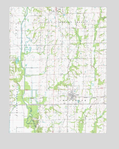
Laclede, MO USGS Topographic Map
Click on map above to begin viewing in our Map Viewer.

This topographic map contains these locations and features:
Feature Name Type Latitude Longitude GNIS ID View Map
Big Turkey CreekStreamN39.8642°W93.1321°714232View Map
City of LacledeCivilN39.7878°W93.1697°2395577View Map
General John J. Pershing Boyhood HomeBuildingN39.7881°W93.1694°2463093View Map
Higgins DitchCanalN39.7650°W93.2491°719512View Map
Kemper BranchStreamN39.8720°W93.2269°720528View Map
LacledePopulated PlaceN39.7856°W93.1666°720726View Map
Laclede Community Fire Protection DistrictBuildingN39.7900°W93.1700°2621128View Map
Laclede Post OfficePost OfficeN39.7851°W93.1689°2782972View Map
Locust Creek SchoolSchoolN39.7572°W93.1933°721384View Map
Moore SchoolSchoolN39.8575°W93.1416°722588View Map
Muddy CreekStreamN39.7678°W93.2202°723036View Map
NeedlesLocaleN39.7864°W93.1374°759953View Map
Oak Arbor School (historical)SchoolN39.7800°W93.1260°723552View Map
Pershing State ParkParkN39.7667°W93.2169°724245View Map
Plum Grove SchoolSchoolN39.8131°W93.2005°724671View Map
Slater SchoolSchoolN39.8584°W93.2099°726535View Map
Strawberry BranchStreamN39.8656°W93.2302°727173View Map
Sunny Point SchoolSchoolN39.8225°W93.1724°727300View Map
Township of JeffersonCivilN39.7713°W93.1759°766920View Map

Note: Coordinates in the location and feature list above are referenced to NAD83 datum.


Copyright (C) 2008-2025 Ryan Niemi / Sunset Dynamics ... All Rights Reserved