TopoQuest Logo
Do you find TopoQuest useful?
Help keep TopoQuest running and adding new maps/features by donating!
Bitcoin:  19c7KJd3qBynnjoSw5npx9KScwjBe4ifkT
Litecoin:  LXs6TkuXGGXo1vDsWCkWVdjQX94eUKd6ui
Home View Maps Find Maps Find Places Resources & Links


Laconia, Tennessee Topographic Map

USGS Map Title: Laconia, TN
USGS Map MRC: 35089C3
DRG (GeoTIFF) Download: o35089c3.tif


Neighboring USGS Topographic Map Quads:


  Stanton, TN  
35089D4
 

  Dancyville, TN  
35089D3
 

  Hillville, TN  
35089D2
 

  Lambert, TN  
35089C4
 

  Laconia, TN  
35089C3
 

  Whiteville, TN  
35089C2
 

  Macon, TN  
35089B4
 

  Somerville, TN  
35089B3
 

  Hickory Valley, TN  
35089B2


Map MRC Location:

N36°
W90°
N36°
W89°
H8 H7 H6 H5 H4 H3 H2 H1
G8 G7 G6 G5 G4 G3 G2 G1
F8 F7 F6 F5 F4 F3 F2 F1
E8 E7 E6 E5 E4 E3 E2 E1
D8 D7 D6 D5 D4 D3 D2 D1
C8 C7 C6 C5 C4 C3 C2 C1
B8 B7 B6 B5 B4 B3 B2 B1
A8 A7 A6 A5 A4 A3 A2 A1
N35°
W90°
N35°
W89°

Laconia, TN USGS 1:24K Topographic Map Preview:
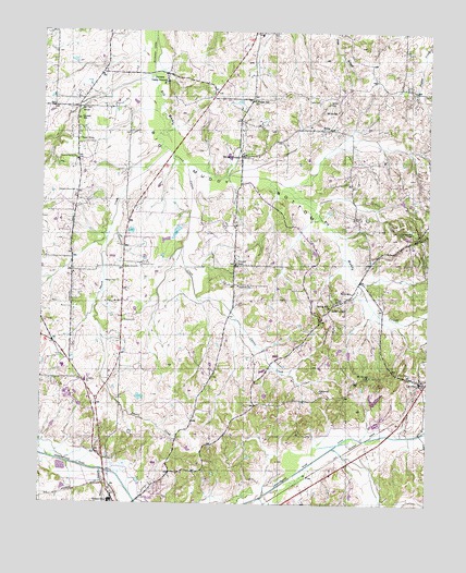
Laconia, TN USGS Topographic Map
Click on map above to begin viewing in our Map Viewer.

This topographic map contains these locations and features:
Feature Name Type Latitude Longitude GNIS ID View Map
Alexander ChapelChurchN35.3137°W89.3120°1275557View Map
Alexander SchoolSchoolN35.3079°W89.3115°1275562View Map
Armour CreekStreamN35.2515°W89.2648°1275858View Map
Burns Shop (historical)LocaleN35.2806°W89.2748°1319798View Map
Catron CreekStreamN35.3393°W89.3284°1279906View Map
Commissioner District 2CivilN35.2730°W89.2647°2463917View Map
Duncan LakeReservoirN35.2909°W89.2785°1301727View Map
Duncan Lake DamDamN35.2918°W89.2784°1301726View Map
Fayette Corners Division (historical)CensusN35.3515°W89.2642°1648684View Map
Fayette County Vocational CenterSchoolN35.2862°W89.3678°1319813View Map
Garnett SchoolSchoolN35.3518°W89.3637°1285181View Map
Hilliard School (historical)SchoolN35.3181°W89.2687°1319839View Map
Hobson CemeteryCemeteryN35.3090°W89.3501°1287942View Map
Howell CreekStreamN35.2526°W89.3020°1304745View Map
Jefferson Elementary SchoolSchoolN35.2826°W89.3606°1648389View Map
Joyners CampgroundLocaleN35.3620°W89.3351°1289864View Map
Kings CreekStreamN35.2651°W89.2801°1269279View Map
LaconiaPopulated PlaceN35.2823°W89.2520°1290442View Map
Laconia Post OfficePost OfficeN35.2826°W89.2524°1651342View Map
Liberty HillPopulated PlaceN35.3023°W89.2809°1315391View Map
Liberty School (historical)SchoolN35.3031°W89.2803°1319851View Map
Lipsky CreekStreamN35.3629°W89.3395°1647506View Map
Love SchoolSchoolN35.2848°W89.2592°1292129View Map
Marsh LakeReservoirN35.2779°W89.2664°1301714View Map
Marsh Lake DamDamN35.2768°W89.2684°1301715View Map
MillerPopulated PlaceN35.3492°W89.2826°1293899View Map
Miller CemeteryCemeteryN35.3565°W89.2826°1293915View Map
Miller SchoolSchoolN35.3542°W89.2798°1293965View Map
Mission Church (historical)ChurchN35.2654°W89.3198°1319857View Map
Mount Carmel CemeteryCemeteryN35.2842°W89.2678°1319863View Map
Mount Carmel ChurchChurchN35.2840°W89.2684°1294575View Map
Olive ChurchChurchN35.3567°W89.3073°1319888View Map
Pepper SchoolSchoolN35.3570°W89.3070°1297173View Map
Perry SchoolSchoolN35.3062°W89.2742°1297221View Map
Pleasant Grove ChurchChurchN35.3415°W89.3642°1297815View Map
Pleasant Grove SchoolSchoolN35.3326°W89.3640°1297837View Map
Pontotoc HillSummitN35.2793°W89.2840°1298125View Map
Pontotoc School (historical)SchoolN35.2779°W89.2942°1319897View Map
Seymour SchoolSchoolN35.2984°W89.3484°1301136View Map
Shady Grove ChurchChurchN35.3129°W89.3490°1301167View Map
Shiloh ChurchChurchN35.3481°W89.3634°1319913View Map
Shiloh ChurchChurchN35.3543°W89.3620°1319914View Map
Smart CreekStreamN35.3426°W89.3337°1270548View Map
Somerville CemeteryCemeteryN35.2523°W89.3509°1319920View Map
Spring Hill CemeteryCemeteryN35.3220°W89.2551°1271103View Map
Spring Hill ChurchChurchN35.3023°W89.2815°1271107View Map
Taylor CemeteryCemeteryN35.3567°W89.2856°1272194View Map
Taylor ChapelLocaleN35.3423°W89.3103°1304021View Map
Taylors Chapel CemeteryCemeteryN35.3448°W89.3067°1319929View Map
Town BranchStreamN35.2590°W89.3548°1269288View Map
Town CreekStreamN35.2590°W89.3548°1269289View Map
Travelers Rest ChurchChurchN35.2843°W89.2601°1319931View Map
Wells Land Company LakeReservoirN35.3220°W89.3316°1301746View Map
Wells Land Company Lake DamDamN35.3234°W89.3301°1301747View Map
Yum YumPopulated PlaceN35.3454°W89.3640°1304716View Map

Note: Coordinates in the location and feature list above are referenced to NAD83 datum.


Copyright (C) 2008-2025 Ryan Niemi / Sunset Dynamics ... All Rights Reserved