TopoQuest Logo
Do you find TopoQuest useful?
Help keep TopoQuest running and adding new maps/features by donating!
Bitcoin:  19c7KJd3qBynnjoSw5npx9KScwjBe4ifkT
Litecoin:  LXs6TkuXGGXo1vDsWCkWVdjQX94eUKd6ui
Home View Maps Find Maps Find Places Resources & Links


Macon, Tennessee Topographic Map

USGS Map Title: Macon, TN
USGS Map MRC: 35089B4
DRG (GeoTIFF) Download: o35089b4.tif


Neighboring USGS Topographic Map Quads:


  Gallaway, TN  
35089C5
 

  Lambert, TN  
35089C4
 

  Laconia, TN  
35089C3
 

  Oakland, TN  
35089B5
 

  Macon, TN  
35089B4
 

  Somerville, TN  
35089B3
 

  Rossville, TN  
35089A5
 

  Moscow, TN  
35089A4
 

  Moscow SE, TN  
35089A3


Map MRC Location:

N36°
W90°
N36°
W89°
H8 H7 H6 H5 H4 H3 H2 H1
G8 G7 G6 G5 G4 G3 G2 G1
F8 F7 F6 F5 F4 F3 F2 F1
E8 E7 E6 E5 E4 E3 E2 E1
D8 D7 D6 D5 D4 D3 D2 D1
C8 C7 C6 C5 C4 C3 C2 C1
B8 B7 B6 B5 B4 B3 B2 B1
A8 A7 A6 A5 A4 A3 A2 A1
N35°
W90°
N35°
W89°

Macon, TN USGS 1:24K Topographic Map Preview:
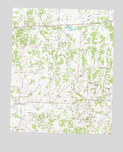
Macon, TN USGS Topographic Map
Click on map above to begin viewing in our Map Viewer.

This topographic map contains these locations and features:
Feature Name Type Latitude Longitude GNIS ID View Map
Bluff CreekStreamN35.2309°W89.4659°1277825View Map
Burnett School (historical)SchoolN35.1312°W89.4190°1319797View Map
Chaffin CemeteryCemeteryN35.2245°W89.4320°1280192View Map
City of WillistonCivilN35.1582°W89.3754°2405751View Map
Commissioner District 1CivilN35.2324°W89.3973°2464229View Map
Commissioner District 6CivilN35.1574°W89.4511°2464528View Map
Corner SchoolSchoolN35.2095°W89.4429°1281319View Map
Double W Ranch LakeReservoirN35.1254°W89.4701°1301586View Map
Double W Ranch Lake DamDamN35.1268°W89.4684°1301587View Map
Dungan CemeteryCemeteryN35.1762°W89.4040°1283178View Map
East Macon Church (historical)ChurchN35.1618°W89.4540°1319806View Map
Ebenezer Church (historical)ChurchN35.1809°W89.4623°1319808View Map
Fayette CountyCivilN35.1971°W89.4144°1639742View Map
Fayette County AirportAirportN35.2073°W89.3932°1301317View Map
Gaither School (historical)SchoolN35.1581°W89.4187°1319821View Map
Glengary LakeReservoirN35.2304°W89.4289°1285511View Map
Glengary Lake DamDamN35.2337°W89.4326°1307087View Map
Granbery CemeteryCemeteryN35.1598°W89.4926°1285813View Map
Granbery CemeteryCemeteryN35.1679°W89.4901°1285814View Map
Harris CemeteryCemeteryN35.1529°W89.4856°1286952View Map
Jones ChapelChurchN35.1404°W89.4059°1289769View Map
Jones Chapel CemeteryCemeteryN35.1395°W89.4051°1319843View Map
Jones School (historical)SchoolN35.1393°W89.4059°1319844View Map
Ketchum CemeteryCemeteryN35.2187°W89.4467°1290109View Map
Lewis Parrot CemeteryCemeteryN35.1620°W89.4406°1291089View Map
MaconPopulated PlaceN35.1531°W89.4898°1292459View Map
Macon CemeteryCemeteryN35.1631°W89.4778°1292460View Map
Macon ChurchChurchN35.1609°W89.4798°1292461View Map
Macon Post OfficePost OfficeN35.1531°W89.4917°1651345View Map
Macon School (historical)SchoolN35.1512°W89.4948°1319853View Map
Macon Volunteer Fire DepartmentBuildingN35.1541°W89.4935°2653651View Map
McCulley CemeteryCemeteryN35.2298°W89.4870°1293222View Map
McFerrin CemeteryCemeteryN35.2104°W89.3812°1293293View Map
Moe CemeteryCemeteryN35.1915°W89.3901°1294146View Map
Morris CemeteryCemeteryN35.1498°W89.4020°1294413View Map
Mosby SchoolSchoolN35.1729°W89.4648°1294476View Map
Perry CemeteryCemeteryN35.2187°W89.4073°1297201View Map
Person CemeteryCemeteryN35.2251°W89.4562°1297236View Map
PowersPopulated PlaceN35.2376°W89.4137°1298434View Map
Saint Pauls CemeteryCemeteryN35.1270°W89.3803°1319909View Map
Saint Pauls ChurchChurchN35.1279°W89.3798°1300503View Map
Sardis CemeteryCemeteryN35.1790°W89.4515°1300790View Map
Shady Grove CemeteryCemeteryN35.1756°W89.3970°1319911View Map
Shady Grove ChurchChurchN35.1748°W89.3976°1301164View Map
Southwest Elementary SchoolSchoolN35.1398°W89.4879°1319923View Map
Spring Hill CemeteryCemeteryN35.2315°W89.4345°1319924View Map
Spring Hill ChurchChurchN35.2315°W89.4337°1271106View Map
Tarpley CemeteryCemeteryN35.1556°W89.4648°1272134View Map
Tharp CemeteryCemeteryN35.2040°W89.4412°1272359View Map
Town of SomervilleCivilN35.2346°W89.3832°2407366View Map
Waller CemeteryCemeteryN35.1962°W89.4712°1273695View Map
WarrenPopulated PlaceN35.2384°W89.4429°1273818View Map
Wesley CemeteryCemeteryN35.1837°W89.4130°1319934View Map
Wesley ChurchChurchN35.1831°W89.4131°1304452View Map
Wesley School (historical)SchoolN35.1840°W89.4140°1319935View Map

Note: Coordinates in the location and feature list above are referenced to NAD83 datum.


Copyright (C) 2008-2025 Ryan Niemi / Sunset Dynamics ... All Rights Reserved