TopoQuest Logo
Do you find TopoQuest useful?
Help keep TopoQuest running and adding new maps/features by donating!
Bitcoin:  19c7KJd3qBynnjoSw5npx9KScwjBe4ifkT
Litecoin:  LXs6TkuXGGXo1vDsWCkWVdjQX94eUKd6ui
Home View Maps Find Maps Find Places Resources & Links


Bangor, Michigan Topographic Map

USGS Map Title: Bangor, MI
USGS Map MRC: 42086C1
DRG (GeoTIFF) Download: o42086c1.tif


Neighboring USGS Topographic Map Quads:


  Lacota, MI  
42086D2
 

  Pullman, MI  
42086D1
 

  Bloomingdale, MI  
42085D8
 

  McDonald, MI  
42086C2
 

  Bangor, MI  
42086C1
 

  Gobles West, MI  
42085C8
 

  Hartford, MI  
42086B2
 

  Lawrence, MI  
42086B1
 

  Paw Paw, MI  
42085B8


Map MRC Location:

N43°
W87°
N43°
W86°
H8 H7 H6 H5 H4 H3 H2 H1
G8 G7 G6 G5 G4 G3 G2 G1
F8 F7 F6 F5 F4 F3 F2 F1
E8 E7 E6 E5 E4 E3 E2 E1
D8 D7 D6 D5 D4 D3 D2 D1
C8 C7 C6 C5 C4 C3 C2 C1
B8 B7 B6 B5 B4 B3 B2 B1
A8 A7 A6 A5 A4 A3 A2 A1
N42°
W87°
N42°
W86°

Bangor, MI USGS 1:24K Topographic Map Preview:
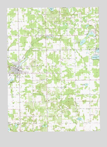
Bangor, MI USGS Topographic Map
Click on map above to begin viewing in our Map Viewer.

This topographic map contains these locations and features:
Feature Name Type Latitude Longitude GNIS ID View Map
Ackley SchoolSchoolN42.3459°W86.1103°619806View Map
Arlington Center SchoolSchoolN42.2936°W86.0528°620220View Map
Arlington Heights SchoolSchoolN42.2584°W86.0509°620221View Map
Arlington Hill CemeteryCemeteryN42.3153°W86.0978°2112804View Map
Arlington Post Office (historical)Post OfficeN42.2731°W86.0711°2574495View Map
BangorPopulated PlaceN42.3125°W86.1131°620546View Map
Bangor Baptist ChurchChurchN42.3092°W86.0861°2574992View Map
Bangor Branch LibraryBuildingN42.3128°W86.1142°2575005View Map
Bangor City HallBuildingN42.3133°W86.1111°2575004View Map
Bangor Community Fire DepartmentBuildingN42.3086°W86.1146°2575003View Map
Bangor High SchoolSchoolN42.3078°W86.1217°2575009View Map
Bangor Medical CenterHospitalN42.3092°W86.0928°2575002View Map
Bangor Middle SchoolSchoolN42.3078°W86.1219°2575008View Map
Bangor Police DepartmentBuildingN42.3141°W86.1105°2574999View Map
Bangor Post OfficePost OfficeN42.3139°W86.1117°2575000View Map
Bangor Primary SchoolSchoolN42.3092°W86.1119°2575007View Map
Bangor South Walnut Elementary SchoolSchoolN42.3056°W86.1125°2575006View Map
Bangor StationLocaleN42.3142°W86.1114°2575001View Map
Black River Extension DrainStreamN42.3361°W86.0386°1617401View Map
BreedsvillePopulated PlaceN42.3464°W86.0731°621915View Map
Breedsville CemeteryCemeteryN42.3458°W86.0611°2574959View Map
Breedsville Post OfficePost OfficeN42.3464°W86.0731°2574497View Map
Breedsville StationLocaleN42.3475°W86.0783°2574176View Map
Carroll LakeLakeN42.2556°W86.0728°622787View Map
Cedar DrainStreamN42.3011°W86.1150°1623098View Map
Church of ChristChurchN42.3114°W86.1117°2574995View Map
City of BangorCivilN42.3121°W86.1133°1625879View Map
Coburn CemeteryCemeteryN42.2650°W86.0703°623526View Map
Coloma Emergency Medical Services Medical Transport Station 3BuildingN42.3739°W86.0536°2662119View Map
Columbia Township Fire Department Station 2BuildingN42.3739°W86.0536°2636144View Map
East Arlington ChurchChurchN42.2725°W86.0139°2112799View Map
Family Gospel ChapelChurchN42.3117°W86.1142°2574997View Map
First Congregational ChurchChurchN42.3114°W86.1111°2574994View Map
Fisk LakeLakeN42.2624°W86.0280°626088View Map
Free Methodist ChurchChurchN42.3103°W86.1131°2574996View Map
Garden of Eden SchoolSchoolN42.3161°W86.0236°626630View Map
Great Bear Lake DrainCanalN42.3639°W86.0111°2112806View Map
Haney LakeLakeN42.2526°W86.1248°1623103View Map
Hicks CemeteryCemeteryN42.2667°W86.0128°2112798View Map
Hicks SchoolSchoolN42.2717°W86.0125°628202View Map
Hillocher LakeLakeN42.2554°W86.0774°628318View Map
Hogmire SchoolSchoolN42.3070°W86.0725°628401View Map
Hoppin CemeteryCemeteryN42.3167°W86.0858°2112803View Map
Jeptha Lake Golf CourseLocaleN42.3453°W86.0036°2574991View Map
Lake FourteenLakeN42.2969°W86.0178°626342View Map
Lakeside SchoolSchoolN42.3495°W86.0236°630038View Map
Lee SchoolSchoolN42.3314°W86.0525°630260View Map
Lions ParkParkN42.3167°W86.1139°2112805View Map
Lower Jeptha LakeLakeN42.3395°W86.0226°631173View Map
Lower Jeptha Lake DrainStreamN42.3361°W86.0386°1623109View Map
Maple CreekStreamN42.3175°W86.1209°631421View Map
Mill PondLakeN42.3170°W86.1070°632333View Map
Munson LakeLakeN42.3735°W86.0643°633129View Map
Nelson Extension DrainStreamN42.3011°W86.1150°1623114View Map
New Jerusalem ChurchChurchN42.3361°W86.1089°2112807View Map
Orton SchoolSchoolN42.2795°W86.0722°634117View Map
Sacred Heart ChurchChurchN42.3067°W86.1111°2112800View Map
Sacred Heart ChurchChurchN42.3158°W86.0606°2112802View Map
Saddle Lake SchoolSchoolN42.3684°W86.0531°636477View Map
Scott LakesLakeN42.3223°W86.0000°1623121View Map
Simpson United Methodist ChurchChurchN42.3128°W86.1156°2574998View Map
South Scott LakeLakeN42.3243°W86.0025°637473View Map
Southard CemeteryCemeteryN42.2589°W86.1089°2112801View Map
Southard LakeLakeN42.2565°W86.1139°638431View Map
Stillwell LakeLakeN42.3559°W86.0159°638848View Map
Swamp SchoolSchoolN42.3314°W86.0142°639146View Map
Township of ArlingtonCivilN42.2879°W86.0510°1625849View Map
Trinity Evangelical Lutheran ChurchChurchN42.3125°W86.1086°2574993View Map
Upper Jeptha LakeLakeN42.3475°W86.0103°1615405View Map
Village of BreedsvilleCivilN42.3489°W86.0717°2397447View Map

Note: Coordinates in the location and feature list above are referenced to NAD83 datum.


Copyright (C) 2008-2024 Ryan Niemi / Sunset Dynamics ... All Rights Reserved