TopoQuest Logo
Do you find TopoQuest useful?
Help keep TopoQuest running and adding new maps/features by donating!
Bitcoin:  19c7KJd3qBynnjoSw5npx9KScwjBe4ifkT
Litecoin:  LXs6TkuXGGXo1vDsWCkWVdjQX94eUKd6ui
Home View Maps Find Maps Find Places Resources & Links


Pullman, Michigan Topographic Map

USGS Map Title: Pullman, MI
USGS Map MRC: 42086D1
DRG (GeoTIFF) Download: o42086d1.tif


Neighboring USGS Topographic Map Quads:


  Glenn, MI  
42086E2
 

  Fennville, MI  
42086E1
 

  Millgrove, MI  
42085E8
 

  Lacota, MI  
42086D2
 

  Pullman, MI  
42086D1
 

  Bloomingdale, MI  
42085D8
 

  McDonald, MI  
42086C2
 

  Bangor, MI  
42086C1
 

  Gobles West, MI  
42085C8


Map MRC Location:

N43°
W87°
N43°
W86°
H8 H7 H6 H5 H4 H3 H2 H1
G8 G7 G6 G5 G4 G3 G2 G1
F8 F7 F6 F5 F4 F3 F2 F1
E8 E7 E6 E5 E4 E3 E2 E1
D8 D7 D6 D5 D4 D3 D2 D1
C8 C7 C6 C5 C4 C3 C2 C1
B8 B7 B6 B5 B4 B3 B2 B1
A8 A7 A6 A5 A4 A3 A2 A1
N42°
W87°
N42°
W86°

Pullman, MI USGS 1:24K Topographic Map Preview:
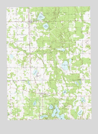
Pullman, MI USGS Topographic Map
Click on map above to begin viewing in our Map Viewer.

This topographic map contains these locations and features:
Feature Name Type Latitude Longitude GNIS ID View Map
Avis Post Office (historical)Post OfficeN42.4844°W86.1236°2573940View Map
BakersvillePopulated PlaceN42.4900°W86.0698°620492View Map
Barber CreekStreamN42.4481°W86.0884°620580View Map
Barrow SchoolSchoolN42.4548°W86.1117°620648View Map
Bronson SchoolSchoolN42.3750°W86.0931°622027View Map
Burrows SchoolSchoolN42.4592°W86.1106°2109209View Map
Camp ChanningLocaleN42.4750°W86.0634°622547View Map
Camp SearsLocaleN42.4828°W86.0642°2109208View Map
Christ Gospel ChurchChurchN42.4850°W86.0903°2574274View Map
Clear LakeLakeN42.4405°W86.0308°623411View Map
Coffee LakeLakeN42.3935°W86.0842°623536View Map
Columbia SchoolSchoolN42.3975°W86.0470°623641View Map
Columbia Township Fire Department Station 1BuildingN42.4046°W86.0747°2636023View Map
Country ChapelChurchN42.4628°W86.1061°2109210View Map
Deer LakeLakeN42.4151°W86.0217°624470View Map
Drum DitchCanalN42.4620°W86.1003°624890View Map
First Congregational ChurchChurchN42.4044°W86.0739°2574833View Map
Gingerbread ChurchChurchN42.4334°W86.0906°626848View Map
Grand JunctionLocaleN42.4014°W86.0758°2574835View Map
Grand JunctionPopulated PlaceN42.4042°W86.0731°627088View Map
Grand Junction CemeteryCemeteryN42.4022°W86.0628°2574958View Map
Grand Junction Post OfficePost OfficeN42.4044°W86.0725°2574834View Map
Hilton SchoolSchoolN42.4834°W86.0320°628338View Map
Horseshoe ChurchChurchN42.4478°W86.0261°2109204View Map
Horseshoe Post Office (historical)Post OfficeN42.4481°W86.0319°2573912View Map
Horseshoe SchoolSchoolN42.4478°W86.0323°628635View Map
Lake ElevenLakeN42.3963°W86.0123°625432View Map
Lake FourteenLakeN42.3825°W86.0172°626343View Map
Lake MoriahLakeN42.4162°W86.0162°632699View Map
LeePopulated PlaceN42.4509°W86.0909°1617676View Map
Lee Post Office (historical)Post OfficeN42.4508°W86.0908°2573911View Map
Lee Township CemeteryCemeteryN42.4564°W86.0614°2109206View Map
Lee Township Fire DepartmentBuildingN42.4824°W86.0902°2635932View Map
Lester LakeLakeN42.4276°W86.0829°630332View Map
Little Bear LakeLakeN42.4055°W86.0396°630552View Map
Little Bear Lake DrainStreamN42.4228°W86.0428°1623108View Map
Lower Scott LakeLakeN42.4887°W86.0740°631183View Map
Melvin CreekStreamN42.4228°W86.0428°632085View Map
Mount Calvary ChurchChurchN42.4547°W86.0728°2109207View Map
Mud LakeLakeN42.4165°W86.0930°632919View Map
New Hope Missionary Baptist ChurchChurchN42.4592°W86.1103°2574273View Map
North LakeLakeN42.3788°W86.0711°633592View Map
Osterhout LakeLakeN42.4349°W86.0387°634147View Map
PullmanPopulated PlaceN42.4836°W86.0914°635511View Map
Pullman Bible ChurchChurchN42.4833°W86.0811°2574122View Map
Pullman ChurchChurchN42.4336°W86.0894°2109205View Map
Pullman Elementary SchoolSchoolN42.4825°W86.0886°2573984View Map
Pullman LibraryBuildingN42.4831°W86.0906°2573982View Map
Pullman Post OfficePost OfficeN42.4831°W86.0906°2573983View Map
Pullman SchoolSchoolN42.4842°W86.1114°635513View Map
Pullman StationLocaleN42.4844°W86.0917°2573986View Map
Sacred Heart CemeteryCemeteryN42.4011°W86.0719°2112778View Map
Saddle LakeLakeN42.3817°W86.0500°636476View Map
Saddle Lake Post Office (historical)Post OfficeN42.3833°W86.0550°2574423View Map
Saints CemeteryCemeteryN42.4222°W86.0803°2574038View Map
Sherman ParkPopulated PlaceN42.4920°W86.0820°637766View Map
Silver LakeLakeN42.3891°W86.0600°637938View Map
Smith SchoolSchoolN42.4298°W86.1098°638173View Map
Spring BrookStreamN42.4511°W86.0628°638538View Map
Spring Brook LakeLakeN42.4518°W86.0404°638549View Map
Township of ColumbiaCivilN42.3756°W86.0522°1626121View Map
Township of LeeCivilN42.4628°W86.0708°1626598View Map
Upper Scott LakeLakeN42.4786°W86.0667°1615412View Map
Warner Memorial CampLocaleN42.4236°W86.0806°2109203View Map
Wildwood SchoolSchoolN42.4400°W86.0706°1616471View Map

Note: Coordinates in the location and feature list above are referenced to NAD83 datum.


Copyright (C) 2008-2025 Ryan Niemi / Sunset Dynamics ... All Rights Reserved