TopoQuest Logo
Do you find TopoQuest useful?
Help keep TopoQuest running and adding new maps/features by donating!
Bitcoin:  19c7KJd3qBynnjoSw5npx9KScwjBe4ifkT
Litecoin:  LXs6TkuXGGXo1vDsWCkWVdjQX94eUKd6ui
Home View Maps Find Maps Find Places Resources & Links


Lake Canadohta, Pennsylvania Topographic Map

USGS Map Title: Lake Canadohta, PA
USGS Map MRC: 41079G7
DRG (GeoTIFF) Download: o41079g7.tif


Neighboring USGS Topographic Map Quads:


  Waterford, PA  
41079H8
 

  Union City, PA  
41079H7
 

  Corry, PA  
41079H6
 

  Millers Station, PA  
41079G8
 

  Lake Canadohta, PA  
41079G7
 

  Spartansburg, PA  
41079G6
 

  Townville, PA  
41079F8
 

  Centerville, PA  
41079F7
 

  Titusville North, PA  
41079F6


Map MRC Location:

N42°
W80°
N42°
W79°
H8 H7 H6 H5 H4 H3 H2 H1
G8 G7 G6 G5 G4 G3 G2 G1
F8 F7 F6 F5 F4 F3 F2 F1
E8 E7 E6 E5 E4 E3 E2 E1
D8 D7 D6 D5 D4 D3 D2 D1
C8 C7 C6 C5 C4 C3 C2 C1
B8 B7 B6 B5 B4 B3 B2 B1
A8 A7 A6 A5 A4 A3 A2 A1
N41°
W80°
N41°
W79°

Lake Canadohta, PA USGS 1:24K Topographic Map Preview:
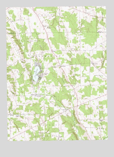
Lake Canadohta, PA USGS Topographic Map
Click on map above to begin viewing in our Map Viewer.

This topographic map contains these locations and features:
Feature Name Type Latitude Longitude GNIS ID View Map
Aldorf CornersLocaleN41.8220°W79.7684°1168136View Map
Bentley SchoolSchoolN41.8709°W79.7834°1205406View Map
Bloomfield Burying GroundCemeteryN41.8189°W79.8170°1169842View Map
Bloomfield RunStreamN41.7781°W79.7931°1169843View Map
Bloomfield SchoolSchoolN41.7920°W79.8334°1169844View Map
Bloomfield Township Volunteer Fire Department 1BuildingN41.7981°W79.8416°2645493View Map
Brimstone CornersLocaleN41.7689°W79.7601°1170258View Map
Canadohta LakePopulated PlaceN41.8137°W79.8348°1852856View Map
Canadohta Lake Census Designated PlaceCensusN41.8177°W79.8364°2389274View Map
Canadohta Ski SlopeLocaleN41.8323°W79.8581°1213161View Map
Clements CornersLocaleN41.7531°W79.8109°1171985View Map
Cottage Hill ChurchChurchN41.8687°W79.7739°1172487View Map
Dutch HillSummitN41.8073°W79.8126°1173654View Map
East Shreve RunStreamN41.8167°W79.8334°1173871View Map
Lady of Fatima ChapelChurchN41.8126°W79.8281°1178749View Map
Lake CanadohtaLakeN41.8129°W79.8381°1171149View Map
Lake Canadohta (historical)CivilN41.8001°W79.7664°1216316View Map
Lake Canadohta Post Office (historical)Post OfficeN41.8137°W79.8348°2027117View Map
LakevillePopulated PlaceN41.8092°W79.8448°1212153View Map
LincolnvillePopulated PlaceN41.7937°W79.8381°1179401View Map
Lincolnville Census Designated PlaceCensusN41.7902°W79.8381°2390071View Map
Loomis CemeteryCemeteryN41.7945°W79.8681°1179936View Map
Maple Grove Church (historical)ChurchN41.7873°W79.8642°1205403View Map
Mosey RunStreamN41.7953°W79.8406°1181606View Map
Mount Pleasant CemeteryCemeteryN41.8345°W79.7933°1181806View Map
Mount Pleasant ChurchChurchN41.8345°W79.7926°1205405View Map
Pages CornersLocaleN41.8195°W79.8081°1183190View Map
Pine Hollow RunStreamN41.7901°W79.7942°1183845View Map
Puckerbrush LakeLakeN41.7738°W79.8621°1184481View Map
RicevillePopulated PlaceN41.7776°W79.8028°1184991View Map
Riceville Census Designated PlaceCensusN41.7793°W79.8046°2389747View Map
RootvillePopulated PlaceN41.7748°W79.8709°1204540View Map
Saint Church (historical)ChurchN41.7809°W79.8642°1205402View Map
Shreve RidgeRidgeN41.8334°W79.8606°1187615View Map
Shreve Ridge CemeteryCemeteryN41.8248°W79.8556°1187616View Map
Shreve Ridge Church (historical)ChurchN41.8270°W79.8570°1205404View Map
Shreve SchoolSchoolN41.8637°W79.8564°1205407View Map
State Game Lands Number 202ParkN41.8423°W79.8384°1188546View Map
Taylor Strand SchoolSchoolN41.7626°W79.8456°1205401View Map
TillotsonPopulated PlaceN41.8339°W79.8178°1204813View Map
Township of BloomfieldCivilN41.8132°W79.8396°1216298View Map
Union City Country ClubLocaleN41.8559°W79.8228°1213386View Map
Union City Golf CourseLocaleN41.8628°W79.8295°1205858View Map
WCTL-FM (Union City)TowerN41.8592°W79.8470°1200324View Map
West Shreve RunStreamN41.8192°W79.8384°1193643View Map

Note: Coordinates in the location and feature list above are referenced to NAD83 datum.


Copyright (C) 2008-2024 Ryan Niemi / Sunset Dynamics ... All Rights Reserved