TopoQuest Logo
Do you find TopoQuest useful?
Help keep TopoQuest running and adding new maps/features by donating!
Bitcoin:  19c7KJd3qBynnjoSw5npx9KScwjBe4ifkT
Litecoin:  LXs6TkuXGGXo1vDsWCkWVdjQX94eUKd6ui
Home View Maps Find Maps Find Places Resources & Links


Centerville, Pennsylvania Topographic Map

USGS Map Title: Centerville, PA
USGS Map MRC: 41079F7
DRG (GeoTIFF) Download: o41079f7.tif


Neighboring USGS Topographic Map Quads:


  Millers Station, PA  
41079G8
 

  Lake Canadohta, PA  
41079G7
 

  Spartansburg, PA  
41079G6
 

  Townville, PA  
41079F8
 

  Centerville, PA  
41079F7
 

  Titusville North, PA  
41079F6
 

  Sugar Lake, PA  
41079E8
 

  Dempseytown, PA  
41079E7
 

  Titusville South, PA  
41079E6


Map MRC Location:

N42°
W80°
N42°
W79°
H8 H7 H6 H5 H4 H3 H2 H1
G8 G7 G6 G5 G4 G3 G2 G1
F8 F7 F6 F5 F4 F3 F2 F1
E8 E7 E6 E5 E4 E3 E2 E1
D8 D7 D6 D5 D4 D3 D2 D1
C8 C7 C6 C5 C4 C3 C2 C1
B8 B7 B6 B5 B4 B3 B2 B1
A8 A7 A6 A5 A4 A3 A2 A1
N41°
W80°
N41°
W79°

Centerville, PA USGS 1:24K Topographic Map Preview:
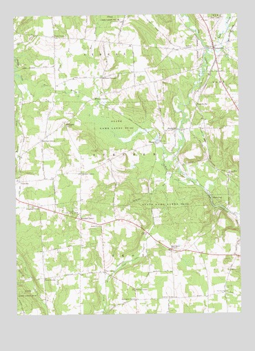
Centerville, PA USGS Topographic Map
Click on map above to begin viewing in our Map Viewer.

This topographic map contains these locations and features:
Feature Name Type Latitude Longitude GNIS ID View Map
Altenburg CornersLocaleN41.6701°W79.8614°1168224View Map
Beardsley SchoolSchoolN41.6942°W79.8673°1200912View Map
Borough of CentervilleCivilN41.7389°W79.7611°1215132View Map
Boyles CornersLocaleN41.6403°W79.8595°1170104View Map
Brier Hill SchoolSchoolN41.6448°W79.8601°1200909View Map
Center SchoolSchoolN41.7401°W79.8389°1200915View Map
CentervillePopulated PlaceN41.7362°W79.7631°1192252View Map
Centerville Post OfficePost OfficeN41.7362°W79.7635°2779960View Map
Centerville Volunteer Fire Department 6BuildingN41.7355°W79.7643°2645829View Map
ClappvillePopulated PlaceN41.6964°W79.7945°1171895View Map
Dannart CornersLocaleN41.7356°W79.7787°1172924View Map
DeWolfe RunStreamN41.6837°W79.7876°1173018View Map
Drake CornersLocaleN41.7412°W79.8520°1173443View Map
East Branch Muddy CreekStreamN41.7237°W79.8709°1173755View Map
East Branch Oil CreekStreamN41.7353°W79.7664°1173758View Map
East Troy CemeteryCemeteryN41.6362°W79.7581°1173888View Map
East Troy ChurchChurchN41.6339°W79.7589°1173890View Map
Grays Mills StationLocaleN41.6828°W79.7556°1176033View Map
Green Acres Golf CourseLocaleN41.6512°W79.7620°1205852View Map
Hatch SchoolSchoolN41.7239°W79.8323°1200914View Map
Hawthorne CornersLocaleN41.6309°W79.8087°1176678View Map
Highway TabernacleChurchN41.6589°W79.8014°1177059View Map
Koochogey CornersLocaleN41.7053°W79.8467°1178642View Map
Lonetot CornersLocaleN41.6314°W79.7873°1179843View Map
Markley CornersLocaleN41.6353°W79.8087°1180427View Map
Marsh RunStreamN41.6848°W79.7831°1180459View Map
McCurdy School (historical)SchoolN41.6526°W79.7503°1200978View Map
McGinnet CornersLocaleN41.7242°W79.8253°1180717View Map
Melvin SchoolSchoolN41.6645°W79.8362°1200910View Map
Morehead CornersLocaleN41.6648°W79.8384°1181539View Map
Moss Grove CornersLocaleN41.6517°W79.7884°1181624View Map
Moss Grove SchoolSchoolN41.6520°W79.7876°1200979View Map
Mystic ParkPopulated PlaceN41.6739°W79.7645°1182146View Map
Navy RunStreamN41.7226°W79.8712°1182188View Map
Potash RunStreamN41.7181°W79.8464°1184324View Map
Smith CornersLocaleN41.6626°W79.8270°1187864View Map
State Game Lands Number 122ParkN41.7042°W79.8189°1188438View Map
State Game Lands Number 199ParkN41.7489°W79.8206°1193442View Map
Steuben CornersLocaleN41.6842°W79.8381°1188621View Map
Steuben SchoolSchoolN41.6842°W79.8356°1200911View Map
Sunnyside CemeteryCemeteryN41.7402°W79.7734°1189080View Map
Township of AthensCivilN41.7456°W79.8424°1216296View Map
Township of SteubenCivilN41.6943°W79.8202°1216318View Map
Township of TroyCivilN41.6393°W79.8266°1216321View Map
Troy CenterPopulated PlaceN41.6426°W79.8259°1204832View Map
TryonvillePopulated PlaceN41.7017°W79.7848°1189892View Map
Tryonville StationLocaleN41.7123°W79.7731°1189893View Map
Twomile CreekStreamN41.7453°W79.7564°1190026View Map
Wheelock CornersLocaleN41.6981°W79.8598°1191224View Map
White School (historical)SchoolN41.6312°W79.7906°1200980View Map
Whitman CornersLocaleN41.7242°W79.8256°1191353View Map
Whitman SchoolSchoolN41.7201°W79.8073°1200913View Map

Note: Coordinates in the location and feature list above are referenced to NAD83 datum.


Copyright (C) 2008-2025 Ryan Niemi / Sunset Dynamics ... All Rights Reserved