TopoQuest Logo
Do you find TopoQuest useful?
Help keep TopoQuest running and adding new maps/features by donating!
Bitcoin:  19c7KJd3qBynnjoSw5npx9KScwjBe4ifkT
Litecoin:  LXs6TkuXGGXo1vDsWCkWVdjQX94eUKd6ui
Home View Maps Find Maps Find Places Resources & Links


Titusville North, Pennsylvania Topographic Map

USGS Map Title: Titusville North, PA
USGS Map MRC: 41079F6
DRG (GeoTIFF) Download: o41079f6.tif


Neighboring USGS Topographic Map Quads:


  Lake Canadohta, PA  
41079G7
 

  Spartansburg, PA  
41079G6
 

  Spring Creek, PA  
41079G5
 

  Centerville, PA  
41079F7
 

  Titusville North, PA  
41079F6
 

  Grand Valley, PA  
41079F5
 

  Dempseytown, PA  
41079E7
 

  Titusville South, PA  
41079E6
 

  Pleasantville, PA  
41079E5


Map MRC Location:

N42°
W80°
N42°
W79°
H8 H7 H6 H5 H4 H3 H2 H1
G8 G7 G6 G5 G4 G3 G2 G1
F8 F7 F6 F5 F4 F3 F2 F1
E8 E7 E6 E5 E4 E3 E2 E1
D8 D7 D6 D5 D4 D3 D2 D1
C8 C7 C6 C5 C4 C3 C2 C1
B8 B7 B6 B5 B4 B3 B2 B1
A8 A7 A6 A5 A4 A3 A2 A1
N41°
W80°
N41°
W79°

Titusville North, PA USGS 1:24K Topographic Map Preview:
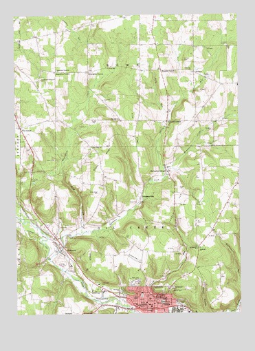
Titusville North, PA USGS Topographic Map
Click on map above to begin viewing in our Map Viewer.

This topographic map contains these locations and features:
Feature Name Type Latitude Longitude GNIS ID View Map
Bethel ChurchChurchN41.6862°W79.6659°1169402View Map
Bog HollowValleyN41.6597°W79.7133°1169934View Map
Borough of HydetownCivilN41.6512°W79.7246°1215136View Map
Burgess ParkParkN41.6301°W79.6603°1170710View Map
Church Run Oil FieldOilfieldN41.6792°W79.6531°1171865View Map
City of TitusvilleCivilN41.6273°W79.6698°1215142View Map
Cloverdale CornersLocaleN41.7056°W79.6648°1172032View Map
Curry CemeteryCemeteryN41.6571°W79.6885°1172842View Map
Dolly RunStreamN41.7081°W79.6626°1173358View Map
Elm Street SchoolSchoolN41.6317°W79.6845°1174172View Map
Emanuel ChurchChurchN41.6323°W79.6770°1174206View Map
Fink RidgeRidgeN41.7023°W79.6823°1174760View Map
Fink Ridge ChurchChurchN41.7064°W79.6914°1198728View Map
Fink Ridge SchoolSchoolN41.7064°W79.6901°1201018View Map
Five CornersPopulated PlaceN41.7034°W79.7470°1174858View Map
Free ChurchChurchN41.6309°W79.6770°1175201View Map
Gilson RidgeRidgeN41.6903°W79.7001°1198803View Map
Gilson Ridge CemeteryCemeteryN41.6758°W79.7036°1175627View Map
Gilson Ridge ChurchChurchN41.6953°W79.7067°1175628View Map
Gilson Ridge SchoolSchoolN41.6762°W79.7001°1201019View Map
Greenwood CemeteryCemeteryN41.6376°W79.7029°1176199View Map
Harrison CemeteryCemeteryN41.7310°W79.6551°1176584View Map
Henderson ChurchChurchN41.6514°W79.6478°1176825View Map
Henderson SchoolSchoolN41.6437°W79.6506°1201021View Map
Hummer CreekStreamN41.6862°W79.6631°1177586View Map
Hummer School (historical)SchoolN41.7053°W79.6384°1201024View Map
HydetownPopulated PlaceN41.6526°W79.7270°1177667View Map
Hydetown Volunteer Fire Department 14BuildingN41.6506°W79.7234°2645280View Map
Immaculate Conception CemeteryCemeteryN41.7220°W79.7343°1177698View Map
Immaculate Conception ChurchChurchN41.7270°W79.7264°1177700View Map
Kerr SchoolSchoolN41.6831°W79.6453°1201022View Map
Mageetown CornersLocaleN41.7264°W79.7267°1180193View Map
Main Street Elementary SchoolSchoolN41.6317°W79.6745°1214742View Map
Main Street SchoolSchoolN41.6281°W79.6751°1192880View Map
Maple Grove SchoolSchoolN41.7278°W79.6492°1201014View Map
McLaughlin CornersPopulated PlaceN41.7262°W79.7087°1180771View Map
McLaughlin CreekStreamN41.6587°W79.7139°1180772View Map
Paul Personal Use AirportAirportN41.7188°W79.6778°1194274View Map
Rendalls CornersLocaleN41.7270°W79.6676°1184894View Map
Rometown ChurchChurchN41.7270°W79.6509°1185414View Map
Saint Catherines CemeteryCemeteryN41.6444°W79.7162°1185858View Map
Saint Josephs High SchoolSchoolN41.6287°W79.6814°1186240View Map
Saint Stephens ChurchChurchN41.6523°W79.6489°1186730View Map
Saint Titusville SchoolSchoolN41.6284°W79.6823°1186760View Map
Saint Walburgas ChurchChurchN41.6323°W79.6723°1186782View Map
Shelmadine SpringsSpringN41.6845°W79.6659°1187453View Map
Shirley RunStreamN41.6809°W79.6678°1187568View Map
Thompson CreekStreamN41.6481°W79.7317°1189499View Map
Thompson Creek Church (historical)ChurchN41.6645°W79.6981°1201020View Map
Thompsons MillsPopulated PlaceN41.6731°W79.6803°1189515View Map
TitusvillePopulated PlaceN41.6270°W79.6737°1189602View Map
Titusville Area HospitalHospitalN41.6336°W79.6798°2718096View Map
Titusville Country ClubLocaleN41.6348°W79.7076°1213380View Map
Titusville Fire Department 26BuildingN41.6302°W79.6737°2645277View Map
Titusville Junior High SchoolSchoolN41.6301°W79.6678°1205652View Map
Titusville Police DepartmentBuildingN41.6305°W79.6737°2780543View Map
Titusville Post OfficePost OfficeN41.6262°W79.6749°2779875View Map
Titusville Senior High SchoolSchoolN41.6301°W79.6689°1205651View Map
Township of Oil CreekCivilN41.6591°W79.6780°1216309View Map
Township of RomeCivilN41.7359°W79.6859°1216322View Map
Union CemeteryCemeteryN41.6778°W79.6592°1190118View Map
University of Pittsburgh at TitusvilleSchoolN41.6289°W79.6651°1190217View Map
Vosburgh Airport (historical)AirportN41.6501°W79.6845°1194267View Map
VroomanPopulated PlaceN41.7259°W79.6495°1204881View Map
White Oak SchoolSchoolN41.6839°W79.6256°1201023View Map
Woodlawn CemeteryCemeteryN41.6347°W79.6917°1199813View Map

Note: Coordinates in the location and feature list above are referenced to NAD83 datum.


Copyright (C) 2008-2025 Ryan Niemi / Sunset Dynamics ... All Rights Reserved