TopoQuest Logo
Do you find TopoQuest useful?
Help keep TopoQuest running and adding new maps/features by donating!
Bitcoin:  19c7KJd3qBynnjoSw5npx9KScwjBe4ifkT
Litecoin:  LXs6TkuXGGXo1vDsWCkWVdjQX94eUKd6ui
Home View Maps Find Maps Find Places Resources & Links


Lake Combie, California Topographic Map

USGS Map Title: Lake Combie, CA
USGS Map MRC: 39121A1
DRG (GeoTIFF) Download: o39121a1.tif


Neighboring USGS Topographic Map Quads:


  Rough And Ready, CA  
39121B2
 

  Grass Valley, CA  
39121B1
 

  Chicago Park, CA  
39120B8
 

  Wolf, CA  
39121A2
 

  Lake Combie, CA  
39121A1
 

  Colfax, CA  
39120A8
 

  Gold Hill, CA  
38121H2
 

  Auburn, CA  
38121H1
 

  Greenwood, CA  
38120H8


Map MRC Location:

N40°
W122°
N40°
W121°
H8 H7 H6 H5 H4 H3 H2 H1
G8 G7 G6 G5 G4 G3 G2 G1
F8 F7 F6 F5 F4 F3 F2 F1
E8 E7 E6 E5 E4 E3 E2 E1
D8 D7 D6 D5 D4 D3 D2 D1
C8 C7 C6 C5 C4 C3 C2 C1
B8 B7 B6 B5 B4 B3 B2 B1
A8 A7 A6 A5 A4 A3 A2 A1
N39°
W122°
N39°
W121°

Lake Combie, CA USGS 1:24K Topographic Map Preview:
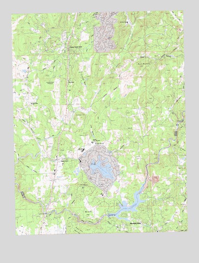
Lake Combie, CA USGS Topographic Map
Click on map above to begin viewing in our Map Viewer.

This topographic map contains these locations and features:
Feature Name Type Latitude Longitude GNIS ID View Map
Alta Sierra AirportAirportN39.1132°W121.0552°1653493View Map
Alta Sierra Census Designated PlaceCensusN39.1237°W121.0524°2407731View Map
Alta Sierra Elementary SchoolSchoolN39.1185°W121.0419°1682831View Map
Alta Sierra EstatesPopulated PlaceN39.1141°W121.0552°1682832View Map
Alta Sierra RanchesPopulated PlaceN39.1043°W121.0247°1682833View Map
B CanalCanalN39.1096°W121.1083°233448View Map
Bear River High SchoolSchoolN39.0471°W121.0757°1682839View Map
Buck MountainSummitN39.0935°W121.0311°219997View Map
Cedar RavineValleyN39.1016°W121.0458°220793View Map
Cherry Creek AcresPopulated PlaceN39.1041°W121.0827°1658265View Map
China FlatFlatN39.0421°W121.0352°221029View Map
Combie 61-009 DamDamN39.0095°W121.0582°1663484View Map
Combie Crossing (historical)CrossingN39.0138°W121.0416°1703628View Map
Combie Ophir CanalCanalN39.0057°W121.0899°221427View Map
Cottage HillSummitN39.0657°W121.0774°221619View Map
Cottage Hill Elementary SchoolSchoolN39.0507°W121.0667°1682865View Map
Coyote CreekStreamN39.0155°W121.0030°221736View Map
Cunningham DitchCanalN39.1168°W121.0669°221917View Map
Dew DropPopulated PlaceN39.0871°W121.0866°222332View Map
Dog Bar BridgeBridgeN39.0627°W121.0024°252017View Map
Eden ValleyValleyN39.0527°W121.0080°233830View Map
Egbert HillSummitN39.0557°W121.0727°222999View Map
Fattebort HillSummitN39.0249°W121.0766°223410View Map
Gautier BridgeBridgeN39.0118°W121.1044°252025View Map
Higgins Area Fire Protection DistrictBuildingN39.0433°W121.0936°2622204View Map
Higgins CornerPopulated PlaceN39.0427°W121.0949°252688View Map
Kyler DitchCanalN39.1188°W121.0752°226698View Map
La Mar FlatFlatN39.0274°W121.0613°226713View Map
Lake CombieReservoirN39.0101°W121.0518°221428View Map
Lake Combie PitMineN39.0294°W121.0267°2678218View Map
Lake of the PinesPopulated PlaceN39.0396°W121.0566°1682905View Map
Lake of the PinesReservoirN39.0363°W121.0625°1664296View Map
Lake of the Pines Census Designated PlaceCensusN39.0378°W121.0643°2408547View Map
Limekiln SchoolSchoolN39.0877°W121.1158°227111View Map
Little Sage HillSummitN39.0446°W121.0019°1658982View Map
Long HollowValleyN39.0524°W121.1086°227572View Map
Long RavineValleyN39.0682°W121.0738°227595View Map
Magnolia 1302 DamDamN39.0382°W121.0627°1664295View Map
Magnolia CreekStreamN39.0235°W121.1205°227941View Map
Magnolia DitchCanalN39.0180°W121.0849°263118View Map
McCarty FlatFlatN39.0127°W121.0736°228283View Map
Meadow VistaPopulated PlaceN39.0010°W121.0219°1659097View Map
Meadow Vista Census Designated PlaceCensusN39.0029°W121.0304°2408810View Map
Meyer RavineValleyN39.0441°W121.1227°228555View Map
Nevada County Consolidated Fire District Station 90BuildingN39.1123°W121.0807°2622257View Map
Nickerson RanchLocaleN39.0471°W121.1052°1877804View Map
Perkins SpringSpringN39.0450°W121.0550°230532View Map
Placer County Fire Department Station 84 / Placer Hills Fire Department Station 1BuildingN39.0008°W121.0229°2621973View Map
Pleasant Ridge Charter SchoolSchoolN39.0741°W121.1125°1682945View Map
Ragsdale CreekStreamN39.0455°W121.1094°231168View Map
Salt CreekStreamN39.0702°W121.0708°232300View Map
Salt FlatFlatN39.0713°W121.0572°232317View Map
Sierra Knoll EstatesPopulated PlaceN39.0671°W121.0344°1682967View Map
South Wolf CreekStreamN39.0624°W121.0897°267538View Map
State Foresty Guard StationLocaleN39.0443°W121.0944°235401View Map
Stockton Hill DitchCanalN39.0980°W121.0899°235503View Map
Stockton Hill MineMineN39.0843°W121.0991°235504View Map
Trailer HillSummitN39.0913°W121.0786°236513View Map
Van Giesen DamDamN39.0093°W121.0583°237003View Map
Viet Cameron DitchCanalN39.0780°W121.1222°237080View Map
Willaura EstatesPopulated PlaceN39.1030°W121.0980°1682997View Map
Wooley CreekStreamN39.0063°W121.0422°238181View Map

Note: Coordinates in the location and feature list above are referenced to NAD83 datum.


Copyright (C) 2008-2024 Ryan Niemi / Sunset Dynamics ... All Rights Reserved