TopoQuest Logo
Do you find TopoQuest useful?
Help keep TopoQuest running and adding new maps/features by donating!
Bitcoin:  19c7KJd3qBynnjoSw5npx9KScwjBe4ifkT
Litecoin:  LXs6TkuXGGXo1vDsWCkWVdjQX94eUKd6ui
Home View Maps Find Maps Find Places Resources & Links


Chicago Park, California Topographic Map

USGS Map Title: Chicago Park, CA
USGS Map MRC: 39120B8
DRG (GeoTIFF) Download: o39120b8.tif


Neighboring USGS Topographic Map Quads:


  Nevada City, CA  
39121C1
 

  North Bloomfield, CA  
39120C8
 

  Washington, CA  
39120C7
 

  Grass Valley, CA  
39121B1
 

  Chicago Park, CA  
39120B8
 

  Dutch Flat, CA  
39120B7
 

  Lake Combie, CA  
39121A1
 

  Colfax, CA  
39120A8
 

  Foresthill, CA  
39120A7


Map MRC Location:

N40°
W121°
N40°
W120°
H8 H7 H6 H5 H4 H3 H2 H1
G8 G7 G6 G5 G4 G3 G2 G1
F8 F7 F6 F5 F4 F3 F2 F1
E8 E7 E6 E5 E4 E3 E2 E1
D8 D7 D6 D5 D4 D3 D2 D1
C8 C7 C6 C5 C4 C3 C2 C1
B8 B7 B6 B5 B4 B3 B2 B1
A8 A7 A6 A5 A4 A3 A2 A1
N39°
W121°
N39°
W120°

Chicago Park, CA USGS 1:24K Topographic Map Preview:
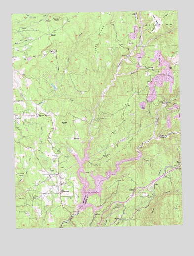
Chicago Park, CA USGS Topographic Map
Click on map above to begin viewing in our Map Viewer.

This topographic map contains these locations and features:
Feature Name Type Latitude Longitude GNIS ID View Map
Arrowhead MineMineN39.1877°W120.9363°256332View Map
Banner MineMineN39.2463°W120.9730°256498View Map
Banner MountainSummitN39.2457°W120.9652°256499View Map
Bear River PinesPopulated PlaceN39.1693°W120.9680°1655818View Map
Bear River SchoolSchoolN39.1910°W120.9813°256699View Map
Brady RanchLocaleN39.2174°W120.8769°257431View Map
Buckeye DiggingsMineN39.2449°W120.8927°257603View Map
Buckeye RidgeRidgeN39.2482°W120.8802°257608View Map
Buena Vista (historical)Populated PlaceN39.1891°W120.9733°1682850View Map
Canada Hill MineMineN39.2482°W120.9944°1693082View Map
Cape HornPopulated PlaceN39.1291°W120.9247°1655868View Map
Central School (historical)SchoolN39.2307°W120.9941°1682857View Map
Chalk BluffCliffN39.2163°W120.8805°1655884View Map
Chicago ParkLocaleN39.1452°W120.9672°258262View Map
Chicago Park DitchCanalN39.1730°W120.9811°258263View Map
Chicago Park Elementary SchoolSchoolN39.1510°W120.9644°1682858View Map
Chicago Park Post OfficePost OfficeN39.1459°W120.9673°2789118View Map
Clipper CreekStreamN39.2027°W120.9694°258463View Map
ColemanPopulated PlaceN39.1774°W120.9758°1682862View Map
D-S CanalCanalN39.2454°W120.9930°266616View Map
Gas CanyonValleyN39.2432°W120.9041°260498View Map
Goat RockSummitN39.1432°W120.9947°1656048View Map
Greenhorn CampgroundLocaleN39.1657°W120.9502°274927View Map
Greenhorn CreekStreamN39.1438°W120.9469°260871View Map
Greenhorn Creek PitMineN39.1992°W120.9339°2677640View Map
Greenhorn Picnic AreaLocaleN39.1685°W120.9572°1682897View Map
Hawkins CanyonValleyN39.1888°W120.8986°261162View Map
Hayford HillSummitN39.1424°W120.9027°261173View Map
Head RanchLocaleN39.1777°W120.9558°261203View Map
Hilltop RanchLocaleN39.2038°W120.9508°261359View Map
Hunts Hill (historical)Populated PlaceN39.2382°W120.9127°1682901View Map
Jones RidgeRidgeN39.2338°W120.9355°262008View Map
KJFA-FM (Grass Valley)TowerN39.2463°W120.9644°1665036View Map
KNCO-FM (Grass Valley)TowerN39.2455°W120.9655°1665037View Map
KVMR-FM (Nevada City)TowerN39.2463°W120.9644°1665060View Map
Lava Cap MineMineN39.2277°W120.9708°262360View Map
Lava Cap ReservoirReservoirN39.2375°W120.9722°262361View Map
Little Clipper CreekStreamN39.2102°W120.9680°262567View Map
Little Greenhorn CreekStreamN39.1882°W120.9405°262613View Map
Little York (historical)Populated PlaceN39.1952°W120.8772°1682911View Map
Little York DiggingsMineN39.1902°W120.8769°262752View Map
Loma Rica Airport 61-025 DamDamN39.2229°W120.9897°1663493View Map
Long Ravine CampgroundLocaleN39.1427°W120.9427°274930View Map
MagraPopulated PlaceN39.1491°W120.8966°1656148View Map
Missouri CanyonValleyN39.2132°W120.9224°263703View Map
Mount OliveSummitN39.1341°W120.9941°264346View Map
Nevada City Raw Water 2026 DamDamN39.2466°W120.9977°1664505View Map
Nevada County Consolidated Fire District Station 86BuildingN39.2399°W120.9926°2622311View Map
Orchard Springs CampgroundLocaleN39.1405°W120.9519°274929View Map
PeardalePopulated PlaceN39.1910°W120.9999°264598View Map
Peardale - Chicago Park Fire Protection DistrictBuildingN39.1472°W120.9664°2622161View Map
Peardale - Chicago Park Fire Protection District Station 257BuildingN39.1904°W120.9856°2622162View Map
Peninsula CampgroundLocaleN39.1491°W120.9447°274928View Map
PinecrestPopulated PlaceN39.1627°W120.9683°1682942View Map
Poore MineMineN39.2318°W120.9127°264944View Map
Poorman CreekStreamN39.1649°W120.9444°264945View Map
Red DogPopulated PlaceN39.2166°W120.8994°265266View Map
Red Dog You Bet DiggingsMineN39.2127°W120.8919°265267View Map
Rollins 61-021 DamDamN39.1357°W120.9526°1663489View Map
Rollins ReservoirReservoirN39.1520°W120.9404°265554View Map
Secret TownPopulated PlaceN39.1571°W120.8777°1656283View Map
Sonntag HillSummitN39.1868°W120.9630°267395View Map
South Fork Greenhorn CreekStreamN39.2310°W120.9047°267459View Map
Stampede CanyonValleyN39.1652°W120.9072°267661View Map
Steephollow CreekStreamN39.1766°W120.8958°267715View Map
Steeplehollow CrossingCrossingN39.1960°W120.8863°1656333View Map
Sunshine ValleyBasinN39.1552°W120.9955°267980View Map
Victory MineMineN39.1463°W120.9116°268692View Map
You BetPopulated PlaceN39.2091°W120.8999°1656416View Map
Yuba ReservoirReservoirN39.2234°W120.9884°269382View Map

Note: Coordinates in the location and feature list above are referenced to NAD83 datum.


Copyright (C) 2008-2024 Ryan Niemi / Sunset Dynamics ... All Rights Reserved