TopoQuest Logo
Do you find TopoQuest useful?
Help keep TopoQuest running and adding new maps/features by donating!
Bitcoin:  19c7KJd3qBynnjoSw5npx9KScwjBe4ifkT
Litecoin:  LXs6TkuXGGXo1vDsWCkWVdjQX94eUKd6ui
Home View Maps Find Maps Find Places Resources & Links


Lake Mike Connor, Mississippi Topographic Map

USGS Map Title: Lake Mike Connor, MS
USGS Map MRC: 31089E6
DRG (GeoTIFF) Download: o31089e6.tif


Neighboring USGS Topographic Map Quads:


  Mount Carmel, MS  
31089F7
 

  Lone Star, MS  
31089F6
 

  Collins, MS  
31089F5
 

  Prentiss East, MS  
31089E7
 

  Lake Mike Connor, MS  
31089E6
 

  Williamsburg, MS  
31089E5
 

  Bunker Hill, MS  
31089D7
 

  Bassfield, MS  
31089D6
 

  Sumrall, MS  
31089D5


Map MRC Location:

N32°
W90°
N32°
W89°
H8 H7 H6 H5 H4 H3 H2 H1
G8 G7 G6 G5 G4 G3 G2 G1
F8 F7 F6 F5 F4 F3 F2 F1
E8 E7 E6 E5 E4 E3 E2 E1
D8 D7 D6 D5 D4 D3 D2 D1
C8 C7 C6 C5 C4 C3 C2 C1
B8 B7 B6 B5 B4 B3 B2 B1
A8 A7 A6 A5 A4 A3 A2 A1
N31°
W90°
N31°
W89°

Lake Mike Connor, MS USGS 1:24K Topographic Map Preview:
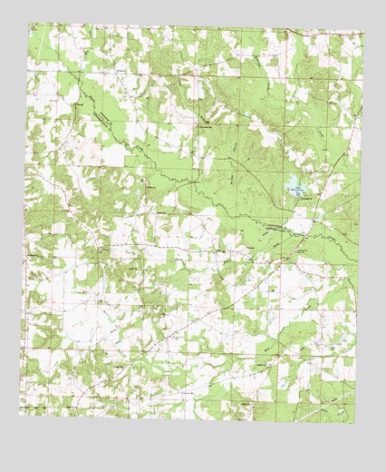
Lake Mike Connor, MS USGS Topographic Map
Click on map above to begin viewing in our Map Viewer.

This topographic map contains these locations and features:
Feature Name Type Latitude Longitude GNIS ID View Map
Barwick CemeteryCemeteryN31.5316°W89.7340°691221View Map
Bassfield ChurchChurchN31.5182°W89.6584°666564View Map
Bethel School (historical)SchoolN31.5863°W89.7362°689725View Map
Black Jack (historical)LocaleN31.6210°W89.7195°710615View Map
Black Jack School (historical)SchoolN31.6238°W89.7209°710616View Map
Booth CemeteryCemeteryN31.5268°W89.7056°691214View Map
Bowie Creek CemeteryCemeteryN31.5613°W89.6445°691325View Map
Cantwell MillPopulated PlaceN31.5091°W89.6901°691747View Map
Chance CemeteryCemeteryN31.5416°W89.6562°691206View Map
Chapel Church (historical)ChurchN31.5927°W89.6854°689826View Map
Chapel School (historical)SchoolN31.6016°W89.6798°689827View Map
China Mission Church (historical)ChurchN31.6093°W89.7056°689828View Map
Colbert BranchStreamN31.5710°W89.6820°668653View Map
Connely Davis Lake DamDamN31.5135°W89.6517°680739View Map
Crossroad ChurchChurchN31.5282°W89.6251°668973View Map
DeenPopulated PlaceN31.5535°W89.6781°691805View Map
Deen CemeteryCemeteryN31.5538°W89.6762°691212View Map
Deen CemeteryCemeteryN31.5363°W89.7192°691222View Map
Deen Store (historical)LocaleN31.5810°W89.6459°689831View Map
Double Churches (historical)Populated PlaceN31.5546°W89.6487°689724View Map
Double Churches CemeteryCemeteryN31.5552°W89.6484°691205View Map
Dry CreekStreamN31.6071°W89.7301°669429View Map
Good Hope School (historical)SchoolN31.5318°W89.6384°689733View Map
Goodhope ChurchChurchN31.5549°W89.6478°670494View Map
Graves CemeteryCemeteryN31.5650°W89.7230°691218View Map
Graves CemeteryCemeteryN31.5614°W89.7265°691219View Map
Graves CemeteryCemeteryN31.5657°W89.7011°670621View Map
Gray CemeteryCemeteryN31.5241°W89.6348°691562View Map
Gum BranchStreamN31.6013°W89.6595°689835View Map
Harper CemeteryCemeteryN31.5116°W89.7001°691215View Map
Harper School (historical)SchoolN31.5063°W89.7123°689738View Map
Hartley BranchStreamN31.5654°W89.6695°670993View Map
Hathorn CemeteryCemeteryN31.5204°W89.6728°691203View Map
Hathorn CemeteryCemeteryN31.5271°W89.6623°691204View Map
Hawthorn CemeteryCemeteryN31.5013°W89.7195°691224View Map
King CemeteryCemeteryN31.5513°W89.6581°691207View Map
King CemeteryCemeteryN31.5452°W89.6665°691211View Map
King CemeteryCemeteryN31.5527°W89.7087°672148View Map
King CemeteryCemeteryN31.5552°W89.6670°672149View Map
King School (historical)SchoolN31.5543°W89.6759°689747View Map
Lake Mike ConnorReservoirN31.5751°W89.6491°673557View Map
Loflin-Applewhite CemeteryCemeteryN31.5207°W89.7187°691223View Map
McKinnis CreekStreamN31.6004°W89.6490°673388View Map
McRaneyPopulated PlaceN31.6096°W89.7173°692059View Map
Methodist-Protestant CampgroundsLocaleN31.6241°W89.6362°710673View Map
Mike Connor Lake DamDamN31.5752°W89.6501°680770View Map
New Chapel United Pentecostal ChurchChurchN31.5843°W89.6876°674601View Map
Old Chapel CemeteryCemeteryN31.5932°W89.6856°675170View Map
Pleasant Grove Congregational Methodist ChurchChurchN31.6241°W89.7212°675995View Map
Price School (historical)SchoolN31.5307°W89.7034°689766View Map
Progress CemeteryCemeteryN31.5257°W89.6928°691213View Map
Progress Missionary Baptist ChurchChurchN31.5264°W89.6937°691605View Map
Reese CemeteryCemeteryN31.5163°W89.7115°676581View Map
SanteePopulated PlaceN31.5543°W89.7223°710603View Map
Santee Baptist ChurchChurchN31.5657°W89.7334°691610View Map
Santee BranchStreamN31.5616°W89.6526°677402View Map
Santee CemeteryCemeteryN31.5532°W89.7209°710598View Map
Santee CemeteryCemeteryN31.5685°W89.7337°691217View Map
Santee ChurchChurchN31.5532°W89.7215°677403View Map
Santee School (historical)SchoolN31.5418°W89.7209°689773View Map
Saulters-McRaney CemeteryCemeteryN31.5846°W89.7348°691216View Map
Strahan (historical)LocaleN31.5829°W89.6390°710734View Map
Strahan Mill (historical)LocaleN31.5877°W89.6387°689849View Map
Sweet Water CemeteryCemeteryN31.5502°W89.7473°691220View Map
Sweetwater ChurchChurchN31.5504°W89.7484°691619View Map
TerrellPopulated PlaceN31.5993°W89.7317°692260View Map
Terrell CemeteryCemeteryN31.6004°W89.7381°678639View Map
Turnage CemeteryCemeteryN31.5638°W89.6895°691210View Map
Victory CemeteryCemeteryN31.5543°W89.6490°710602View Map
Victory ChurchChurchN31.5543°W89.6484°679220View Map
Watsons Mill PondReservoirN31.6189°W89.6498°689852View Map
Whitehead CemeteryCemeteryN31.5668°W89.6928°691208View Map
Willie Fortenberry Lake DamDamN31.5385°W89.6451°680749View Map
Wilson CemeteryCemeteryN31.5613°W89.7006°691209View Map

Note: Coordinates in the location and feature list above are referenced to NAD83 datum.


Copyright (C) 2008-2024 Ryan Niemi / Sunset Dynamics ... All Rights Reserved