TopoQuest Logo
Do you find TopoQuest useful?
Help keep TopoQuest running and adding new maps/features by donating!
Bitcoin:  19c7KJd3qBynnjoSw5npx9KScwjBe4ifkT
Litecoin:  LXs6TkuXGGXo1vDsWCkWVdjQX94eUKd6ui
Home View Maps Find Maps Find Places Resources & Links


Mount Carmel, Mississippi Topographic Map

USGS Map Title: Mount Carmel, MS
USGS Map MRC: 31089F7
DRG (GeoTIFF) Download: o31089f7.tif


Neighboring USGS Topographic Map Quads:


  Shivers, MS  
31089G8
 

  Mendenhall SE, MS  
31089G7
 

  Magee South, MS  
31089G6
 

  New Hebron, MS  
31089F8
 

  Mount Carmel, MS  
31089F7
 

  Lone Star, MS  
31089F6
 

  Prentiss West, MS  
31089E8
 

  Prentiss East, MS  
31089E7
 

  Lake Mike Connor, MS  
31089E6


Map MRC Location:

N32°
W90°
N32°
W89°
H8 H7 H6 H5 H4 H3 H2 H1
G8 G7 G6 G5 G4 G3 G2 G1
F8 F7 F6 F5 F4 F3 F2 F1
E8 E7 E6 E5 E4 E3 E2 E1
D8 D7 D6 D5 D4 D3 D2 D1
C8 C7 C6 C5 C4 C3 C2 C1
B8 B7 B6 B5 B4 B3 B2 B1
A8 A7 A6 A5 A4 A3 A2 A1
N31°
W90°
N31°
W89°

Mount Carmel, MS USGS 1:24K Topographic Map Preview:
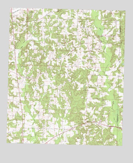
Mount Carmel, MS USGS Topographic Map
Click on map above to begin viewing in our Map Viewer.

This topographic map contains these locations and features:
Feature Name Type Latitude Longitude GNIS ID View Map
Bass CemeteryCemeteryN31.6399°W89.8420°691288View Map
Betsy SpringSpringN31.6960°W89.8620°667036View Map
Bridges CemeteryCemeteryN31.6829°W89.8406°691282View Map
Brinson CemeteryCemeteryN31.7352°W89.8723°667573View Map
Bryant CemeteryCemeteryN31.6663°W89.8167°691278View Map
ClemPopulated PlaceN31.7110°W89.7879°691770View Map
Clem Lookout TowerTowerN31.7435°W89.8359°711218View Map
Clem School (historical)SchoolN31.7127°W89.7865°689722View Map
Cooper CemeteryCemeteryN31.7268°W89.7656°691267View Map
Durr CemeteryCemeteryN31.6543°W89.8665°691284View Map
Gray School (historical)SchoolN31.6785°W89.7945°689736View Map
Griffith CemeteryCemeteryN31.6402°W89.8053°670747View Map
Griffith CemeteryCemeteryN31.7274°W89.8548°691281View Map
Gwinville Oil and Gas FieldOilfieldN31.7266°W89.8512°670813View Map
Harmony ChurchChurchN31.6891°W89.7559°691563View Map
Jerusalem School (historical)SchoolN31.7377°W89.7598°710595View Map
Lee CemeteryCemeteryN31.7335°W89.7870°672371View Map
Magee CemeteryCemeteryN31.6343°W89.8740°673057View Map
Magee CemeteryCemeteryN31.6890°W89.7612°691270View Map
Magee CemeteryCemeteryN31.7143°W89.7801°691578View Map
Mcinnis CemeteryCemeteryN31.7324°W89.7670°673451View Map
McInnis CemeteryCemeteryN31.7210°W89.7634°691268View Map
McWorthy CemeteryCemeteryN31.7329°W89.8251°691274View Map
Mount CarmelPopulated PlaceN31.6452°W89.7898°673998View Map
Mount Carmel CemeteryCemeteryN31.6782°W89.7876°691273View Map
Mount Carmel CemeteryCemeteryN31.6449°W89.7937°691276View Map
Mount Carmel ChurchChurchN31.6785°W89.7876°673954View Map
Mount Harmony CemeteryCemeteryN31.6885°W89.7559°691271View Map
Mount Zion CemeteryCemeteryN31.6316°W89.7934°691277View Map
Mount Zion CemeteryCemeteryN31.6424°W89.8356°691287View Map
Mount Zion ChurchChurchN31.6410°W89.8359°674337View Map
Mount Zion ChurchChurchN31.6307°W89.7937°691585View Map
Newton CemeteryCemeteryN31.6485°W89.8545°691285View Map
Oak Grove CemeteryCemeteryN31.7343°W89.8562°691280View Map
Oak Grove ChurchChurchN31.7341°W89.8567°675029View Map
Old Mount Harmony CemeteryCemeteryN31.6815°W89.7609°691272View Map
Old Williams CemeteryCemeteryN31.7188°W89.8312°691275View Map
Phalti CemeteryCemeteryN31.7060°W89.7862°691269View Map
Phalti ChurchChurchN31.7063°W89.7865°675669View Map
Pine Bluff School (historical)SchoolN31.6810°W89.8623°689757View Map
Point Pleasant CemeteryCemeteryN31.7332°W89.7931°676170View Map
Point Pleasant CemeteryCemeteryN31.7379°W89.7606°691266View Map
Point Pleasant ChurchChurchN31.7379°W89.7598°676171View Map
Point Pleasant School (historical)SchoolN31.7335°W89.7948°689758View Map
Polk School (historical)SchoolN31.6313°W89.8587°689759View Map
Poplar Springs School (historical)SchoolN31.7379°W89.8512°689760View Map
Prentiss Fire Department Station 2BuildingN31.7284°W89.7589°2667892View Map
Prentiss Fire Department Station 3BuildingN31.7375°W89.8377°2667894View Map
Prentiss Fire Department Station 4BuildingN31.6909°W89.8705°2667893View Map
Red House School (historical)SchoolN31.6874°W89.8615°689768View Map
Rock Hill CemeteryCemeteryN31.7215°W89.7762°710597View Map
Rock Hill ChurchChurchN31.7210°W89.7762°676755View Map
Steward CemeteryCemeteryN31.7021°W89.7912°691618View Map
Supervisor District 4CivilN31.6649°W89.7910°711917View Map
Thompson CemeteryCemeteryN31.7046°W89.7848°678694View Map
Walker BranchStreamN31.6496°W89.8479°679257View Map
Ward CemeteryCemeteryN31.6432°W89.8367°691286View Map
White CemeteryCemeteryN31.6582°W89.8323°691279View Map
White Sand CemeteryCemeteryN31.6863°W89.8534°691283View Map
Whitesand ChurchChurchN31.6857°W89.8534°691630View Map
Williams BranchStreamN31.6918°W89.7709°679702View Map
Williams CemeteryCemeteryN31.6993°W89.8681°679705View Map

Note: Coordinates in the location and feature list above are referenced to NAD83 datum.


Copyright (C) 2008-2025 Ryan Niemi / Sunset Dynamics ... All Rights Reserved