TopoQuest Logo
Do you find TopoQuest useful?
Help keep TopoQuest running and adding new maps/features by donating!
Bitcoin:  19c7KJd3qBynnjoSw5npx9KScwjBe4ifkT
Litecoin:  LXs6TkuXGGXo1vDsWCkWVdjQX94eUKd6ui
Home View Maps Find Maps Find Places Resources & Links


Sumrall, Mississippi Topographic Map

USGS Map Title: Sumrall, MS
USGS Map MRC: 31089D5
DRG (GeoTIFF) Download: o31089d5.tif


Neighboring USGS Topographic Map Quads:


  Lake Mike Connor, MS  
31089E6
 

  Williamsburg, MS  
31089E5
 

  Seminary, MS  
31089E4
 

  Bassfield, MS  
31089D6
 

  Sumrall, MS  
31089D5
 

  Sanford, MS  
31089D4
 

  Improve, MS  
31089C6
 

  Oloh, MS  
31089C5
 

  Hattiesburg SW, MS  
31089C4


Map MRC Location:

N32°
W90°
N32°
W89°
H8 H7 H6 H5 H4 H3 H2 H1
G8 G7 G6 G5 G4 G3 G2 G1
F8 F7 F6 F5 F4 F3 F2 F1
E8 E7 E6 E5 E4 E3 E2 E1
D8 D7 D6 D5 D4 D3 D2 D1
C8 C7 C6 C5 C4 C3 C2 C1
B8 B7 B6 B5 B4 B3 B2 B1
A8 A7 A6 A5 A4 A3 A2 A1
N31°
W90°
N31°
W89°

Sumrall, MS USGS 1:24K Topographic Map Preview:
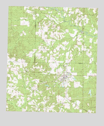
Sumrall, MS USGS Topographic Map
Click on map above to begin viewing in our Map Viewer.

This topographic map contains these locations and features:
Feature Name Type Latitude Longitude GNIS ID View Map
Aultman CemeteryCemeteryN31.4974°W89.5492°666427View Map
Beaver CreekStreamN31.4668°W89.5034°666701View Map
Beavercreek School (historical)SchoolN31.4891°W89.5240°689820View Map
Bethlehem Bovie School (historical)SchoolN31.4666°W89.5278°710612View Map
Bethlehem CemeteryCemeteryN31.4671°W89.5273°710613View Map
Bethlehem ChurchChurchN31.4668°W89.5281°666989View Map
BynumPopulated PlaceN31.3943°W89.5420°691743View Map
Byrd CemeteryCemeteryN31.4196°W89.5090°667888View Map
C R Fortenberry Pond DamDamN31.4052°W89.5717°680710View Map
Church of the Lord Jesus ChristChurchN31.4110°W89.5748°668446View Map
Clark CemeteryCemeteryN31.4613°W89.5640°668505View Map
Clark School (historical)SchoolN31.4507°W89.5734°689829View Map
Clear RunStreamN31.4832°W89.5473°668586View Map
Colters CreekStreamN31.3841°W89.5981°668713View Map
Cooks BranchStreamN31.4991°W89.5615°668785View Map
CoralPopulated PlaceN31.3863°W89.5298°691787View Map
EpleyPopulated PlaceN31.3766°W89.5112°691846View Map
Fairview CemeteryCemeteryN31.4038°W89.5906°669880View Map
Fairview ChurchChurchN31.4010°W89.5876°669883View Map
First Baptist ChurchChurchN31.4171°W89.5445°685777View Map
First Pentecostal ChurchChurchN31.4094°W89.5765°2597001View Map
Gabby Reed BrakeStreamN31.4882°W89.5109°670278View Map
Gates CemeteryCemeteryN31.4810°W89.5831°670332View Map
Graham CemeteryCemeteryN31.4599°W89.5737°670567View Map
Graham School (historical)SchoolN31.4952°W89.5787°689834View Map
Grahams Mill (historical)LocaleN31.4929°W89.5906°689734View Map
Gum Swamp CreekStreamN31.4816°W89.5909°670802View Map
Hayden CreekStreamN31.4718°W89.5240°671022View Map
Hickory Grove Baptist ChurchChurchN31.4299°W89.5459°671164View Map
Hickory Grove Volunteer Fire DepartmentBuildingN31.3961°W89.6077°2668024View Map
HigginsPopulated PlaceN31.4232°W89.5976°691932View Map
Hudson Brothers Pond DamDamN31.4135°W89.5317°680713View Map
Jesus Name ChurchChurchN31.3938°W89.5651°671870View Map
Jones CemeteryCemeteryN31.4032°W89.5906°671961View Map
King CemeteryCemeteryN31.3932°W89.5784°672147View Map
Lowery CemeteryCemeteryN31.4991°W89.5826°672926View Map
Martin BranchStreamN31.4663°W89.5306°673171View Map
Martin CemeteryCemeteryN31.4524°W89.5528°673175View Map
Military Baptist ChurchChurchN31.3860°W89.5461°2596887View Map
New Hope (historical)LocaleN31.4704°W89.5220°710690View Map
New Hope Baptist ChurchChurchN31.4702°W89.5209°674681View Map
New Hope CemeteryCemeteryN31.4707°W89.5206°710691View Map
New Hope Line School (historical)SchoolN31.4702°W89.5215°710692View Map
Presley Watts CemeteryCemeteryN31.4527°W89.5159°676326View Map
Rock Hill ChurchChurchN31.4507°W89.5748°676752View Map
Saint Louis Missionary Baptist ChurchChurchN31.4148°W89.5501°2596648View Map
Sportsman Club Lake DamDamN31.3952°W89.5151°680702View Map
Sportsman Club Lake DamDamN31.3968°W89.5101°680706View Map
Sportsman Club Lake DamDamN31.4002°W89.5117°680708View Map
SumrallPopulated PlaceN31.4174°W89.5423°678406View Map
Sumrall Attendance CenterSchoolN31.4177°W89.5409°707482View Map
Sumrall Elementary SchoolSchoolN31.4188°W89.5417°707483View Map
Sumrall Methodist ChurchChurchN31.4171°W89.5423°685810View Map
Sumrall Middle SchoolSchoolN31.4179°W89.5417°707484View Map
Sumrall Mill CreekStreamN31.4310°W89.5501°685811View Map
Sumrall Police DepartmentBuildingN31.4160°W89.5453°2754064View Map
Sumrall Post OfficePost OfficeN31.4157°W89.5454°2596475View Map
Sumrall Sportsman Club Dam Number 3DamN31.4018°W89.5051°680709View Map
Sumrall Volunteer Fire DepartmentBuildingN31.4167°W89.5444°2667856View Map
Taylor CemeteryCemeteryN31.4396°W89.5740°678584View Map
Threemile School (historical)SchoolN31.4091°W89.5815°685815View Map
Tick CreekStreamN31.4660°W89.5028°678749View Map
Town of SumrallCivilN31.4171°W89.5422°2406689View Map
Watts Box (historical)LocaleN31.4760°W89.5028°683133View Map

Note: Coordinates in the location and feature list above are referenced to NAD83 datum.


Copyright (C) 2008-2025 Ryan Niemi / Sunset Dynamics ... All Rights Reserved