TopoQuest Logo
Do you find TopoQuest useful?
Help keep TopoQuest running and adding new maps/features by donating!
Bitcoin:  19c7KJd3qBynnjoSw5npx9KScwjBe4ifkT
Litecoin:  LXs6TkuXGGXo1vDsWCkWVdjQX94eUKd6ui
Home View Maps Find Maps Find Places Resources & Links


Lake Miltona West, Minnesota Topographic Map

USGS Map Title: Lake Miltona West, MN
USGS Map MRC: 46095A4
DRG (GeoTIFF) Download: o46095a4.tif


Neighboring USGS Topographic Map Quads:


  Inspiration Peak, MN  
46095B5
 

  Parkers Prairie NW, MN  
46095B4
 

  Parkers Prairie, MN  
46095B3
 

  Millerville, MN  
46095A5
 

  Lake Miltona West, MN  
46095A4
 

  Lake Miltona East, MN  
46095A3
 

  Brandon, MN  
45095H5
 

  Alexandria West, MN  
45095H4
 

  Alexandria East, MN  
45095H3


Map MRC Location:

N47°
W96°
N47°
W95°
H8 H7 H6 H5 H4 H3 H2 H1
G8 G7 G6 G5 G4 G3 G2 G1
F8 F7 F6 F5 F4 F3 F2 F1
E8 E7 E6 E5 E4 E3 E2 E1
D8 D7 D6 D5 D4 D3 D2 D1
C8 C7 C6 C5 C4 C3 C2 C1
B8 B7 B6 B5 B4 B3 B2 B1
A8 A7 A6 A5 A4 A3 A2 A1
N46°
W96°
N46°
W95°

Lake Miltona West, MN USGS 1:24K Topographic Map Preview:
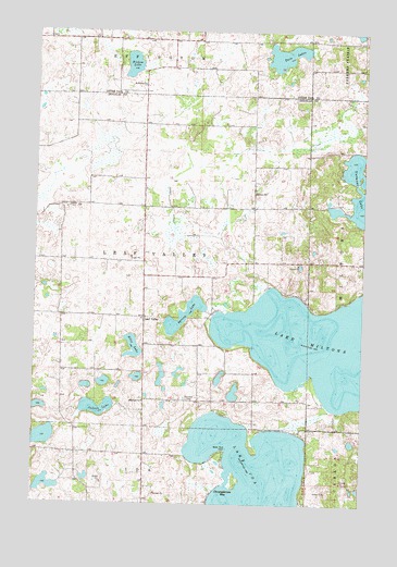
Lake Miltona West, MN USGS Topographic Map
Click on map above to begin viewing in our Map Viewer.

This topographic map contains these locations and features:
Feature Name Type Latitude Longitude GNIS ID View Map
Aaron LakeReservoirN46.0666°W95.4187°1776191View Map
Aaron Lake DamDamN46.0666°W95.4187°1776190View Map
Betsy Ross PointCapeN46.0147°W95.4259°640068View Map
Christopherson BayBayN46.0027°W95.4281°641202View Map
County Ditch Number ElevenCanalN46.0736°W95.4470°641600View Map
Diekow LakeLakeN46.1166°W95.4638°642813View Map
Ebenezer CemeteryCemeteryN46.0277°W95.4423°643139View Map
Ebenezer ChurchChurchN46.0272°W95.4584°643143View Map
Ellis LakeLakeN46.0414°W95.4624°643289View Map
Indian LakeLakeN46.0251°W95.4765°645411View Map
Leaf ValleyPopulated PlaceN46.0494°W95.4581°654789View Map
Leaf Valley Post Office (historical)Post OfficeN46.0494°W95.4578°2069742View Map
Leaf Valley Township Fire DepartmentBuildingN46.0496°W95.4588°2666218View Map
Lucky Acres CampgroundLocaleN46.0519°W95.4306°2069690View Map
Miltona LakeReservoirN46.0250°W95.3870°1776207View Map
Miltona Lake DamDamN46.0250°W95.3870°1776206View Map
Private Lake (not official)LakeN46.0174°W95.4968°1675540View Map
Saint James CemeteryCemeteryN46.1105°W95.4597°2072697View Map
Saint James ChurchChurchN46.1108°W95.4592°650620View Map
Spring LakeLakeN46.0498°W95.4433°652462View Map
Township of Leaf ValleyCivilN46.0642°W95.4583°664740View Map
Twin LakesLakeN46.1189°W95.4042°653442View Map
Vermont LakeLakeN46.0832°W95.3768°653636View Map

Note: Coordinates in the location and feature list above are referenced to NAD83 datum.


Copyright (C) 2008-2025 Ryan Niemi / Sunset Dynamics ... All Rights Reserved