TopoQuest Logo
Do you find TopoQuest useful?
Help keep TopoQuest running and adding new maps/features by donating!
Bitcoin:  19c7KJd3qBynnjoSw5npx9KScwjBe4ifkT
Litecoin:  LXs6TkuXGGXo1vDsWCkWVdjQX94eUKd6ui
Home View Maps Find Maps Find Places Resources & Links


Inspiration Peak, Minnesota Topographic Map

USGS Map Title: Inspiration Peak, MN
USGS Map MRC: 46095B5
DRG (GeoTIFF) Download: o46095b5.tif


Neighboring USGS Topographic Map Quads:


  Battle Lake, MN  
46095C6
 

  Vining, MN  
46095C5
 

  Henning, MN  
46095C4
 

  Eagle Lake, MN  
46095B6
 

  Inspiration Peak, MN  
46095B5
 

  Parkers Prairie NW, MN  
46095B4
 

  Evansville, MN  
46095A6
 

  Millerville, MN  
46095A5
 

  Lake Miltona West, MN  
46095A4


Map MRC Location:

N47°
W96°
N47°
W95°
H8 H7 H6 H5 H4 H3 H2 H1
G8 G7 G6 G5 G4 G3 G2 G1
F8 F7 F6 F5 F4 F3 F2 F1
E8 E7 E6 E5 E4 E3 E2 E1
D8 D7 D6 D5 D4 D3 D2 D1
C8 C7 C6 C5 C4 C3 C2 C1
B8 B7 B6 B5 B4 B3 B2 B1
A8 A7 A6 A5 A4 A3 A2 A1
N46°
W96°
N46°
W95°

Inspiration Peak, MN USGS 1:24K Topographic Map Preview:
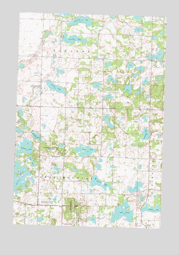
Inspiration Peak, MN USGS Topographic Map
Click on map above to begin viewing in our Map Viewer.

This topographic map contains these locations and features:
Feature Name Type Latitude Longitude GNIS ID View Map
Arken LakeLakeN46.1368°W95.5082°639436View Map
Deusch LakeLakeN46.1518°W95.5563°642779View Map
Ellingson LakeLakeN46.2458°W95.5725°643283View Map
Geology of Inspiration Peak Geological MarkerParkN46.1369°W95.5764°2073145View Map
Inspiration PeakSummitN46.1361°W95.5737°645430View Map
Inspiration Peak CemeteryCemeteryN46.1364°W95.5839°2072680View Map
Inspiration Peak Historical MarkerParkN46.1369°W95.5764°2073146View Map
Inspiration Peak State Wayside ParkParkN46.1366°W95.5778°645431View Map
Inspiration State Wildlife Management AreParkN46.1702°W95.5862°645432View Map
Lake JessieLakeN46.1338°W95.5330°645639View Map
Leaf Mountain ChurchChurchN46.1655°W95.5878°646563View Map
Leaf Mountain Lutheran CemeteryCemeteryN46.1667°W95.5869°2072681View Map
Leaf Mountain Post Office (historical)Post OfficeN46.1639°W95.5875°2073001View Map
Long LakeLakeN46.1625°W95.6104°647076View Map
Millpond LakeLakeN46.1775°W95.6079°647888View Map
Mission Covenant CemeteryCemeteryN46.1950°W95.5464°647979View Map
Nidaros ChurchChurchN46.2363°W95.5892°648550View Map
Sampson LakeLakeN46.1705°W95.6166°651126View Map
Siverson LakeLakeN46.2350°W95.5790°652097View Map
Stemmer LakeLakeN46.1805°W95.5151°652616View Map
Toms LakeLakeN46.1692°W95.5650°653230View Map
Township of Leaf MountainCivilN46.1512°W95.5833°664738View Map
Township of NidarosCivilN46.2374°W95.5850°665122View Map
Trulse LakeLakeN46.2065°W95.5926°653354View Map
Vestre Nidaaros Lutheran Church CemeteryCemeteryN46.2367°W95.5892°2072671View Map

Note: Coordinates in the location and feature list above are referenced to NAD83 datum.


Copyright (C) 2008-2025 Ryan Niemi / Sunset Dynamics ... All Rights Reserved