TopoQuest Logo
Do you find TopoQuest useful?
Help keep TopoQuest running and adding new maps/features by donating!
Bitcoin:  19c7KJd3qBynnjoSw5npx9KScwjBe4ifkT
Litecoin:  LXs6TkuXGGXo1vDsWCkWVdjQX94eUKd6ui
Home View Maps Find Maps Find Places Resources & Links


Lake Roesiger, Washington Topographic Map

USGS Map Title: Lake Roesiger, WA
USGS Map MRC: 47121H8
DRG (GeoTIFF) Download: o47121h8.tif


Neighboring USGS Topographic Map Quads:


  Lake Stevens, WA  
48122A1
 

  Granite Falls, WA  
48121A8
 

  Verlot, WA  
48121A7
 

  Snohomish, WA  
47122H1
 

  Lake Roesiger, WA  
47121H8
 

  Lake Chaplain, WA  
47121H7
 

  Maltby, WA  
47122G1
 

  Monroe, WA  
47121G8
 

  Sultan, WA  
47121G7


Map MRC Location:

N48°
W122°
N48°
W121°
H8 H7 H6 H5 H4 H3 H2 H1
G8 G7 G6 G5 G4 G3 G2 G1
F8 F7 F6 F5 F4 F3 F2 F1
E8 E7 E6 E5 E4 E3 E2 E1
D8 D7 D6 D5 D4 D3 D2 D1
C8 C7 C6 C5 C4 C3 C2 C1
B8 B7 B6 B5 B4 B3 B2 B1
A8 A7 A6 A5 A4 A3 A2 A1
N47°
W122°
N47°
W121°

Lake Roesiger, WA USGS 1:24K Topographic Map Preview:
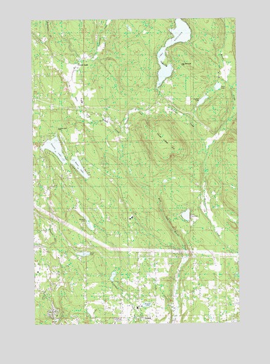
Lake Roesiger, WA USGS Topographic Map
Click on map above to begin viewing in our Map Viewer.

This topographic map contains these locations and features:
Feature Name Type Latitude Longitude GNIS ID View Map
Bevis LakeLakeN47.9718°W121.8877°1516459View Map
Box R FarmsLocaleN47.8767°W121.9433°2706252View Map
Bughollow FarmLocaleN47.8792°W121.8753°2706254View Map
Carpenter CreekStreamN47.9826°W121.9648°1517416View Map
Chain LakeLakeN47.9038°W121.9708°1517604View Map
Chain Lake Census Designated PlaceCensusN47.9038°W121.9861°2584957View Map
Chain Lake Elementary SchoolSchoolN47.8875°W121.9677°2462310View Map
Chief Seattle Boy Scout ReservationLocaleN47.9643°W121.8998°1517694View Map
Flowing LakeLakeN47.9472°W121.9876°1519659View Map
Flowing Lake ParkParkN47.9548°W121.9887°1529331View Map
Forest GladePopulated PlaceN47.9815°W121.9732°1519689View Map
Hughes LakeLakeN47.9661°W121.8974°1521048View Map
Lake CochranLakeN47.9192°W121.9079°1517905View Map
Lake RoesigerPopulated PlaceN47.9834°W121.9293°1852946View Map
Lake RoesigerLakeN47.9907°W121.9143°1525185View Map
Lake Roesiger Census Designated PlaceCensusN47.9838°W121.9129°2408549View Map
Lake Roesiger ParkParkN47.9809°W121.9135°1529332View Map
Meadow LakeLakeN47.9165°W121.9681°1522967View Map
Monroe DivisionCivilN47.9003°W121.9264°1939563View Map
Monroe Fire District 3 Station 32BuildingN47.8776°W121.9343°2619543View Map
Monroe North Census Designated PlaceCensusN47.8825°W121.9880°2585009View Map
Roesiger CreekStreamN47.9459°W121.8948°1525184View Map
Salem Woods Elementary SchoolSchoolN47.8816°W121.9384°2462471View Map
Snohomish County Fire District 16 Station 85 - Lake RoesigerBuildingN47.9860°W121.9176°2619541View Map
Sorgenfrei CreekStreamN47.9429°W121.9462°1528482View Map
Storm LakeLakeN47.9394°W121.9729°1526600View Map
Swinging R RanchLocaleN47.8764°W121.8928°2706263View Map
Three LakesLakeN47.9470°W121.9857°1530012View Map
Three Lakes Census Designated PlaceCensusN47.9420°W121.9925°2409314View Map
WagnerPopulated PlaceN47.8790°W121.9365°1527745View Map
Wagner LakeLakeN47.8827°W121.9326°1527748View Map
Woods CreekPopulated PlaceN47.8787°W121.8985°1852961View Map
Woods Creek Census Designated PlaceCensusN47.8821°W121.8982°2409626View Map

Note: Coordinates in the location and feature list above are referenced to NAD83 datum.


Copyright (C) 2008-2024 Ryan Niemi / Sunset Dynamics ... All Rights Reserved