TopoQuest Logo
Do you find TopoQuest useful?
Help keep TopoQuest running and adding new maps/features by donating!
Bitcoin:  19c7KJd3qBynnjoSw5npx9KScwjBe4ifkT
Litecoin:  LXs6TkuXGGXo1vDsWCkWVdjQX94eUKd6ui
Home View Maps Find Maps Find Places Resources & Links


Ramsey, Illinois Topographic Map

USGS Map Title: Ramsey, IL
USGS Map MRC: 39089B1
DRG (GeoTIFF) Download: o39089b1.tif


Neighboring USGS Topographic Map Quads:


  Ohlman, IL  
39089C2
 

  Oconee, IL  
39089C1
 

  Lakewood, IL  
39088C8
 

  Ramsey Lake, IL  
39089B2
 

  Ramsey, IL  
39089B1
 

  Herrick, IL  
39088B8
 

  Bingham, IL  
39089A2
 

  Vera, IL  
39089A1
 

  Avena, IL  
39088A8


Map MRC Location:

N40°
W90°
N40°
W89°
H8 H7 H6 H5 H4 H3 H2 H1
G8 G7 G6 G5 G4 G3 G2 G1
F8 F7 F6 F5 F4 F3 F2 F1
E8 E7 E6 E5 E4 E3 E2 E1
D8 D7 D6 D5 D4 D3 D2 D1
C8 C7 C6 C5 C4 C3 C2 C1
B8 B7 B6 B5 B4 B3 B2 B1
A8 A7 A6 A5 A4 A3 A2 A1
N39°
W90°
N39°
W89°

Ramsey, IL USGS 1:24K Topographic Map Preview:
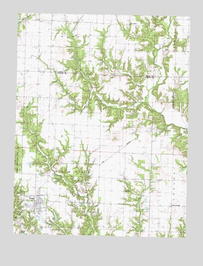
Ramsey, IL USGS Topographic Map
Click on map above to begin viewing in our Map Viewer.

This topographic map contains these locations and features:
Feature Name Type Latitude Longitude GNIS ID View Map
Bowling Green HillSummitN39.1750°W89.0073°404745View Map
Bowling Green School (historical)SchoolN39.1831°W89.0098°404746View Map
Brewer AirportAirportN39.2090°W89.1188°2717716View Map
Bridges KnobSummitN39.1812°W89.0526°404856View Map
Buell School (historical)SchoolN39.2467°W89.0826°405150View Map
Center Community ChurchChurchN39.2445°W89.0440°1725245View Map
Center School (historical)SchoolN39.2445°W89.0445°405801View Map
Chandlerville School (historical)SchoolN39.1731°W89.0798°405950View Map
Clark CemeteryCemeteryN39.2455°W89.0822°406154View Map
Cothern Family CemeteryCemeteryN39.1412°W89.0287°1965891View Map
Dixie School (historical)SchoolN39.2406°W89.1195°1725255View Map
DressorPopulated PlaceN39.1731°W89.0512°422635View Map
Fox Den School (historical)SchoolN39.2159°W89.0448°408620View Map
HansonPopulated PlaceN39.2173°W89.1109°422781View Map
Hanson School (historical)SchoolN39.2175°W89.1209°409757View Map
Hayes CemeteryCemeteryN39.1348°W89.1234°1736951View Map
Little CreekStreamN39.2012°W89.0317°412309View Map
Little Democracy School (historical)SchoolN39.1467°W89.0453°412326View Map
Moonshine School (historical)SchoolN39.2156°W89.0104°413773View Map
Moonshine School (historical)SchoolN39.2492°W89.0004°413774View Map
Mount Pleasant CemeteryCemeteryN39.1514°W89.0445°1802270View Map
Mount Pleasant ChurchChurchN39.1509°W89.0451°1736968View Map
Oak Grove School (historical)SchoolN39.2025°W89.0951°414796View Map
Prater CemeteryCemeteryN39.1970°W89.1181°1736982View Map
RamseyPopulated PlaceN39.1445°W89.1087°416367View Map
Ramsey City HallBuildingN39.1425°W89.1067°1736983View Map
Ramsey Elementary SchoolSchoolN39.1406°W89.1131°1773100View Map
Ramsey Fire Protection DistrictBuildingN39.1409°W89.1092°2640217View Map
Ramsey High SchoolSchoolN39.1406°W89.1145°1773101View Map
Ramsey Lake Golf CourseLocaleN39.1614°W89.1081°1773102View Map
Ramsey Police DepartmentBuildingN39.1409°W89.1086°2759066View Map
Ramsey Post OfficePost OfficeN39.1416°W89.1080°2788442View Map
Reed CemeteryCemeteryN39.1467°W89.0080°1966003View Map
Saint Josephs CemeteryCemeteryN39.1464°W89.1178°1736992View Map
Shedd CemeteryCemeteryN39.2120°W89.0967°418323View Map
Staff CemeteryCemeteryN39.1831°W89.0226°1737001View Map
Sturgeon School (historical)SchoolN39.1867°W89.0465°419246View Map
Township of RamseyCivilN39.1515°W89.0830°429616View Map
Twin ChurchesPopulated PlaceN39.1431°W89.0112°419976View Map
Union School (historical)SchoolN39.1287°W89.0040°420097View Map
Village of RamseyCivilN39.1442°W89.1105°2399038View Map
WJLY-FM (Ramsey)TowerN39.1350°W89.1006°428537View Map

Note: Coordinates in the location and feature list above are referenced to NAD83 datum.


Copyright (C) 2008-2025 Ryan Niemi / Sunset Dynamics ... All Rights Reserved