TopoQuest Logo
Do you find TopoQuest useful?
Help keep TopoQuest running and adding new maps/features by donating!
Bitcoin:  19c7KJd3qBynnjoSw5npx9KScwjBe4ifkT
Litecoin:  LXs6TkuXGGXo1vDsWCkWVdjQX94eUKd6ui
Home View Maps Find Maps Find Places Resources & Links


Barry, Illinois Topographic Map

USGS Map Title: Barry, IL
USGS Map MRC: 39091F1
DRG (GeoTIFF) Download: o39091f1.tif


Neighboring USGS Topographic Map Quads:


  Payson, IL  
39091G2
 

  Richfield, IL  
39091G1
 

  Fishhook, IL  
39090G8
 

  Hull, IL  
39091F2
 

  Barry, IL  
39091F1
 

  Baylis, IL  
39090F8
 

  Ashburn, MO  
39091E2
 

  Rockport, IL  
39091E1
 

  Summer Hill, IL  
39090E8


Map MRC Location:

N40°
W92°
N40°
W91°
H8 H7 H6 H5 H4 H3 H2 H1
G8 G7 G6 G5 G4 G3 G2 G1
F8 F7 F6 F5 F4 F3 F2 F1
E8 E7 E6 E5 E4 E3 E2 E1
D8 D7 D6 D5 D4 D3 D2 D1
C8 C7 C6 C5 C4 C3 C2 C1
B8 B7 B6 B5 B4 B3 B2 B1
A8 A7 A6 A5 A4 A3 A2 A1
N39°
W92°
N39°
W91°

Barry, IL USGS 1:24K Topographic Map Preview:
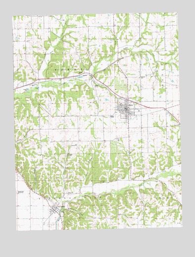
Barry, IL USGS Topographic Map
Click on map above to begin viewing in our Map Viewer.

This topographic map contains these locations and features:
Feature Name Type Latitude Longitude GNIS ID View Map
BarryPopulated PlaceN39.6942°W91.0390°403933View Map
Barry BalloonportAirportN39.6875°W91.0312°427044View Map
Barry CemeteryCemeteryN39.6942°W91.0482°1852457View Map
Barry Fire Protection DistrictBuildingN39.6939°W91.0397°2640336View Map
Barry High SchoolSchoolN39.6973°W91.0446°1822208View Map
Barry Historic DistrictParkN39.6937°W91.0410°1822209View Map
Barry Post OfficePost OfficeN39.6952°W91.0417°2788748View Map
Beebe CreekStreamN39.7100°W91.1007°404093View Map
Blair CemeteryCemeteryN39.6764°W91.0457°404541View Map
Bluegrass School (historical)SchoolN39.7128°W91.1243°1747220View Map
Bowler School (historical)SchoolN39.7431°W91.0476°1747221View Map
Buckeye School (historical)SchoolN39.7428°W91.0101°1747225View Map
Bull RunStreamN39.6542°W91.0143°405182View Map
City of BarryCivilN39.6983°W91.0398°2394070View Map
Collins School (historical)SchoolN39.6517°W91.0196°1747229View Map
Gully Landing Strip (historical)AirportN39.6739°W91.0779°1747240View Map
Guss School (historical)SchoolN39.7420°W91.0904°1747241View Map
Holy Redeemer ChurchChurchN39.6934°W91.0312°1987810View Map
Horn HollowValleyN39.6498°W91.0750°410540View Map
Jennings SpringSpringN39.6687°W91.0851°411090View Map
Mound School (historical)SchoolN39.6834°W91.0876°1747250View Map
New CantonPopulated PlaceN39.6362°W91.0960°414385View Map
New Canton Fire Protection DistrictBuildingN39.6376°W91.0971°2640660View Map
New Canton Post OfficePost OfficeN39.6370°W91.0963°2788663View Map
New Canton Station (historical)LocaleN39.6292°W91.1043°1822216View Map
North Fork Hadley CreekStreamN39.7267°W91.0474°414597View Map
Oak Grove School (historical)SchoolN39.7128°W91.0174°1747252View Map
Park Lawn CemeteryCemeteryN39.6942°W91.0479°1852486View Map
Pike County Sheriff's Office - Barry StationBuildingN39.6915°W91.0400°2759040View Map
Potter Airport (historical)AirportN39.7435°W91.0718°427045View Map
Shearer CemeteryCemeteryN39.6464°W91.0871°418321View Map
Shewhart HollowValleyN39.6472°W91.1105°418384View Map
Spring School (historical)SchoolN39.6648°W91.0907°1747265View Map
Spring Valley School (historical)SchoolN39.7114°W91.0637°1747266View Map
Stoney Point CemeteryCemeteryN39.6525°W91.0576°419190View Map
Stony Point School (historical)SchoolN39.6523°W91.0582°1747268View Map
Town of New CantonCivilN39.6373°W91.0982°2396799View Map
Township of BarryCivilN39.7131°W91.0889°428639View Map
Weber SpringSpringN39.7087°W91.0607°420691View Map
Whippoorwill HollowValleyN39.6377°W91.0878°421006View Map
Whittleton School (historical)SchoolN39.6906°W91.0110°1747272View Map
Williams School (historical)SchoolN39.6773°W91.0482°1747274View Map
Woodruff CemeteryCemeteryN39.7128°W91.0290°421469View Map

Note: Coordinates in the location and feature list above are referenced to NAD83 datum.


Copyright (C) 2008-2025 Ryan Niemi / Sunset Dynamics ... All Rights Reserved