TopoQuest Logo
Do you find TopoQuest useful?
Help keep TopoQuest running and adding new maps/features by donating!
Bitcoin:  19c7KJd3qBynnjoSw5npx9KScwjBe4ifkT
Litecoin:  LXs6TkuXGGXo1vDsWCkWVdjQX94eUKd6ui
Home View Maps Find Maps Find Places Resources & Links


Richfield, Illinois Topographic Map

USGS Map Title: Richfield, IL
USGS Map MRC: 39091G1
DRG (GeoTIFF) Download: o39091g1.tif


Neighboring USGS Topographic Map Quads:


  Columbus, IL  
39091H2
 

  Liberty, IL  
39091H1
 

  Kellerville, IL  
39090H8
 

  Payson, IL  
39091G2
 

  Richfield, IL  
39091G1
 

  Fishhook, IL  
39090G8
 

  Hull, IL  
39091F2
 

  Barry, IL  
39091F1
 

  Baylis, IL  
39090F8


Map MRC Location:

N40°
W92°
N40°
W91°
H8 H7 H6 H5 H4 H3 H2 H1
G8 G7 G6 G5 G4 G3 G2 G1
F8 F7 F6 F5 F4 F3 F2 F1
E8 E7 E6 E5 E4 E3 E2 E1
D8 D7 D6 D5 D4 D3 D2 D1
C8 C7 C6 C5 C4 C3 C2 C1
B8 B7 B6 B5 B4 B3 B2 B1
A8 A7 A6 A5 A4 A3 A2 A1
N39°
W92°
N39°
W91°

Richfield, IL USGS 1:24K Topographic Map Preview:
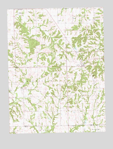
Richfield, IL USGS Topographic Map
Click on map above to begin viewing in our Map Viewer.

This topographic map contains these locations and features:
Feature Name Type Latitude Longitude GNIS ID View Map
Akers School (historical)SchoolN39.8214°W91.0490°403370View Map
Baker Family CemeteryCemeteryN39.7953°W91.1065°1720496View Map
Brick School (historical)SchoolN39.8670°W91.0604°404842View Map
Broady Family CemeteryCemeteryN39.8723°W91.0976°1720499View Map
Center School (historical)SchoolN39.8087°W91.0885°405812View Map
Dale A Klassing Airport (historical)AirportN39.8167°W91.0335°427453View Map
De Wees LakeReservoirN39.7643°W91.0731°1692604View Map
De Wees Lake DamDamN39.7634°W91.0735°1692603View Map
Drescher Family CemeteryCemeteryN39.8523°W91.0729°1720515View Map
Elmwood Family CemeteryCemeteryN39.8639°W91.0401°1720519View Map
Hadley Creek Number 2 DamDamN39.7850°W91.0268°1691554View Map
Hadley Creek Number 2 ReservoirReservoirN39.7859°W91.0269°1691555View Map
Hickory Grove School (historical)SchoolN39.8603°W91.0882°410160View Map
KingstonPopulated PlaceN39.8167°W91.0279°411517View Map
Kingston CemeteryCemeteryN39.8203°W91.0249°1984962View Map
Klarner CemeteryCemeteryN39.8387°W91.0768°1720539View Map
Lone Oak School (historical)SchoolN39.7714°W91.0071°412539View Map
Maynard School (historical)SchoolN39.8662°W91.0126°413162View Map
Pearce CemeteryCemeteryN39.8623°W91.0590°1720558View Map
Pin Oak School (historical)SchoolN39.7714°W91.0968°415690View Map
Pleasant View CemeteryCemeteryN39.8748°W91.0501°1720560View Map
Potter CemeteryCemeteryN39.7573°W91.0893°1720561View Map
Rice Family CemeteryCemeteryN39.7934°W91.1249°1720563View Map
RichfieldPopulated PlaceN39.8153°W91.1165°416597View Map
Richfield QuarryMineN39.7956°W91.1040°1837331View Map
Rock School (historical)SchoolN39.8378°W91.1165°416831View Map
Rose Hill School (historical)SchoolN39.7942°W91.0693°416948View Map
School Number 7 (historical)SchoolN39.7717°W91.0493°425463View Map
Stewart CemeteryCemeteryN39.7567°W91.0399°1747267View Map
Township of RichfieldCivilN39.8012°W91.0888°429629View Map

Note: Coordinates in the location and feature list above are referenced to NAD83 datum.


Copyright (C) 2008-2024 Ryan Niemi / Sunset Dynamics ... All Rights Reserved