TopoQuest Logo
Do you find TopoQuest useful?
Help keep TopoQuest running and adding new maps/features by donating!
Bitcoin:  19c7KJd3qBynnjoSw5npx9KScwjBe4ifkT
Litecoin:  LXs6TkuXGGXo1vDsWCkWVdjQX94eUKd6ui
Home View Maps Find Maps Find Places Resources & Links


Payson, Illinois Topographic Map

USGS Map Title: Payson, IL
USGS Map MRC: 39091G2
DRG (GeoTIFF) Download: o39091g2.tif


Neighboring USGS Topographic Map Quads:


  Quincy East, IL  
39091H3
 

  Columbus, IL  
39091H2
 

  Liberty, IL  
39091H1
 

  Marblehead, IL  
39091G3
 

  Payson, IL  
39091G2
 

  Richfield, IL  
39091G1
 

  Hannibal East, MO  
39091F3
 

  Hull, IL  
39091F2
 

  Barry, IL  
39091F1


Map MRC Location:

N40°
W92°
N40°
W91°
H8 H7 H6 H5 H4 H3 H2 H1
G8 G7 G6 G5 G4 G3 G2 G1
F8 F7 F6 F5 F4 F3 F2 F1
E8 E7 E6 E5 E4 E3 E2 E1
D8 D7 D6 D5 D4 D3 D2 D1
C8 C7 C6 C5 C4 C3 C2 C1
B8 B7 B6 B5 B4 B3 B2 B1
A8 A7 A6 A5 A4 A3 A2 A1
N39°
W92°
N39°
W91°

Payson, IL USGS 1:24K Topographic Map Preview:
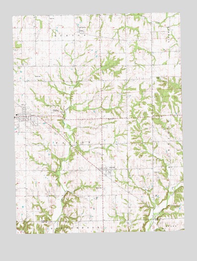
Payson, IL USGS Topographic Map
Click on map above to begin viewing in our Map Viewer.

This topographic map contains these locations and features:
Feature Name Type Latitude Longitude GNIS ID View Map
AdamsPopulated PlaceN39.8653°W91.1982°403343View Map
Anderson BranchStreamN39.7559°W91.1504°403502View Map
California School (historical)SchoolN39.8603°W91.1271°405364View Map
Cooke School (historical)SchoolN39.8150°W91.1721°406508View Map
Franks CemeteryCemeteryN39.8378°W91.1412°1720522View Map
Greencastle School (historical)SchoolN39.7645°W91.1657°409422View Map
Krutmeier AirportAirportN39.8196°W91.2226°427659View Map
Lock Family CemeteryCemeteryN39.7703°W91.1465°1720545View Map
Meyers Dairy FarmLocaleN39.8606°W91.1533°2680753View Map
Newton CemeteryCemeteryN39.8670°W91.2001°1720554View Map
Nichols Family CemeteryCemeteryN39.8398°W91.2299°1720555View Map
Oakwood School (historical)SchoolN39.8037°W91.1351°414940View Map
Oregon School (historical)SchoolN39.8598°W91.1654°415167View Map
PaysonPopulated PlaceN39.8170°W91.2424°415476View Map
Payson - Fall Creek Fire Protection District 1BuildingN39.8183°W91.2415°2640255View Map
Payson Congregational ChurchChurchN39.8173°W91.2410°2040103View Map
Payson New CemeteryCemeteryN39.8109°W91.2468°1984981View Map
Payson Old CemeteryCemeteryN39.8156°W91.2454°1984982View Map
Payson Post OfficePost OfficeN39.8192°W91.2416°2788691View Map
PlainvillePopulated PlaceN39.7859°W91.1854°415759View Map
Plainville Post OfficePost OfficeN39.7861°W91.1854°2788343View Map
Rice School (historical)SchoolN39.8381°W91.1463°416588View Map
Richland CemeteryCemeteryN39.8145°W91.1754°1720564View Map
Schroth School (historical)SchoolN39.8362°W91.1990°418113View Map
Seymour Elementary SchoolSchoolN39.8184°W91.2482°1785345View Map
Shiloh CemeteryCemeteryN39.7839°W91.1468°1720570View Map
Sodom School (historical)SchoolN39.7792°W91.2413°418692View Map
Steward CemeteryCemeteryN39.7756°W91.1857°1720576View Map
Tandy CemeteryCemeteryN39.8731°W91.2226°1720577View Map
Tandy School (historical)SchoolN39.8606°W91.2338°419536View Map
Township of PaysonCivilN39.8013°W91.2064°429536View Map
Union School (historical)SchoolN39.7573°W91.1960°420109View Map
Village of PaysonCivilN39.8171°W91.2444°2399639View Map
Village of PlainvilleCivilN39.7848°W91.1817°2399685View Map
Wagy School (historical)SchoolN39.7789°W91.1354°420376View Map
Whitcomb School (historical)SchoolN39.7967°W91.2021°421018View Map

Note: Coordinates in the location and feature list above are referenced to NAD83 datum.


Copyright (C) 2008-2024 Ryan Niemi / Sunset Dynamics ... All Rights Reserved