TopoQuest Logo
Do you find TopoQuest useful?
Help keep TopoQuest running and adding new maps/features by donating!
Bitcoin:  19c7KJd3qBynnjoSw5npx9KScwjBe4ifkT
Litecoin:  LXs6TkuXGGXo1vDsWCkWVdjQX94eUKd6ui
Home View Maps Find Maps Find Places Resources & Links


Lawton, Pennsylvania Topographic Map

USGS Map Title: Lawton, PA
USGS Map MRC: 41076G1
DRG (GeoTIFF) Download: o41076g1.tif


Neighboring USGS Topographic Map Quads:


  Little Meadows, PA  
41076H2
 

  Friendsville, PA  
41076H1
 

  Laurel Lake, PA  
41075H8
 

  Le Raysville, PA  
41076G2
 

  Lawton, PA  
41076G1
 

  Montrose West, PA  
41075G8
 

  Laceyville, PA  
41076F2
 

  Auburn Center, PA  
41076F1
 

  Springville, PA  
41075F8


Map MRC Location:

N42°
W77°
N42°
W76°
H8 H7 H6 H5 H4 H3 H2 H1
G8 G7 G6 G5 G4 G3 G2 G1
F8 F7 F6 F5 F4 F3 F2 F1
E8 E7 E6 E5 E4 E3 E2 E1
D8 D7 D6 D5 D4 D3 D2 D1
C8 C7 C6 C5 C4 C3 C2 C1
B8 B7 B6 B5 B4 B3 B2 B1
A8 A7 A6 A5 A4 A3 A2 A1
N41°
W77°
N41°
W76°

Lawton, PA USGS 1:24K Topographic Map Preview:
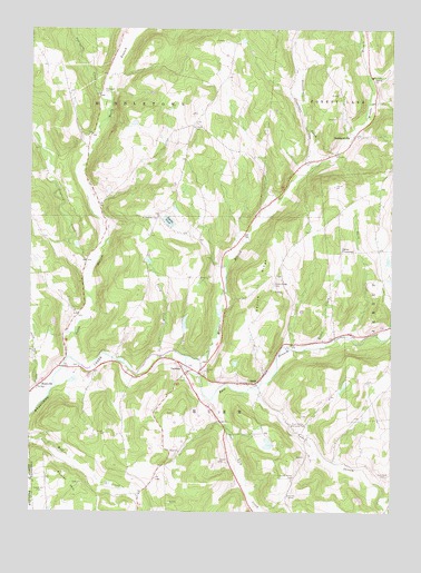
Lawton, PA USGS Topographic Map
Click on map above to begin viewing in our Map Viewer.

This topographic map contains these locations and features:
Feature Name Type Latitude Longitude GNIS ID View Map
Birchardsville Post Office (historical)Post OfficeN41.8476°W76.0121°1214537View Map
BirchardvillePopulated PlaceN41.8476°W76.0127°1203098View Map
County Home CemeteryCemeteryN41.7592°W76.0330°1172505View Map
Deer Lick CreekStreamN41.7795°W76.0608°1173094View Map
Deuel CreekStreamN41.7923°W76.0327°1173188View Map
Devine RidgeRidgeN41.8040°W76.0435°1173211View Map
Devine Ridge CemeteryCemeteryN41.8095°W76.0402°1173212View Map
East Branch Wyalusing CreekStreamN41.7904°W76.0702°1173781View Map
East Rush CemeteryCemeteryN41.7595°W76.0008°1173866View Map
Elk Lake StreamStreamN41.7812°W76.0488°1209298View Map
Flynn SchoolSchoolN41.8509°W76.0683°1197349View Map
Fowler HillSummitN41.7595°W76.1160°1175082View Map
Fowler Hill CemeteryCemeteryN41.7551°W76.1199°1175083View Map
Gaylord CreekStreamN41.8098°W76.1063°1175492View Map
LawtonPopulated PlaceN41.7859°W76.0708°1203995View Map
Lawton Post OfficePost OfficeN41.7862°W76.0714°2773178View Map
Logan Hill School (historical)SchoolN41.7659°W76.0852°1197348View Map
Middle Branch Wyalusing CreekStreamN41.7904°W76.0702°1181015View Map
North Branch Wyalusing CreekStreamN41.7904°W76.1113°1182558View Map
Parks CrossroadPopulated PlaceN41.8173°W76.0171°1204363View Map
Rigsby PondLakeN41.8254°W76.0769°1185082View Map
RushPopulated PlaceN41.7834°W76.0463°1204558View Map
Rush Center Memorial ParkCemeteryN41.7717°W76.0330°1185638View Map
Rush Volunteer Fire Department Station 1BuildingN41.7875°W76.0639°2653017View Map
RushvillePopulated PlaceN41.7826°W76.1222°1204562View Map
Saint Johns CemeteryCemeteryN41.8503°W76.0671°1186081View Map
Saint Patricks ChurchChurchN41.8259°W76.0810°1186539View Map
Snell CreekStreamN41.7959°W76.0144°1187938View Map
Steadwell CemeteryCemeteryN41.8590°W76.0999°1188574View Map
Stonestreet CreekStreamN41.8395°W76.0274°1188748View Map
Summers CreekStreamN41.8556°W76.0969°1189027View Map
Terry CreekStreamN41.7906°W76.0788°1189374View Map
Township of MiddletownCivilN41.8714°W76.0876°1217247View Map
Township of RushCivilN41.7800°W76.0619°1217095View Map

Note: Coordinates in the location and feature list above are referenced to NAD83 datum.


Copyright (C) 2008-2025 Ryan Niemi / Sunset Dynamics ... All Rights Reserved