TopoQuest Logo
Do you find TopoQuest useful?
Help keep TopoQuest running and adding new maps/features by donating!
Bitcoin:  19c7KJd3qBynnjoSw5npx9KScwjBe4ifkT
Litecoin:  LXs6TkuXGGXo1vDsWCkWVdjQX94eUKd6ui
Home View Maps Find Maps Find Places Resources & Links


Sparta, Oregon Topographic Map

USGS Map Title: Sparta, OR
USGS Map MRC: 44117G3
DRG (GeoTIFF) Download: o44117g3.tif


Neighboring USGS Topographic Map Quads:


  Balm Creek Reservoir, OR  
44117H4
 

  Sparta Butte, OR  
44117H3
 

  Jimtown, OR  
44117H2
 

  Glasgow Butte, OR  
44117G4
 

  Sparta, OR  
44117G3
 

  Richland, OR  
44117G2
 

  Lawrence Creek, OR  
44117F4
 

  Little Lookout Mountain, OR  
44117F3
 

  Daly Creek, OR  
44117F2


Map MRC Location:

N45°
W118°
N45°
W117°
H8 H7 H6 H5 H4 H3 H2 H1
G8 G7 G6 G5 G4 G3 G2 G1
F8 F7 F6 F5 F4 F3 F2 F1
E8 E7 E6 E5 E4 E3 E2 E1
D8 D7 D6 D5 D4 D3 D2 D1
C8 C7 C6 C5 C4 C3 C2 C1
B8 B7 B6 B5 B4 B3 B2 B1
A8 A7 A6 A5 A4 A3 A2 A1
N44°
W118°
N44°
W117°

Sparta, OR USGS 1:24K Topographic Map Preview:
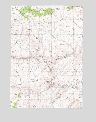
Sparta, OR USGS Topographic Map
Click on map above to begin viewing in our Map Viewer.

This topographic map contains these locations and features:
Feature Name Type Latitude Longitude GNIS ID View Map
Baldy GulchValleyN44.8721°W117.2982°1152807View Map
Blue GulchValleyN44.8082°W117.2955°1129550View Map
Boyce springSpringN44.7827°W117.3346°1130910View Map
Canyon CreekStreamN44.7754°W117.2810°1118573View Map
Crystal Palace MineMineN44.8552°W117.3705°1119609View Map
Deer FlatsFlatN44.8374°W117.3135°1116463View Map
Del Monte MineMineN44.8696°W117.3196°1119846View Map
Dry GulchValleyN44.8124°W117.3399°1129549View Map
Eagle Creek CanyonValleyN44.8568°W117.3094°1152809View Map
Eagle Valley DivisionCivilN44.7908°W117.3473°1938005View Map
Gem Mine (historical)MineN44.8615°W117.3580°1121092View Map
Gem Post Office (historical)Post OfficeN44.8707°W117.3580°1165302View Map
Goodwin GulchValleyN44.7818°W117.2566°1158633View Map
Hole in the Wall GulchValleyN44.8082°W117.3205°1129547View Map
Hyall GulchValleyN44.7799°W117.2599°1143973View Map
Keystone MineMineN44.7813°W117.3088°1122717View Map
Kuykendahl GulchValleyN44.7777°W117.2591°1122864View Map
Lone Star Mine (historical)MineN44.8190°W117.3660°1123389View Map
Long GulchValleyN44.7804°W117.2732°1129429View Map
Lost GulchValleyN44.7971°W117.3121°1129427View Map
Lower Timber CanyonValleyN44.7577°W117.2543°1123596View Map
Macy MineMineN44.8057°W117.3044°1123669View Map
Maiden GulchValleyN44.8015°W117.3102°1123696View Map
Minnie May MineMineN44.7999°W117.3091°1124244View Map
Murray GulchValleyN44.8110°W117.3274°1129548View Map
Pittsburg GulchValleyN44.8115°W117.3566°1125455View Map
Rattlesnake GulchValleyN44.7777°W117.3057°1133294View Map
Rich CreekStreamN44.8110°W117.3413°1129430View Map
Rosebud MineMineN44.8688°W117.3391°1126296View Map
Skin-it GulchValleyN44.8624°W117.3149°1129431View Map
SpartaPopulated PlaceN44.8710°W117.3241°1136770View Map
Sparta CemeteryCemeteryN44.8716°W117.3268°1116462View Map
Sparta Post Office (historical)Post OfficeN44.8710°W117.3241°1165967View Map
Tackle GulchValleyN44.8707°W117.3510°1152806View Map
Thorn GulchValleyN44.8182°W117.2635°1129439View Map
Upper Timber CanyonValleyN44.7764°W117.2833°1128478View Map
Wyatt GulchValleyN44.7888°W117.3010°1129428View Map
Wyatt ReservoirReservoirN44.8556°W117.2675°1129432View Map

Note: Coordinates in the location and feature list above are referenced to NAD83 datum.


Copyright (C) 2008-2024 Ryan Niemi / Sunset Dynamics ... All Rights Reserved