TopoQuest Logo
Do you find TopoQuest useful?
Help keep TopoQuest running and adding new maps/features by donating!
Bitcoin:  19c7KJd3qBynnjoSw5npx9KScwjBe4ifkT
Litecoin:  LXs6TkuXGGXo1vDsWCkWVdjQX94eUKd6ui
Home View Maps Find Maps Find Places Resources & Links


Lawton, Michigan Topographic Map

USGS Map Title: Lawton, MI
USGS Map MRC: 42085B7
DRG (GeoTIFF) Download: o42085b7.tif


Neighboring USGS Topographic Map Quads:


  Gobles West, MI  
42085C8
 

  Gobles East, MI  
42085C7
 

  Kalamazoo SW, MI  
42085C6
 

  Paw Paw, MI  
42085B8
 

  Lawton, MI  
42085B7
 

  Schoolcraft NW, MI  
42085B6
 

  Decatur, MI  
42085A8
 

  Marcellus, MI  
42085A7
 

  Schoolcraft, MI  
42085A6


Map MRC Location:

N43°
W86°
N43°
W85°
H8 H7 H6 H5 H4 H3 H2 H1
G8 G7 G6 G5 G4 G3 G2 G1
F8 F7 F6 F5 F4 F3 F2 F1
E8 E7 E6 E5 E4 E3 E2 E1
D8 D7 D6 D5 D4 D3 D2 D1
C8 C7 C6 C5 C4 C3 C2 C1
B8 B7 B6 B5 B4 B3 B2 B1
A8 A7 A6 A5 A4 A3 A2 A1
N42°
W86°
N42°
W85°

Lawton, MI USGS 1:24K Topographic Map Preview:
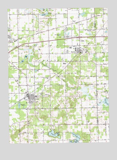
Lawton, MI USGS Topographic Map
Click on map above to begin viewing in our Map Viewer.

This topographic map contains these locations and features:
Feature Name Type Latitude Longitude GNIS ID View Map
Acorn SchoolSchoolN42.2453°W85.8645°619809View Map
Antwerp SchoolSchoolN42.1709°W85.8036°620158View Map
Antwerp Sunshine Branch LibraryBuildingN42.2083°W85.7925°2574704View Map
Antwerp Township Primitive ParkParkN42.1853°W85.8244°2112860View Map
Assembly of God ChurchChurchN42.1967°W85.8678°2112864View Map
Bangs CemeteryCemeteryN42.2208°W85.8667°2112866View Map
Buck LakeLakeN42.1925°W85.8403°2112861View Map
Cedar LakeLakeN42.2453°W85.8253°2112871View Map
Chamberlain SchoolSchoolN42.1345°W85.8517°623050View Map
Chamberlin CemeteryCemeteryN42.1350°W85.8536°623051View Map
Church of GodChurchN42.1947°W85.8647°2112862View Map
Deal Mobile Home VillagePopulated PlaceN42.2125°W85.7883°2574709View Map
Durkee SchoolSchoolN42.1862°W85.8522°625025View Map
Evangelical Mennonite ChurchChurchN42.1633°W85.8417°2574718View Map
Faith AcademySchoolN42.2147°W85.7911°2112869View Map
Faith Baptist ChurchChurchN42.2147°W85.7906°2574703View Map
First Baptist ChurchChurchN42.2217°W85.8669°2112865View Map
Freshwater Community ChurchChurchN42.2261°W85.8431°2574678View Map
Full Gospel ChurchChurchN42.2153°W85.8686°2574676View Map
Grace Missionary ChurchChurchN42.2344°W85.7847°2112870View Map
Harwick CemeteryCemeteryN42.2153°W85.8250°627911View Map
Heroes LakeLakeN42.2276°W85.7522°2747256View Map
Houppert Winery Historical MarkerParkN42.1735°W85.8423°2570908View Map
Huzzy LakeLakeN42.1335°W85.8200°628901View Map
Interchange 66CrossingN42.2233°W85.7853°2575013View Map
Kern CemeteryCemeteryN42.1270°W85.7683°629620View Map
Kingdom HallChurchN42.2211°W85.8642°2112867View Map
Kinney SchoolSchoolN42.1392°W85.7506°629741View Map
Lakeview Medical CenterHospitalN42.2292°W85.7856°2574708View Map
Lakeview Medical CenterHospitalN42.1722°W85.8533°2574723View Map
LawtonPopulated PlaceN42.1673°W85.8470°630224View Map
Lawton Elementary SchoolSchoolN42.1689°W85.8403°2574724View Map
Lawton Fire DepartmentBuildingN42.1670°W85.8492°2574722View Map
Lawton Golf ClubLocaleN42.1778°W85.8472°2574727View Map
Lawton High SchoolSchoolN42.1700°W85.8281°2574726View Map
Lawton Middle SchoolSchoolN42.1683°W85.8389°2574725View Map
Lawton Police DepartmentBuildingN42.1672°W85.8492°2574721View Map
Lawton Post OfficePost OfficeN42.1656°W85.8489°2574719View Map
Lawton Public LibraryBuildingN42.1661°W85.8497°2574717View Map
Lawton Station (historical)LocaleN42.1706°W85.8497°2574714View Map
Lewis ParkParkN42.1625°W85.8506°2112859View Map
Little Bankson LakeLakeN42.1310°W85.7910°630544View Map
Maple Grove CemeteryCemeteryN42.2370°W85.7917°631430View Map
MattawanPopulated PlaceN42.2095°W85.7845°631736View Map
Mattawan AirparkAirportN42.1980°W85.8026°1624034View Map
Mattawan CreekStreamN42.2147°W85.7994°2112868View Map
Mattawan Fire DepartmentBuildingN42.2164°W85.7846°2574707View Map
Mattawan High SchoolSchoolN42.2097°W85.7906°2574710View Map
Mattawan Later Elementary SchoolSchoolN42.2106°W85.7906°2574711View Map
Mattawan Middle SchoolSchoolN42.2133°W85.7967°2574712View Map
Mattawan Police DepartmentBuildingN42.2082°W85.7875°2574705View Map
Mattawan Post OfficePost OfficeN42.2172°W85.7850°2574706View Map
Mattawan Station (historical)LocaleN42.2097°W85.7833°2574713View Map
Miracle CampLocaleN42.1264°W85.7956°2112858View Map
Mud LakeLakeN42.2444°W85.8306°2112872View Map
Mud LakeLakeN42.2052°W85.8526°632905View Map
Oak Grove CemeteryCemeteryN42.1709°W85.8339°633819View Map
Oak Grove SchoolSchoolN42.2439°W85.7556°633835View Map
Paw Paw Christian Reformed ChurchChurchN42.2244°W85.8528°2574679View Map
Paw Paw High SchoolSchoolN42.2250°W85.8486°2574693View Map
Pine Island Presbyterian ChurchChurchN42.2089°W85.7703°2574702View Map
Pioneer Point CampgroundLocaleN42.1425°W85.7778°2574720View Map
Richmond SchoolSchoolN42.2289°W85.8250°635890View Map
Rix Post Office (historical)Post OfficeN42.2428°W85.7631°2612226View Map
Saint Anne's ChapelChurchN42.1717°W85.8675°2574715View Map
Saint John Bosco ChurchChurchN42.2103°W85.7844°2574701View Map
Saint Paul's United Methodist ChurchChurchN42.1672°W85.8467°2574716View Map
Sand LakeLakeN42.2013°W85.8572°637182View Map
School Number 8SchoolN42.1273°W85.8225°637410View Map
Seventh Day Adventist ChurchChurchN42.2000°W85.8706°2112863View Map
Steeple SchoolSchoolN42.2228°W85.8636°638780View Map
Township of AntwerpCivilN42.2009°W85.8217°1625841View Map
Turner SchoolSchoolN42.1431°W85.7856°1615188View Map
Village of LawtonCivilN42.1678°W85.8459°2398404View Map
Village of MattawanCivilN42.2165°W85.7858°2399274View Map
Virgo CemeteryCemeteryN42.1784°W85.7644°1615606View Map

Note: Coordinates in the location and feature list above are referenced to NAD83 datum.


Copyright (C) 2008-2025 Ryan Niemi / Sunset Dynamics ... All Rights Reserved