TopoQuest Logo
Do you find TopoQuest useful?
Help keep TopoQuest running and adding new maps/features by donating!
Bitcoin:  19c7KJd3qBynnjoSw5npx9KScwjBe4ifkT
Litecoin:  LXs6TkuXGGXo1vDsWCkWVdjQX94eUKd6ui
Home View Maps Find Maps Find Places Resources & Links


Marcellus, Michigan Topographic Map

USGS Map Title: Marcellus, MI
USGS Map MRC: 42085A7
DRG (GeoTIFF) Download: o42085a7.tif


Neighboring USGS Topographic Map Quads:


  Paw Paw, MI  
42085B8
 

  Lawton, MI  
42085B7
 

  Schoolcraft NW, MI  
42085B6
 

  Decatur, MI  
42085A8
 

  Marcellus, MI  
42085A7
 

  Schoolcraft, MI  
42085A6
 

  Vandalia, MI  
41085H8
 

  Jones, MI  
41085H7
 

  Three Rivers West, MI  
41085H6


Map MRC Location:

N43°
W86°
N43°
W85°
H8 H7 H6 H5 H4 H3 H2 H1
G8 G7 G6 G5 G4 G3 G2 G1
F8 F7 F6 F5 F4 F3 F2 F1
E8 E7 E6 E5 E4 E3 E2 E1
D8 D7 D6 D5 D4 D3 D2 D1
C8 C7 C6 C5 C4 C3 C2 C1
B8 B7 B6 B5 B4 B3 B2 B1
A8 A7 A6 A5 A4 A3 A2 A1
N42°
W86°
N42°
W85°

Marcellus, MI USGS 1:24K Topographic Map Preview:
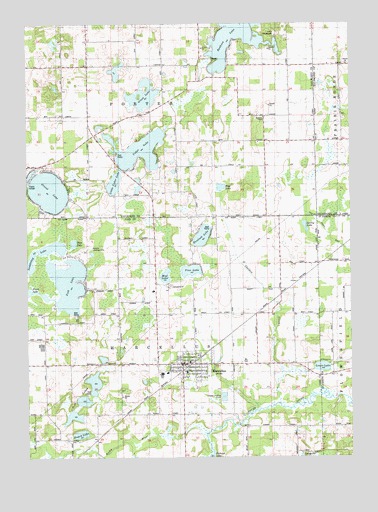
Marcellus, MI USGS Topographic Map
Click on map above to begin viewing in our Map Viewer.

This topographic map contains these locations and features:
Feature Name Type Latitude Longitude GNIS ID View Map
Adams SchoolSchoolN42.1125°W85.7731°619829View Map
Bankson LakeLakeN42.1233°W85.7906°620559View Map
Batchelor SchoolSchoolN42.0417°W85.8250°620734View Map
Beech Grove Trailer ParkPopulated PlaceN42.0375°W85.8250°2414376View Map
Bly CemeteryCemeteryN42.0278°W85.7911°2109329View Map
Bly SchoolSchoolN42.0273°W85.7936°621661View Map
Camp ShawadaseeLocaleN42.1217°W85.7786°2112897View Map
Cedar LakeLakeN42.0886°W85.8312°622918View Map
Cornish FieldAirportN42.0996°W85.8372°2650923View Map
Cranberry Lake CampgroundLocaleN42.0011°W85.7689°2414378View Map
Globe SchoolSchoolN42.0214°W85.8678°626901View Map
Goff Lake CampgroundsLocaleN42.0181°W85.8567°2414377View Map
Goff LakesLakeN42.0165°W85.8534°626920View Map
Grass LakeLakeN42.1043°W85.8295°627176View Map
Gravel LakeLakeN42.0769°W85.8666°627243View Map
Harmony ChapelChurchN42.0975°W85.7836°627811View Map
Hemlock LakeLakeN42.0638°W85.8072°628083View Map
Hemlock Lake CampgroundLocaleN42.0606°W85.8106°2414375View Map
Huyck GravesCemeteryN42.0055°W85.8694°2402240View Map
Huyck LakeLakeN42.0068°W85.8548°628898View Map
Kinney SchoolSchoolN42.0903°W85.7836°629740View Map
Lakeview Family CareHospitalN42.0253°W85.8144°2414371View Map
Lewis LakeLakeN42.0260°W85.7613°1624678View Map
Little Cedar LakeLakeN42.0795°W85.8411°630591View Map
MarcellusPopulated PlaceN42.0259°W85.8156°631539View Map
Marcellus Elementary SchoolSchoolN42.0244°W85.8206°2414365View Map
Marcellus Fire Department / Marcellus Ambulance ServiceBuildingN42.0272°W85.8136°2414370View Map
Marcellus High SchoolSchoolN42.0242°W85.8228°2414366View Map
Marcellus Middle SchoolSchoolN42.0272°W85.8128°2414360View Map
Marcellus Police DepartmentBuildingN42.0272°W85.8133°2414369View Map
Marcellus Post OfficePost OfficeN42.0258°W85.8150°2414367View Map
Marcellus StationLocaleN42.0253°W85.8150°2414364View Map
Marcellus Township LibraryBuildingN42.0267°W85.8178°2414368View Map
Maxam SchoolSchoolN42.0770°W85.8117°631754View Map
Melville Landing Strip (historical)AirportN42.0597°W85.8531°2109330View Map
Mud LakeLakeN42.0523°W85.8216°632895View Map
Mud LakeLakeN42.0779°W85.7999°632897View Map
Otter LakeLakeN42.0618°W85.8569°634187View Map
Patrick SchoolSchoolN42.0114°W85.8400°634459View Map
Peacock Ridge Golf CourseLocaleN42.0736°W85.8236°2420843View Map
Pine LakeLakeN42.0539°W85.8117°634953View Map
Porter Center SchoolSchoolN42.1037°W85.8278°635295View Map
Porter ChurchChurchN42.1125°W85.8511°635297View Map
Porter Town HallLocaleN42.1134°W85.8325°635309View Map
Saddlebag LakeLakeN42.0600°W85.8683°636483View Map
Saint Margaret Mary ChurchChurchN42.0258°W85.8106°2414372View Map
Shannon SchoolSchoolN42.0517°W85.8406°637660View Map
Sheldon CreekStreamN42.0156°W85.7792°637717View Map
Sheldon SchoolSchoolN42.0475°W85.7778°637720View Map
Spring LakeLakeN42.0665°W85.7674°638571View Map
Township of MarcellusCivilN42.0264°W85.8193°1626683View Map
Township of PorterCivilN42.1131°W85.8205°1626931View Map
Trinity Bible ChurchChurchN42.0233°W85.8083°2414373View Map
United Methodist ChurchChurchN42.0267°W85.8167°2414374View Map
Van Buren County Waterfowl Production AreaParkN42.1063°W85.8325°2765542View Map
Village of MarcellusCivilN42.0261°W85.8121°2399253View Map

Note: Coordinates in the location and feature list above are referenced to NAD83 datum.


Copyright (C) 2008-2025 Ryan Niemi / Sunset Dynamics ... All Rights Reserved