TopoQuest Logo
Do you find TopoQuest useful?
Help keep TopoQuest running and adding new maps/features by donating!
Bitcoin:  19c7KJd3qBynnjoSw5npx9KScwjBe4ifkT
Litecoin:  LXs6TkuXGGXo1vDsWCkWVdjQX94eUKd6ui
Home View Maps Find Maps Find Places Resources & Links


Paw Paw, Michigan Topographic Map

USGS Map Title: Paw Paw, MI
USGS Map MRC: 42085B8
DRG (GeoTIFF) Download: o42085b8.tif


Neighboring USGS Topographic Map Quads:


  Bangor, MI  
42086C1
 

  Gobles West, MI  
42085C8
 

  Gobles East, MI  
42085C7
 

  Lawrence, MI  
42086B1
 

  Paw Paw, MI  
42085B8
 

  Lawton, MI  
42085B7
 

  Twin Lakes, MI  
42086A1
 

  Decatur, MI  
42085A8
 

  Marcellus, MI  
42085A7


Map MRC Location:

N43°
W86°
N43°
W85°
H8 H7 H6 H5 H4 H3 H2 H1
G8 G7 G6 G5 G4 G3 G2 G1
F8 F7 F6 F5 F4 F3 F2 F1
E8 E7 E6 E5 E4 E3 E2 E1
D8 D7 D6 D5 D4 D3 D2 D1
C8 C7 C6 C5 C4 C3 C2 C1
B8 B7 B6 B5 B4 B3 B2 B1
A8 A7 A6 A5 A4 A3 A2 A1
N42°
W86°
N42°
W85°

Paw Paw, MI USGS 1:24K Topographic Map Preview:
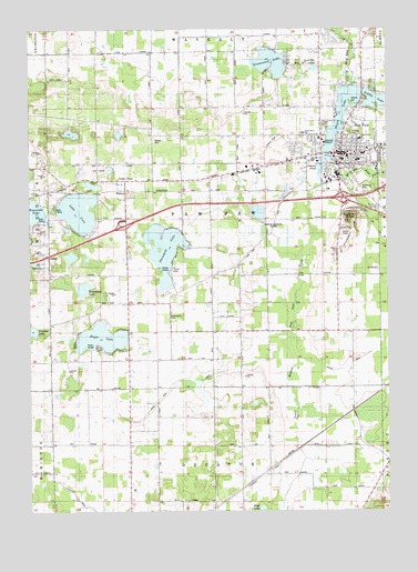
Paw Paw, MI USGS Topographic Map
Click on map above to begin viewing in our Map Viewer.

This topographic map contains these locations and features:
Feature Name Type Latitude Longitude GNIS ID View Map
Ackley LakeLakeN42.2315°W85.8792°619805View Map
Barnum SchoolSchoolN42.2125°W85.9267°620636View Map
Bob Mac PondLakeN42.1898°W85.9792°1623096View Map
Brownwood LakeLakeN42.2414°W85.9157°622118View Map
Buckley DrainCanalN42.2484°W85.9395°622198View Map
Calvary Bible ChurchChurchN42.2411°W85.9036°2112879View Map
Cedar Street SchoolSchoolN42.2214°W85.8842°2112874View Map
Clapp CemeteryCemeteryN42.2258°W85.8975°2112877View Map
Clapp SchoolSchoolN42.2300°W85.9003°623334View Map
Devan Mobile Home ParkPopulated PlaceN42.2039°W85.8786°2574689View Map
Eagle LakeLakeN42.1700°W85.9750°625080View Map
Eagle Lake DrainStreamN42.1714°W85.9095°625089View Map
East Branch Paw Paw RiverStreamN42.2170°W85.8970°625143View Map
East Decatur SchoolSchoolN42.1412°W85.9258°625173View Map
First Christian ChurchChurchN42.2183°W85.8894°2574672View Map
First Presbyterian ChurchChurchN42.2203°W85.8911°2574673View Map
Gates Extension DrainStreamN42.1520°W85.9070°626686View Map
Gliddenberg SchoolSchoolN42.2442°W85.9850°626896View Map
Interchange 56CrossingN42.1994°W85.9661°2575015View Map
Interchange 60CrossingN42.2064°W85.8903°2575014View Map
Ismons PondLakeN42.2147°W85.8978°2112873View Map
Lake CoraLakeN42.2030°W85.9829°623815View Map
Lake Cora Hills Golf ClubLocaleN42.2139°W85.9750°2574700View Map
Lake Cora Post Office (historical)Post OfficeN42.2083°W85.9806°2574431View Map
Lake Cora Station (historical)LocaleN42.2083°W85.9806°2574414View Map
Lakeview Community HospitalHospitalN42.2211°W85.8971°2112876View Map
Lakeview Medical CenterHospitalN42.2200°W85.8969°2574695View Map
Lawton DrainStreamN42.1642°W85.9070°630225View Map
Lee SchoolSchoolN42.1856°W85.9367°630259View Map
Lyle SchoolSchoolN42.1792°W85.9658°631227View Map
Maple IslandIslandN42.2311°W85.8886°631473View Map
Maple LakeLakeN42.2281°W85.8906°631476View Map
Martin DrainCanalN42.1892°W85.8836°631652View Map
McWilliams SchoolSchoolN42.1437°W85.9656°632033View Map
Michigan State Police District 5 HeadquartersBuildingN42.2181°W85.8934°2780876View Map
Michigan State Police District 5 Paw Paw Post 51BuildingN42.2005°W85.9693°2780877View Map
Mud LakeLakeN42.1259°W85.9194°633064View Map
Paw PawPopulated PlaceN42.2178°W85.8911°634488View Map
Paw Paw City HallBuildingN42.2181°W85.8925°2574694View Map
Paw Paw Early Elementary SchoolSchoolN42.2203°W85.9042°2112878View Map
Paw Paw Later Elementary SchoolSchoolN42.2228°W85.9056°2574683View Map
Paw Paw Middle SchoolSchoolN42.2161°W85.9006°2574688View Map
Paw Paw Police DepartmentBuildingN42.2152°W85.8923°2574682View Map
Paw Paw Post OfficePost OfficeN42.2184°W85.8912°2574690View Map
Paw Paw Public Library HIstorical MarkerParkN42.2173°W85.8891°2570909View Map
Paw Paw Station (historical)LocaleN42.2106°W85.8919°2574671View Map
Paw Paw Volunteer Fire DepartmentBuildingN42.2151°W85.8923°2635961View Map
Pioneer CemeteryCemeteryN42.2225°W85.8869°2112875View Map
Plopper SchoolSchoolN42.1853°W85.9931°635138View Map
Popendick LakeLakeN42.1829°W85.9812°634617View Map
Power DrainCanalN42.1367°W85.8975°635377View Map
Prospect HillSummitN42.2006°W85.8892°635480View Map
Prospect Hill CemeteryCemeteryN42.2020°W85.8875°635485View Map
Reverend Darius Barker Historical MarkerParkN42.2178°W85.8842°2570911View Map
Reynolds LakeLakeN42.2023°W85.9990°635826View Map
Saint Mark's Church Historical MarkerParkN42.2178°W85.8842°2570910View Map
Saint Mark's Episcopal ChurchChurchN42.2178°W85.8975°2574681View Map
Saint Mary's Catholic ChurchChurchN42.2158°W85.8856°2574674View Map
Saint Mary's Catholic SchoolSchoolN42.2161°W85.8847°2574692View Map
Saint Marys CemeteryCemeteryN42.2081°W85.8853°636878View Map
Teapot DomePopulated PlaceN42.2109°W85.9661°1614646View Map
Territorial Road Historical MarkerParkN42.2177°W85.8952°2570912View Map
Three Mile Lake DrainStreamN42.1914°W85.9053°1614821View Map
Three Mile Lake Mobile Home ParkPopulated PlaceN42.1875°W85.9494°2574698View Map
Threemile CemeteryCemeteryN42.1753°W85.9520°1614826View Map
Threemile LakeLakeN42.1929°W85.9530°1614832View Map
Township of Paw PawCivilN42.2026°W85.9373°1626886View Map
Trinity Lutheran ChurchChurchN42.2206°W85.8811°2574675View Map
Trinity Lutheran SchoolSchoolN42.2206°W85.8808°2574691View Map
United Methodist ChurchChurchN42.2175°W85.9022°2574677View Map
Unity Missionary Baptist ChurchChurchN42.2481°W85.8986°2574680View Map
Van Buren County Courthouse Historical MarkerParkN42.2163°W85.8896°2570914View Map
Van Buren County Historical MarkerParkN42.2163°W85.9896°2570913View Map
Van Buren County Sheriff's OfficeBuildingN42.2163°W85.8908°2737474View Map
Van Buren CourthouseBuildingN42.2164°W85.8903°2574684View Map
Van Buren Emergency Medical ServicesBuildingN42.2129°W85.9304°2662042View Map
Village of Paw PawCivilN42.2148°W85.8920°2399634View Map
Warner Wine Haus Historical MarkerParkN42.2133°W85.8913°2570915View Map
White Oak SchoolSchoolN42.1662°W85.8886°1616321View Map
Wildey CemeteryCemeteryN42.2217°W85.9567°1616455View Map
Wildey SchoolSchoolN42.2178°W85.9575°1616456View Map
WildeysPopulated PlaceN42.2083°W85.9689°2112881View Map

Note: Coordinates in the location and feature list above are referenced to NAD83 datum.


Copyright (C) 2008-2024 Ryan Niemi / Sunset Dynamics ... All Rights Reserved