TopoQuest Logo
Do you find TopoQuest useful?
Help keep TopoQuest running and adding new maps/features by donating!
Bitcoin:  19c7KJd3qBynnjoSw5npx9KScwjBe4ifkT
Litecoin:  LXs6TkuXGGXo1vDsWCkWVdjQX94eUKd6ui
Home View Maps Find Maps Find Places Resources & Links


Gobles West, Michigan Topographic Map

USGS Map Title: Gobles West, MI
USGS Map MRC: 42085C8
DRG (GeoTIFF) Download: o42085c8.tif


Neighboring USGS Topographic Map Quads:


  Pullman, MI  
42086D1
 

  Bloomingdale, MI  
42085D8
 

  Merson, MI  
42085D7
 

  Bangor, MI  
42086C1
 

  Gobles West, MI  
42085C8
 

  Gobles East, MI  
42085C7
 

  Lawrence, MI  
42086B1
 

  Paw Paw, MI  
42085B8
 

  Lawton, MI  
42085B7


Map MRC Location:

N43°
W86°
N43°
W85°
H8 H7 H6 H5 H4 H3 H2 H1
G8 G7 G6 G5 G4 G3 G2 G1
F8 F7 F6 F5 F4 F3 F2 F1
E8 E7 E6 E5 E4 E3 E2 E1
D8 D7 D6 D5 D4 D3 D2 D1
C8 C7 C6 C5 C4 C3 C2 C1
B8 B7 B6 B5 B4 B3 B2 B1
A8 A7 A6 A5 A4 A3 A2 A1
N42°
W86°
N42°
W85°

Gobles West, MI USGS 1:24K Topographic Map Preview:
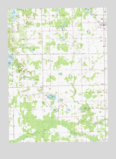
Gobles West, MI USGS Topographic Map
Click on map above to begin viewing in our Map Viewer.

This topographic map contains these locations and features:
Feature Name Type Latitude Longitude GNIS ID View Map
Abernathy LakeLakeN42.3167°W85.9883°619793View Map
Armstrong CornersLocaleN42.3020°W85.8795°620229View Map
Austin CemeteryCemeteryN42.2805°W85.9011°2112789View Map
Austin SchoolSchoolN42.2811°W85.8961°620368View Map
Beachwood SchoolSchoolN42.3545°W85.9353°620805View Map
Beckman Airport (historical)AirportN42.2778°W85.8903°1624098View Map
Bell SchoolSchoolN42.3314°W85.9086°621043View Map
Bethany Presbyterian ChurchChurchN42.3597°W85.8808°2574914View Map
Brandywine CreekStreamN42.2675°W85.9003°621896View Map
Brandywine SchoolSchoolN42.3306°W85.8784°621899View Map
Butterfield DrainCanalN42.2692°W85.9839°622381View Map
Carter CreekStreamN42.2598°W85.9584°622803View Map
Center of Life ChurchChurchN42.2897°W85.8789°2574686View Map
Chase LakeLakeN42.3135°W85.9355°623125View Map
City of GoblesCivilN42.3617°W85.8774°1626360View Map
Country Holiday Estates Mobile Home ParkPopulated PlaceN42.3036°W85.9681°2574685View Map
Covey Hill ChurchChurchN42.3181°W85.8786°623921View Map
Cross SchoolSchoolN42.2573°W85.9959°624122View Map
Davis LakeLakeN42.2803°W85.9253°624342View Map
Dayton SchoolSchoolN42.3028°W85.9084°624383View Map
Dutch Sport ParkLocaleN42.3717°W85.9581°2574990View Map
Evergreen CemeteryCemeteryN42.3464°W85.9778°2112788View Map
Evergreen SchoolSchoolN42.3459°W85.9761°625713View Map
GlendalePopulated PlaceN42.3028°W85.9564°626878View Map
Glendale Baptist ChurchChurchN42.3003°W85.9594°2574697View Map
Glendale CemeteryCemeteryN42.2997°W85.9569°2574954View Map
Glendale Post Office (historical)Post OfficeN42.3028°W85.9564°2574490View Map
GoblesPopulated PlaceN42.3609°W85.8795°626910View Map
Gobles High SchoolSchoolN42.3642°W85.8811°2574925View Map
Gobles LibraryBuildingN42.3586°W85.8783°2574919View Map
Gobles Medical ClinicHospitalN42.3644°W85.8786°2574922View Map
Gobles Police DepartmentBuildingN42.3586°W85.8781°2574920View Map
Gobles Post OfficePost OfficeN42.3597°W85.8839°2574917View Map
Gobles Station (historical)LocaleN42.3547°W85.8786°2574913View Map
Great Bear LakeLakeN42.3712°W85.9928°627273View Map
Haven and Max Lake DrainStreamN42.3723°W85.9884°627944View Map
Kalhaven Community ChurchChurchN42.3578°W85.8808°2574916View Map
Lakeview SchoolSchoolN42.2800°W85.9370°630062View Map
Lyle LakeLakeN42.3519°W85.8985°631226View Map
Martin LakeLakeN42.3575°W85.9298°631658View Map
Max LakeLakeN42.3212°W85.9889°631751View Map
Max LakeLakeN42.3732°W85.9375°631752View Map
Myers SchoolSchoolN42.3175°W85.9070°633195View Map
North Branch Paw Paw RiverStreamN42.2645°W85.9264°633530View Map
North Extension DrainStreamN42.3034°W85.9192°633571View Map
North Scott LakeLakeN42.3306°W85.9988°633645View Map
Rich-Dillon DrainCanalN42.2811°W85.9470°635857View Map
River Valley SchoolSchoolN42.2509°W85.9364°635973View Map
Riverside SchoolSchoolN42.2586°W85.9083°636010View Map
Robinson CemeteryCemeteryN42.3470°W85.8803°636047View Map
Round LakeLakeN42.2894°W85.9358°636282View Map
Saint Judes Catholic ChurchChurchN42.3731°W85.8789°2574918View Map
School Section LakeLakeN42.2923°W85.9451°637414View Map
Scott SchoolSchoolN42.3317°W85.9753°637476View Map
Shaw LakeLakeN42.2797°W85.9398°637689View Map
Simmons LakeLakeN42.2811°W85.9079°637973View Map
Smith LakeLakeN42.3360°W85.9698°638159View Map
South Branch Paw Paw RiverStreamN42.2645°W85.9264°638300View Map
Speicher SchoolSchoolN42.3325°W85.9475°638490View Map
Spring RunStreamN42.2617°W85.9553°638610View Map
Spring Valley CampgroundLocaleN42.3569°W85.9917°2574989View Map
Thayer LakeLakeN42.3463°W85.9325°1614700View Map
Town Line ChurchChurchN42.3325°W85.9514°1614994View Map
Township of WaverlyCivilN42.2898°W85.9347°1627229View Map
United Methodist ChurchChurchN42.3597°W85.8803°2574915View Map
Waverly Post Office (historical)Post OfficeN42.3042°W85.8786°2574418View Map
Wesler Airfield (historical)AirportN42.3564°W85.8853°2112790View Map
Wilcox LakeLakeN42.2783°W85.9066°1616436View Map

Note: Coordinates in the location and feature list above are referenced to NAD83 datum.


Copyright (C) 2008-2025 Ryan Niemi / Sunset Dynamics ... All Rights Reserved