TopoQuest Logo
Do you find TopoQuest useful?
Help keep TopoQuest running and adding new maps/features by donating!
Bitcoin:  19c7KJd3qBynnjoSw5npx9KScwjBe4ifkT
Litecoin:  LXs6TkuXGGXo1vDsWCkWVdjQX94eUKd6ui
Home View Maps Find Maps Find Places Resources & Links


Leakey, Texas Topographic Map

USGS Map Title: Leakey, TX
USGS Map MRC: 29099F7
DRG (GeoTIFF) Download: o29099f7.tif


Neighboring USGS Topographic Map Quads:


  Jo Jan Van Camp, TX  
29099G8
 

  Owl Hollow, TX  
29099G7
 

  Circle Bluff, TX  
29099G6
 

  Crown Mountain, TX  
29099F8
 

  Leakey, TX  
29099F7
 

  Rio Frio, TX  
29099F6
 

  Lake Creek, TX  
29099E8
 

  Reagan Wells, TX  
29099E7
 

  Magers Crossing, TX  
29099E6


Map MRC Location:

N30°
W100°
N30°
W99°
H8 H7 H6 H5 H4 H3 H2 H1
G8 G7 G6 G5 G4 G3 G2 G1
F8 F7 F6 F5 F4 F3 F2 F1
E8 E7 E6 E5 E4 E3 E2 E1
D8 D7 D6 D5 D4 D3 D2 D1
C8 C7 C6 C5 C4 C3 C2 C1
B8 B7 B6 B5 B4 B3 B2 B1
A8 A7 A6 A5 A4 A3 A2 A1
N29°
W100°
N29°
W99°

Leakey, TX USGS 1:24K Topographic Map Preview:
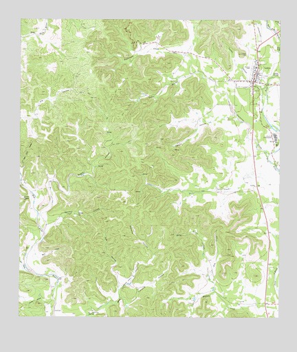
Leakey, TX USGS Topographic Map
Click on map above to begin viewing in our Map Viewer.

This topographic map contains these locations and features:
Feature Name Type Latitude Longitude GNIS ID View Map
Alto Frio EncampmentLocaleN29.7013°W99.7531°1329460View Map
Big LakeReservoirN29.7469°W99.8503°1863765View Map
Big Lake DamDamN29.7469°W99.8503°1863764View Map
Buck HollowValleyN29.6499°W99.8651°1331492View Map
Buffalo CreekStreamN29.6252°W99.7520°1331562View Map
Cattail HollowValleyN29.7090°W99.7816°1332342View Map
Cedar HollowValleyN29.7277°W99.7921°1332453View Map
City of LeakeyCivilN29.7254°W99.7631°2411643View Map
Clark CemeteryCemeteryN29.6271°W99.8401°1332882View Map
Cow HollowValleyN29.6367°W99.8274°1333552View Map
Cummins HollowValleyN29.6312°W99.8239°1333811View Map
Daliby HollowValleyN29.6297°W99.8583°1373336View Map
Elm CreekStreamN29.6358°W99.7817°1335355View Map
Exile CemeteryCemeteryN29.6283°W99.8551°1335594View Map
Frio Canyon Emergency Medical ServiceBuildingN29.7255°W99.7634°2656101View Map
LeakeyPopulated PlaceN29.7288°W99.7614°1339757View Map
Leakey City HallBuildingN29.7257°W99.7633°2753815View Map
Leakey Post OfficePost OfficeN29.7252°W99.7649°2731761View Map
Leakey SpringsSpringN29.7277°W99.7537°1339758View Map
Leakey Volunteer Fire DepartmentBuildingN29.7256°W99.7636°2551199View Map
Lee CreekStreamN29.6438°W99.8703°1339782View Map
Little Buffalo CreekStreamN29.6399°W99.7820°1340036View Map
Negro HollowValleyN29.6611°W99.8637°1342409View Map
Patterson CreekStreamN29.6924°W99.7562°1343676View Map
Real County AirportAirportN29.7483°W99.7600°1387066View Map
Real County JailBuildingN29.7262°W99.7621°2738796View Map
Real County Sheriff's OfficeBuildingN29.7262°W99.7621°2750220View Map
Sanders HollowValleyN29.6638°W99.8625°1346561View Map
Sedberry HollowValleyN29.6502°W99.8111°1346871View Map
Spring Branch SpringsSpringN29.7086°W99.7753°1998347View Map
Tucker HollowValleyN29.7249°W99.7661°1348824View Map
Wilson HollowValleyN29.6755°W99.8703°1350266View Map

Note: Coordinates in the location and feature list above are referenced to NAD83 datum.


Copyright (C) 2008-2025 Ryan Niemi / Sunset Dynamics ... All Rights Reserved