TopoQuest Logo
Do you find TopoQuest useful?
Help keep TopoQuest running and adding new maps/features by donating!
Bitcoin:  19c7KJd3qBynnjoSw5npx9KScwjBe4ifkT
Litecoin:  LXs6TkuXGGXo1vDsWCkWVdjQX94eUKd6ui
Home View Maps Find Maps Find Places Resources & Links


Leetsville, Michigan Topographic Map

USGS Map Title: Leetsville, MI
USGS Map MRC: 44085G2
DRG (GeoTIFF) Download: o44085g2.tif


Neighboring USGS Topographic Map Quads:


  Bellaire, MI  
44085H2
 

  Mancelona, MI  
44085H1


  Leetsville, MI  
44085G2
 

  Westwood, MI  
44085G1
 

  South Boardman, MI  
44085F3
 

  Kalkaska, MI  
44085F2
 

  Sigma, MI  
44085F1


Map MRC Location:

N45°
W86°
N45°
W85°
H8 H7 H6 H5 H4 H3 H2 H1
G8 G7 G6 G5 G4 G3 G2 G1
F8 F7 F6 F5 F4 F3 F2 F1
E8 E7 E6 E5 E4 E3 E2 E1
D8 D7 D6 D5 D4 D3 D2 D1
C8 C7 C6 C5 C4 C3 C2 C1
B8 B7 B6 B5 B4 B3 B2 B1
A8 A7 A6 A5 A4 A3 A2 A1
N44°
W86°
N44°
W85°

Leetsville, MI USGS 1:24K Topographic Map Preview:
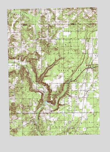
Leetsville, MI USGS Topographic Map
Click on map above to begin viewing in our Map Viewer.

This topographic map contains these locations and features:
Feature Name Type Latitude Longitude GNIS ID View Map
Barber SchoolLocaleN44.8258°W85.2039°620585View Map
Barnard LakeLakeN44.7640°W85.2239°620614View Map
Bird LakeLakeN44.7572°W85.1645°621438View Map
Kalkaska United Methodist ChurchChurchN44.7503°W85.1736°2492909View Map
Lannin SchoolLocaleN44.8456°W85.1939°630138View Map
LeetsvillePopulated PlaceN44.7933°W85.1448°630274View Map
Leetsville Post Office (historical)Post OfficeN44.7933°W85.1447°2494705View Map
Leetsville StationLocaleN44.7936°W85.1444°2492991View Map
Little Rapid RiverStreamN44.7500°W85.2062°630747View Map
Maplegrove CemeteryCemeteryN44.8003°W85.1539°631504View Map
Mayville LakeLakeN44.8740°W85.1305°631784View Map
Miller SchoolLocaleN44.8369°W85.2306°632392View Map
Rapid River Campground and CabinsLocaleN44.8186°W85.1369°2494937View Map
Rugg PondReservoirN44.7826°W85.1989°1623091View Map
Rugg Pond Dam Historical MarkerParkN44.7822°W85.2006°2494767View Map
Rugg Post Office (historical)Post OfficeN44.7722°W85.1936°2494703View Map
Township of Rapid RiverCivilN44.8155°W85.1516°1626953View Map
Westwood CemeteryCemeteryN44.8519°W85.1542°1616232View Map
WKLT-FM (Kalkaska)TowerN44.7914°W85.2389°1625728View Map

Note: Coordinates in the location and feature list above are referenced to NAD83 datum.


Copyright (C) 2008-2025 Ryan Niemi / Sunset Dynamics ... All Rights Reserved