TopoQuest Logo
Do you find TopoQuest useful?
Help keep TopoQuest running and adding new maps/features by donating!
Bitcoin:  19c7KJd3qBynnjoSw5npx9KScwjBe4ifkT
Litecoin:  LXs6TkuXGGXo1vDsWCkWVdjQX94eUKd6ui
Home View Maps Find Maps Find Places Resources & Links


Westwood, Michigan Topographic Map

USGS Map Title: Westwood, MI
USGS Map MRC: 44085G1
DRG (GeoTIFF) Download: o44085g1.tif


Neighboring USGS Topographic Map Quads:


  Bellaire, MI  
44085H2
 

  Mancelona, MI  
44085H1
 

  Alba, MI  
44084H8
 

  Leetsville, MI  
44085G2
 

  Westwood, MI  
44085G1
 

  Starvation Lake, MI  
44084G8
 

  Kalkaska, MI  
44085F2
 

  Sigma, MI  
44085F1
 

  Black Creek, MI  
44084F8


Map MRC Location:

N45°
W86°
N45°
W85°
H8 H7 H6 H5 H4 H3 H2 H1
G8 G7 G6 G5 G4 G3 G2 G1
F8 F7 F6 F5 F4 F3 F2 F1
E8 E7 E6 E5 E4 E3 E2 E1
D8 D7 D6 D5 D4 D3 D2 D1
C8 C7 C6 C5 C4 C3 C2 C1
B8 B7 B6 B5 B4 B3 B2 B1
A8 A7 A6 A5 A4 A3 A2 A1
N44°
W86°
N44°
W85°

Westwood, MI USGS 1:24K Topographic Map Preview:
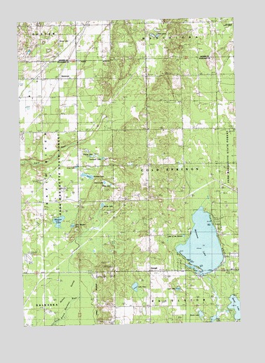
Westwood, MI USGS Topographic Map
Click on map above to begin viewing in our Map Viewer.

This topographic map contains these locations and features:
Feature Name Type Latitude Longitude GNIS ID View Map
Camp Ta-pi-coLocaleN44.7503°W85.0025°622638View Map
Camp TanugaLocaleN44.7875°W85.0284°622644View Map
Cold Spring CemeteryCemeteryN44.8089°W85.0517°623564View Map
Cold Spring ChurchChurchN44.8297°W85.0509°623565View Map
Cold Springs Mennonite ChurchChurchN44.8300°W85.0503°2420835View Map
Coldsprings - Excelsior Township Fire and Rescue DepartmentBuildingN44.7719°W85.0400°2626717View Map
Coldsprings Township HallBuildingN44.8097°W85.0511°2420838View Map
Corner Stone Community Bible ChurchChurchN44.7714°W85.0347°2492912View Map
Croy LakeLakeN44.8151°W85.0927°624150View Map
DarraghPopulated PlaceN44.7717°W85.0520°1617513View Map
Darragh Post Office (historical)Post OfficeN44.7717°W85.0519°2494718View Map
Davis LakeLakeN44.8075°W85.0731°624346View Map
Davis SchoolLocaleN44.8100°W85.0714°624349View Map
Day SchoolLocaleN44.8292°W85.1217°624377View Map
Farrar LakeLakeN44.7992°W85.0783°625848View Map
Grandview Golf ClubLocaleN44.7583°W85.0750°2492918View Map
Grass LakeLakeN44.8668°W85.1007°627202View Map
Grass LakeLakeN44.7557°W85.0020°627214View Map
Hardy SchoolLocaleN44.8295°W85.0314°627791View Map
Hauenstein CreekStreamN44.7575°W85.0978°627943View Map
Lake FiveLakeN44.7653°W85.0604°626121View Map
Lake of the WoodsLakeN44.7856°W85.0317°1616797View Map
Little Wheeler LakeLakeN44.7910°W85.0957°630814View Map
Lost LakeLakeN44.7641°W85.0358°631092View Map
Mahan SwampSwampN44.7650°W85.0998°631330View Map
Manistee LakeLakeN44.7821°W85.0211°631384View Map
Manistee Lake Census Designated PlaceCensusN44.7841°W85.0211°2583751View Map
Perch LakeLakeN44.7535°W85.0229°634635View Map
Peters LakeLakeN44.8084°W85.0767°634707View Map
Post LakeLakeN44.7515°W85.0157°635325View Map
Priests LakeLakeN44.8197°W85.0826°635456View Map
Rainbow LakeLakeN44.8111°W85.0864°635601View Map
Southwell LakeLakeN44.8181°W85.0778°638452View Map
Tillie LakeLakeN44.8682°W85.0443°1614862View Map
Township of ColdspringsCivilN44.8152°W85.0306°1626106View Map
WestwoodPopulated PlaceN44.8517°W85.1020°1617934View Map
Westwood Post Office (historical)Post OfficeN44.8517°W85.1019°2492993View Map
Westwood StationLocaleN44.8517°W85.1014°2492987View Map
Wheeler LakeLakeN44.7929°W85.1037°1616262View Map

Note: Coordinates in the location and feature list above are referenced to NAD83 datum.


Copyright (C) 2008-2024 Ryan Niemi / Sunset Dynamics ... All Rights Reserved