TopoQuest Logo
Do you find TopoQuest useful?
Help keep TopoQuest running and adding new maps/features by donating!
Bitcoin:  19c7KJd3qBynnjoSw5npx9KScwjBe4ifkT
Litecoin:  LXs6TkuXGGXo1vDsWCkWVdjQX94eUKd6ui
Home View Maps Find Maps Find Places Resources & Links


Mancelona, Michigan Topographic Map

USGS Map Title: Mancelona, MI
USGS Map MRC: 44085H1
DRG (GeoTIFF) Download: o44085h1.tif


Neighboring USGS Topographic Map Quads:


  Deadmans Hill, MI  
45084A8
 

  Bellaire, MI  
44085H2
 

  Mancelona, MI  
44085H1
 

  Alba, MI  
44084H8
 

  Leetsville, MI  
44085G2
 

  Westwood, MI  
44085G1
 

  Starvation Lake, MI  
44084G8


Map MRC Location:

N45°
W86°
N45°
W85°
H8 H7 H6 H5 H4 H3 H2 H1
G8 G7 G6 G5 G4 G3 G2 G1
F8 F7 F6 F5 F4 F3 F2 F1
E8 E7 E6 E5 E4 E3 E2 E1
D8 D7 D6 D5 D4 D3 D2 D1
C8 C7 C6 C5 C4 C3 C2 C1
B8 B7 B6 B5 B4 B3 B2 B1
A8 A7 A6 A5 A4 A3 A2 A1
N44°
W86°
N44°
W85°

Mancelona, MI USGS 1:24K Topographic Map Preview:
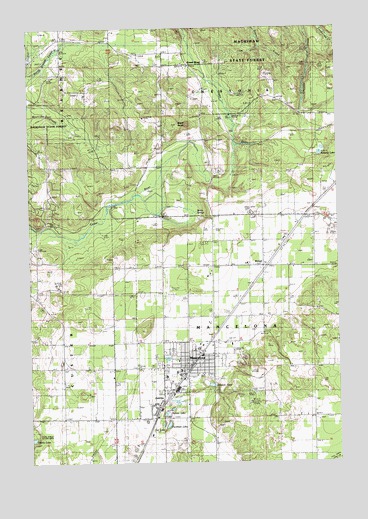
Mancelona, MI USGS Topographic Map
Click on map above to begin viewing in our Map Viewer.

This topographic map contains these locations and features:
Feature Name Type Latitude Longitude GNIS ID View Map
Allied Emergency Medical Services Mancelona StationBuildingN44.8979°W85.0671°2661952View Map
AntrimPopulated PlaceN44.8900°W85.0739°620154View Map
Antrim Church of ChristChurchN44.8833°W85.0783°2463231View Map
Bryden CemeteryCemeteryN44.9808°W85.1019°2463788View Map
Chestonia Township Number Two Cemetery (historical)CemeteryN44.9642°W85.0783°2463787View Map
Church of the NazareneChurchN44.9017°W85.0597°2463661View Map
Fairview CemeteryCemeteryN44.9028°W85.0717°2463786View Map
Free Methodist ChurchChurchN44.8786°W85.0506°2463232View Map
Green RiverPopulated PlaceN44.9892°W85.0553°1617597View Map
Green River Station (historical)LocaleN44.9894°W85.0553°2463623View Map
Greenriver Post Office (historical)Post OfficeN44.9892°W85.0553°2463622View Map
Johnson PondLakeN44.8972°W85.0534°1618855View Map
Kingdom Hall of Jehovah's WitnessesChurchN44.9075°W85.0586°2463648View Map
MancelonaPopulated PlaceN44.9022°W85.0609°631374View Map
Mancelona Area Historical Society MuseumBuildingN44.8903°W85.0736°2463644View Map
Mancelona Baptist ChurchChurchN44.9092°W85.0650°2463657View Map
Mancelona Elementary SchoolSchoolN44.9000°W85.0703°2463655View Map
Mancelona Family PracticeHospitalN44.9028°W85.0686°2463642View Map
Mancelona Fire DistrictBuildingN44.9056°W85.0721°2626742View Map
Mancelona High SchoolSchoolN44.8986°W85.0728°2463656View Map
Mancelona Middle SchoolSchoolN44.9011°W85.0661°2463654View Map
Mancelona Municipal AirportAirportN44.9235°W85.0678°1624021View Map
Mancelona Police DepartmentBuildingN44.9026°W85.0624°2463652View Map
Mancelona Post OfficePost OfficeN44.9033°W85.0600°2463653View Map
Mancelona Public LibraryBuildingN44.9022°W85.0633°2463643View Map
Mancelona StationLocaleN44.8994°W85.0631°2463645View Map
Mancelona United Methodist ChurchChurchN44.9036°W85.0614°2463659View Map
Mancelona Village HallBuildingN44.9028°W85.0625°2463651View Map
Mount BundySummitN44.9720°W85.0609°622254View Map
Nelson LakeLakeN44.8905°W85.0679°633286View Map
Palmer ParkParkN44.8981°W85.0633°2463233View Map
Pathway Community ChurchChurchN44.8992°W85.0647°2463662View Map
Peckham LakeLakeN44.8860°W85.0696°634552View Map
Railroad ParkParkN44.9031°W85.0583°2463650View Map
Rapid River CampgroundLocaleN44.9283°W85.0308°2463647View Map
Sacred Heart ChurchChurchN44.9097°W85.0428°2463230View Map
Saint Anthony Catholic ChurchChurchN44.9042°W85.0650°2463658View Map
Saint Anthony's CemeteryCemeteryN44.8950°W85.0728°2463785View Map
Saint Matthews Lutheran ChurchChurchN44.9039°W85.0569°2463660View Map
Satterly LakeLakeN44.9636°W85.0070°637268View Map
Scotts SpringSpringN44.9478°W85.0592°637484View Map
Tar LakeLakeN44.8858°W85.0726°1614599View Map
Township of ChestoniaCivilN44.9885°W85.0300°1626075View Map
Triangle ParkParkN44.9022°W85.0606°2463649View Map
Village of MancelonaCivilN44.9024°W85.0613°2399236View Map
Village of Wetzell Historical MarkerParkN44.9311°W85.0300°2463776View Map
WetzelPopulated PlaceN44.9314°W85.0303°1617936View Map
Wetzel StationLocaleN44.9317°W85.0300°2463570View Map
Wetzell Post Office (historical)Post OfficeN44.9314°W85.0303°2463577View Map
Whispering Pines Family CampgroundsLocaleN44.9008°W85.0278°2463646View Map
Windmill Farms Golf CourseLocaleN44.9014°W85.0339°2463234View Map

Note: Coordinates in the location and feature list above are referenced to NAD83 datum.


Copyright (C) 2008-2024 Ryan Niemi / Sunset Dynamics ... All Rights Reserved