TopoQuest Logo
Do you find TopoQuest useful?
Help keep TopoQuest running and adding new maps/features by donating!
Bitcoin:  19c7KJd3qBynnjoSw5npx9KScwjBe4ifkT
Litecoin:  LXs6TkuXGGXo1vDsWCkWVdjQX94eUKd6ui
Home View Maps Find Maps Find Places Resources & Links


Liberty, Mississippi Topographic Map

USGS Map Title: Liberty, MS
USGS Map MRC: 31090B7
DRG (GeoTIFF) Download: o31090b7.tif


Neighboring USGS Topographic Map Quads:


  Homochitto, MS  
31090C8
 

  Busy Corner, MS  
31090C7
 

  Smithdale, MS  
31090C6
 

  Bewelcome, MS  
31090B8
 

  Liberty, MS  
31090B7
 

  Peoria, MS  
31090B6
 

  Berwick, MS  
31090A8
 

  Street, MS  
31090A7
 

  Gillsburg, MS  
31090A6


Map MRC Location:

N32°
W91°
N32°
W90°
H8 H7 H6 H5 H4 H3 H2 H1
G8 G7 G6 G5 G4 G3 G2 G1
F8 F7 F6 F5 F4 F3 F2 F1
E8 E7 E6 E5 E4 E3 E2 E1
D8 D7 D6 D5 D4 D3 D2 D1
C8 C7 C6 C5 C4 C3 C2 C1
B8 B7 B6 B5 B4 B3 B2 B1
A8 A7 A6 A5 A4 A3 A2 A1
N31°
W91°
N31°
W90°

Liberty, MS USGS 1:24K Topographic Map Preview:
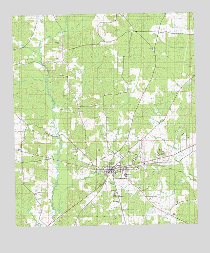
Liberty, MS USGS Topographic Map
Click on map above to begin viewing in our Map Viewer.

This topographic map contains these locations and features:
Feature Name Type Latitude Longitude GNIS ID View Map
Amite CountyCivilN31.1744°W90.8044°695727View Map
Amite County CourthouseBuildingN31.1577°W90.8107°707331View Map
Amite County Sheriff's OfficeBuildingN31.1566°W90.8108°2754289View Map
Amite Lookout TowerTowerN31.1749°W90.7901°711266View Map
Anders Lake DamDamN31.1302°W90.7818°680587View Map
Andrews CemeteryCemeteryN31.1627°W90.7645°685198View Map
Bates CemeteryCemeteryN31.1960°W90.7909°685202View Map
Beall (historical)LocaleN31.2391°W90.7918°685205View Map
Bryant CemeteryCemeteryN31.1591°W90.8084°685218View Map
Carroll BranchStreamN31.1552°W90.8193°668096View Map
Causey CemeteryCemeteryN31.1349°W90.7795°685228View Map
Cedar Grove CemeteryCemeteryN31.1554°W90.8057°685230View Map
Cedar Grove ChurchChurchN31.1563°W90.8057°685231View Map
Central High SchoolSchoolN31.1443°W90.8076°668281View Map
Cheatham Children CemeteryCemeteryN31.1654°W90.8579°685234View Map
Church of God of ProphecyChurchN31.1418°W90.8051°685236View Map
Days CreekStreamN31.2260°W90.8582°693070View Map
Dixon-McDowell CemeteryCemeteryN31.1618°W90.7682°685247View Map
Enterprise School (historical)SchoolN31.1630°W90.8698°685257View Map
Gardner CemeteryCemeteryN31.1985°W90.8026°685268View Map
Gillespie CemeteryCemeteryN31.2088°W90.8154°685273View Map
Griffin CemeteryCemeteryN31.1610°W90.7579°685282View Map
Henderson Poultry FarmLocaleN31.1392°W90.7772°2708724View Map
House of Prayer ChurchChurchN31.1388°W90.8037°690619View Map
House of Prayer ChurchChurchN31.1388°W90.8040°689797View Map
Jenkins Memorial CemeteryCemeteryN31.2277°W90.7784°685305View Map
Jones CemeteryCemeteryN31.1793°W90.8407°685309View Map
Kelly BranchStreamN31.2102°W90.8565°693650View Map
Lazy CreekStreamN31.1949°W90.8501°672330View Map
LibertyPopulated PlaceN31.1582°W90.8123°672435View Map
Liberty Ambulance ServiceBuildingN31.1566°W90.8107°2667761View Map
Liberty Baptist ChurchChurchN31.1582°W90.8107°712190View Map
Liberty CemeteryCemeteryN31.1571°W90.7987°685314View Map
Liberty CemeteryCemeteryN31.1563°W90.8145°685315View Map
Liberty Elementary SchoolSchoolN31.1546°W90.7993°707326View Map
Liberty Police DepartmentBuildingN31.1583°W90.8096°2754282View Map
Liberty Post OfficePost OfficeN31.1597°W90.7975°2768857View Map
Liberty Rural Volunteer Fire DepartmentBuildingN31.1583°W90.8095°2668042View Map
Liberty Sewage Lagoon DamDamN31.1568°W90.8201°680594View Map
Liberty Volunteer Fire DepartmentBuildingN31.1583°W90.8095°2668043View Map
Lilly CemeteryCemeteryN31.1382°W90.7648°672493View Map
Love School (historical)SchoolN31.1980°W90.7876°685320View Map
Mc Gehee Air ParkAirportN31.1656°W90.8165°2676445View Map
McDowell CemeteryCemeteryN31.1679°W90.7982°673340View Map
McGehee CemeteryCemeteryN31.2332°W90.8468°673352View Map
Morgan CemeteryCemeteryN31.1274°W90.7698°685338View Map
Mount Zion ChurchChurchN31.1263°W90.7604°674329View Map
New Day ChurchChurchN31.1455°W90.8059°690623View Map
New Day ChurchChurchN31.1455°W90.8062°689799View Map
Newman BranchStreamN31.2366°W90.8545°694197View Map
North Central Volunteer Fire DepartmentBuildingN31.2485°W90.7979°2667924View Map
Parker CemeteryCemeteryN31.2327°W90.8129°675457View Map
Parker School (historical)SchoolN31.2338°W90.8157°685364View Map
Parson Hill CemeteryCemeteryN31.2285°W90.7795°685366View Map
Parson Hill ChurchChurchN31.2288°W90.7784°690624View Map
Parson Hill ChurchChurchN31.2285°W90.7787°689798View Map
Plainview ChurchChurchN31.1421°W90.8045°690625View Map
Plainview ChurchChurchN31.1396°W90.8045°689800View Map
R J Causey CemeteryCemeteryN31.1860°W90.8107°685372View Map
Saint Regis Paper Company Lake DamDamN31.1935°W90.7768°680602View Map
Sharp CemeteryCemeteryN31.2393°W90.7743°677622View Map
Sharp Lake DamDamN31.2402°W90.7568°680626View Map
Sharp Store (historical)LocaleN31.2396°W90.7743°685389View Map
Sleeper CemeteryCemeteryN31.1738°W90.8057°685392View Map
Smith CemeteryCemeteryN31.1341°W90.8598°677900View Map
Speculation CreekStreamN31.1468°W90.8504°678045View Map
Stubbs-Carter CemeteryCemeteryN31.2341°W90.8648°685402View Map
Supervisor District 1CivilN31.2448°W90.8291°711769View Map
Tanyard CreekStreamN31.1727°W90.8115°678567View Map
Terrell CemeteryCemeteryN31.1929°W90.8326°678637View Map
Thomas Cheatham CemeteryCemeteryN31.1599°W90.8579°685409View Map
Thompson CemeteryCemeteryN31.2027°W90.8434°678692View Map
Town of LibertyCivilN31.1611°W90.8007°2406016View Map
Turnipseed CemeteryCemeteryN31.2096°W90.7995°685421View Map
Warren Hughey CemeteryCemeteryN31.2263°W90.7640°685426View Map
Weathersby-Clairborne CemeteryCemeteryN31.1882°W90.8107°685428View Map
Webb BranchStreamN31.1524°W90.7573°679412View Map
Webb-Whittington CemeteryCemeteryN31.2082°W90.8223°685430View Map
William Frith CemeteryCemeteryN31.2191°W90.8482°685433View Map
Zion Hill CreekStreamN31.2416°W90.8404°680033View Map

Note: Coordinates in the location and feature list above are referenced to NAD83 datum.


Copyright (C) 2008-2025 Ryan Niemi / Sunset Dynamics ... All Rights Reserved