TopoQuest Logo
Do you find TopoQuest useful?
Help keep TopoQuest running and adding new maps/features by donating!
Bitcoin:  19c7KJd3qBynnjoSw5npx9KScwjBe4ifkT
Litecoin:  LXs6TkuXGGXo1vDsWCkWVdjQX94eUKd6ui
Home View Maps Find Maps Find Places Resources & Links


Lilesville, North Carolina Topographic Map

USGS Map Title: Lilesville, NC
USGS Map MRC: 34079H8
DRG (GeoTIFF) Download: o34079h8.tif


Neighboring USGS Topographic Map Quads:


  Ansonville, NC  
35080A1
 

  Mangum, NC  
35079A8
 

  Ellerbe, NC  
35079A7
 

  Wadesboro, NC  
34080H1
 

  Lilesville, NC  
34079H8
 

  Rockingham, NC  
34079H7
 

  Morven West, NC  
34080G1
 

  Morven East, NC  
34079G8
 

  Diggs, NC  
34079G7


Map MRC Location:

N35°
W80°
N35°
W79°
H8 H7 H6 H5 H4 H3 H2 H1
G8 G7 G6 G5 G4 G3 G2 G1
F8 F7 F6 F5 F4 F3 F2 F1
E8 E7 E6 E5 E4 E3 E2 E1
D8 D7 D6 D5 D4 D3 D2 D1
C8 C7 C6 C5 C4 C3 C2 C1
B8 B7 B6 B5 B4 B3 B2 B1
A8 A7 A6 A5 A4 A3 A2 A1
N34°
W80°
N34°
W79°

Lilesville, NC USGS 1:24K Topographic Map Preview:
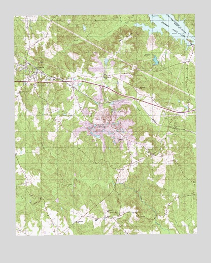
Lilesville, NC USGS Topographic Map
Click on map above to begin viewing in our Map Viewer.

This topographic map contains these locations and features:
Feature Name Type Latitude Longitude GNIS ID View Map
B V Hedrick Sand and Gravel LakeReservoirN34.9738°W79.9021°998254View Map
Battle - Lindsey CemeteryCemeteryN34.9723°W79.9957°2778998View Map
Big IslandIslandN34.9988°W79.8987°981408View Map
Blewett Falls DamDamN34.9671°W79.8798°1023478View Map
Blewett Falls LakeReservoirN34.9829°W79.8776°981595View Map
Blewitt Falls Lake DamDamN34.9885°W79.8798°998270View Map
Bonsal Company LakeReservoirN34.9739°W79.9362°998257View Map
Bonsal Company Lake DamDamN34.9735°W79.9348°998258View Map
CairoPopulated PlaceN34.8846°W79.9328°982408View Map
Cairo SchoolSchoolN34.8840°W79.9453°982409View Map
Cedar Creek Meeting House CemeteryCemeteryN34.9718°W79.9910°2778999View Map
Centenary ChurchChurchN34.9299°W79.9289°982913View Map
Centenary Church CemeteryCemeteryN34.9299°W79.9293°2779003View Map
Clark MountainSummitN34.9863°W79.9245°1019684View Map
Ebenezer ChurchChurchN34.8882°W79.9367°984584View Map
Elizabeth ChurchChurchN34.9218°W79.9073°984684View Map
Flat Rock ChurchChurchN34.8827°W79.9578°985179View Map
Forestville ChurchChurchN34.9652°W79.9381°985291View Map
Forestville Zion ChurchChurchN34.9715°W79.9406°985292View Map
GraveltonPopulated PlaceN34.9399°W79.9278°1023480View Map
Gum Springs ChurchChurchN34.9363°W79.9376°986232View Map
Hale CreekStreamN34.9040°W79.9676°986291View Map
Henry Grove SchoolSchoolN34.9638°W79.9726°986627View Map
Hogan LakeReservoirN34.9927°W79.9511°998276View Map
Hogan Lake DamDamN34.9918°W79.9514°998275View Map
LilesvillePopulated PlaceN34.9677°W79.9845°1021149View Map
Lilesville CemeteryCemeteryN34.9726°W79.9917°2779000View Map
Lilesville Fire DepartmentBuildingN34.9682°W79.9865°2638586View Map
Lilesville Police DepartmentBuildingN34.9674°W79.9838°2769774View Map
Lilesville Post OfficePost OfficeN34.9678°W79.9843°2774043View Map
Lilesville SchoolSchoolN34.9638°W79.9895°1002146View Map
North Fork Smith CreekStreamN34.9954°W79.9256°991231View Map
Parson Grove SchoolSchoolN34.9560°W79.9967°991898View Map
Pee DeePopulated PlaceN34.9352°W79.8895°992002View Map
Pleasant Hill ChurchChurchN34.8879°W79.9298°992516View Map
Rock Hill ChurchChurchN34.9582°W79.9134°993507View Map
Shady Grove ChurchChurchN34.9193°W79.8976°994541View Map
Shilo ChurchChurchN34.8854°W79.9367°994677View Map
Smith CreekStreamN34.9927°W79.8998°994961View Map
Tindallsville (historical)Populated PlaceN34.9657°W79.9353°1002145View Map
Town of LilesvilleCivilN34.9675°W79.9845°2406019View Map
Township of LilesvilleCivilN34.9889°W79.9391°1026375View Map
W R Bonsal Tailings ReservoirReservoirN34.9425°W79.9381°998226View Map
W R Bonsal Tailings Reservoir DamDamN34.9435°W79.9348°998227View Map

Note: Coordinates in the location and feature list above are referenced to NAD83 datum.


Copyright (C) 2008-2024 Ryan Niemi / Sunset Dynamics ... All Rights Reserved