TopoQuest Logo
Do you find TopoQuest useful?
Help keep TopoQuest running and adding new maps/features by donating!
Bitcoin:  19c7KJd3qBynnjoSw5npx9KScwjBe4ifkT
Litecoin:  LXs6TkuXGGXo1vDsWCkWVdjQX94eUKd6ui
Home View Maps Find Maps Find Places Resources & Links


Lime Mountain, California Topographic Map

USGS Map Title: Lime Mountain, CA
USGS Map MRC: 35120F8
DRG (GeoTIFF) Download: o35120f8.tif


Neighboring USGS Topographic Map Quads:


  Bryson, CA  
35121G1
 

  Tierra Redonda Mountain, CA  
35120G8
 

  Bradley, CA  
35120G7
 

  Pebblestone Shut-in, CA  
35121F1
 

  Lime Mountain, CA  
35120F8
 

  Adelaida, CA  
35120F7
 

  Cambria, CA  
35121E1
 

  Cypress Mountain, CA  
35120E8
 

  York Mountain, CA  
35120E7


Map MRC Location:

N36°
W121°
N36°
W120°
H8 H7 H6 H5 H4 H3 H2 H1
G8 G7 G6 G5 G4 G3 G2 G1
F8 F7 F6 F5 F4 F3 F2 F1
E8 E7 E6 E5 E4 E3 E2 E1
D8 D7 D6 D5 D4 D3 D2 D1
C8 C7 C6 C5 C4 C3 C2 C1
B8 B7 B6 B5 B4 B3 B2 B1
A8 A7 A6 A5 A4 A3 A2 A1
N35°
W121°
N35°
W120°

Lime Mountain, CA USGS 1:24K Topographic Map Preview:
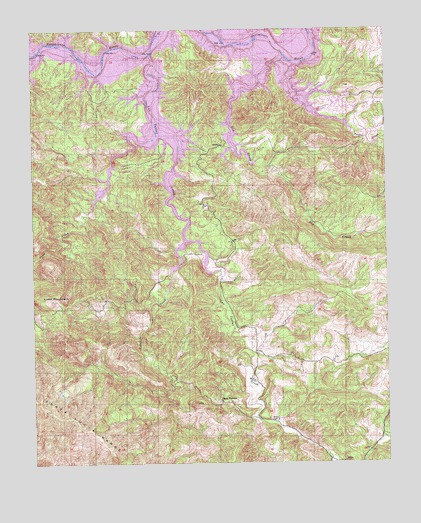
Lime Mountain, CA USGS Topographic Map
Click on map above to begin viewing in our Map Viewer.

This topographic map contains these locations and features:
Feature Name Type Latitude Longitude GNIS ID View Map
California Department of Forestry and Fire Protection Station 33 HeritageBuildingN35.7220°W120.8857°2664813View Map
California Department of Forestry and Fire Protection Station 35 Las TablasBuildingN35.6569°W120.9234°2665199View Map
Camp NatomaLocaleN35.6425°W120.9352°240098View Map
Cappy Culver Elementary SchoolSchoolN35.7431°W120.8777°2518374View Map
Dip CreekStreamN35.7414°W120.9107°241504View Map
Franklin CreekStreamN35.6894°W120.9471°242439View Map
Heritage Lake MarinaLocaleN35.7297°W120.9024°1872154View Map
KlauPopulated PlaceN35.6252°W120.8916°1660841View Map
Lake NacimientoReservoirN35.7442°W120.9690°255655View Map
Lake NacimientoPopulated PlaceN35.7283°W120.8796°1867034View Map
Las Tablas CreekStreamN35.7425°W120.9591°244630View Map
Las Tablas Creek 742 DamDamN35.6883°W120.9427°1664033View Map
Lime MountainSummitN35.6714°W120.9944°244800View Map
Lime Mountain QuarryMineN35.6714°W120.9950°2678368View Map
Snake CreekStreamN35.7397°W120.9077°249616View Map
Town CreekStreamN35.7194°W120.9566°250563View Map
Turkey Cove MarinaLocaleN35.7458°W120.9902°1872175View Map
Williams Ranch (historical)LocaleN35.7477°W120.9246°1667688View Map

Note: Coordinates in the location and feature list above are referenced to NAD83 datum.


Copyright (C) 2008-2025 Ryan Niemi / Sunset Dynamics ... All Rights Reserved