TopoQuest Logo
Do you find TopoQuest useful?
Help keep TopoQuest running and adding new maps/features by donating!
Bitcoin:  19c7KJd3qBynnjoSw5npx9KScwjBe4ifkT
Litecoin:  LXs6TkuXGGXo1vDsWCkWVdjQX94eUKd6ui
Home View Maps Find Maps Find Places Resources & Links


Tierra Redonda Mountain, California Topographic Map

USGS Map Title: Tierra Redonda Mountain, CA
USGS Map MRC: 35120G8
DRG (GeoTIFF) Download: o35120g8.tif


Neighboring USGS Topographic Map Quads:


  Williams Hill, CA  
35121H1
 

  Hames Valley, CA  
35120H8
 

  Wunpost, CA  
35120H7
 

  Bryson, CA  
35121G1
 

  Tierra Redonda Mountain, CA  
35120G8
 

  Bradley, CA  
35120G7
 

  Pebblestone Shut-in, CA  
35121F1
 

  Lime Mountain, CA  
35120F8
 

  Adelaida, CA  
35120F7


Map MRC Location:

N36°
W121°
N36°
W120°
H8 H7 H6 H5 H4 H3 H2 H1
G8 G7 G6 G5 G4 G3 G2 G1
F8 F7 F6 F5 F4 F3 F2 F1
E8 E7 E6 E5 E4 E3 E2 E1
D8 D7 D6 D5 D4 D3 D2 D1
C8 C7 C6 C5 C4 C3 C2 C1
B8 B7 B6 B5 B4 B3 B2 B1
A8 A7 A6 A5 A4 A3 A2 A1
N35°
W121°
N35°
W120°

Tierra Redonda Mountain, CA USGS 1:24K Topographic Map Preview:
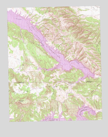
Tierra Redonda Mountain, CA USGS Topographic Map
Click on map above to begin viewing in our Map Viewer.

This topographic map contains these locations and features:
Feature Name Type Latitude Longitude GNIS ID View Map
Bee RockPopulated PlaceN35.7872°W120.9391°252851View Map
Bee Rock CanyonValleyN35.8011°W120.8905°239152View Map
Bee Rock HallBuildingN35.7872°W120.9396°1693267View Map
Bee Rock School (historical)SchoolN35.7797°W120.9419°1670174View Map
Branch Ranch (historical)LocaleN35.8011°W120.8930°239650View Map
California Department of Forestry and Fire Protection Station 34 Oak ShoresBuildingN35.7567°W120.9844°2664648View Map
Godfrey Ranch (historical)LocaleN35.7505°W120.8796°1670178View Map
Hames School (historical)SchoolN35.8714°W120.8871°1670134View Map
Harris CreekStreamN35.8125°W120.9280°243246View Map
Harris ValleyValleyN35.8066°W120.9849°243252View Map
Lake San AntonioReservoirN35.8070°W120.9000°254200View Map
Lynch RanchLocaleN35.7814°W120.9799°1670175View Map
Nacimiento DamDamN35.7584°W120.8851°1693269View Map
Nacimiento Lake MarinaLocaleN35.7580°W120.9024°1872159View Map
Oak Shores Census Designated PlaceCensusN35.7624°W120.9817°2583101View Map
PleytoCivilN35.8500°W120.9927°247616View Map
PleytoPopulated PlaceN35.8602°W120.9935°1661243View Map
Pleyto (historical)Populated PlaceN35.8611°W120.9971°1670149View Map
San Antonio 1008-002 DamDamN35.7980°W120.8852°1664128View Map
San Antonio DamDamN35.7986°W120.8857°1693257View Map
Tierra Redonda MountainSummitN35.7711°W120.9860°250487View Map
Williams Ranch (historical)LocaleN35.7505°W120.9257°1670177View Map

Note: Coordinates in the location and feature list above are referenced to NAD83 datum.


Copyright (C) 2008-2025 Ryan Niemi / Sunset Dynamics ... All Rights Reserved