TopoQuest Logo
Do you find TopoQuest useful?
Help keep TopoQuest running and adding new maps/features by donating!
Bitcoin:  19c7KJd3qBynnjoSw5npx9KScwjBe4ifkT
Litecoin:  LXs6TkuXGGXo1vDsWCkWVdjQX94eUKd6ui
Home View Maps Find Maps Find Places Resources & Links


Bryson, California Topographic Map

USGS Map Title: Bryson, CA
USGS Map MRC: 35121G1
DRG (GeoTIFF) Download: o35121g1.tif


Neighboring USGS Topographic Map Quads:


  Jolon, CA  
35121H2
 

  Williams Hill, CA  
35121H1
 

  Hames Valley, CA  
35120H8
 

  Burnett Peak, CA  
35121G2
 

  Bryson, CA  
35121G1
 

  Tierra Redonda Mountain, CA  
35120G8
 

  San Simeon, CA  
35121F2
 

  Pebblestone Shut-in, CA  
35121F1
 

  Lime Mountain, CA  
35120F8


Map MRC Location:

N36°
W122°
N36°
W121°
H8 H7 H6 H5 H4 H3 H2 H1
G8 G7 G6 G5 G4 G3 G2 G1
F8 F7 F6 F5 F4 F3 F2 F1
E8 E7 E6 E5 E4 E3 E2 E1
D8 D7 D6 D5 D4 D3 D2 D1
C8 C7 C6 C5 C4 C3 C2 C1
B8 B7 B6 B5 B4 B3 B2 B1
A8 A7 A6 A5 A4 A3 A2 A1
N35°
W122°
N35°
W121°

Bryson, CA USGS 1:24K Topographic Map Preview:
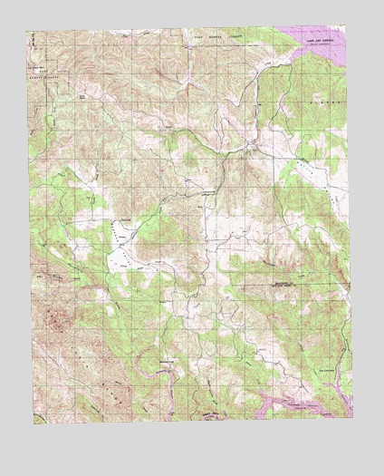
Bryson, CA USGS Topographic Map
Click on map above to begin viewing in our Map Viewer.

This topographic map contains these locations and features:
Feature Name Type Latitude Longitude GNIS ID View Map
Asbury CreekStreamN35.7558°W121.0324°238791View Map
Bald MountainSummitN35.8633°W121.1241°269645View Map
Beasley FlatFlatN35.7686°W121.0730°239128View Map
BrysonPopulated PlaceN35.8066°W121.0905°252862View Map
Cantinas CreekStreamN35.7589°W121.0066°240207View Map
Copperhead CreekStreamN35.8697°W121.0077°240913View Map
Gulch House CreekStreamN35.7889°W121.0938°243080View Map
Hesperia SchoolSchoolN35.8219°W121.0541°243390View Map
Nacimiento River PitMineN35.8117°W121.1239°2681138View Map
Pinkerton School (historical)SchoolN35.8675°W121.0135°1670148View Map
Pleyto SchoolSchoolN35.8144°W121.0905°252403View Map
Sapaque CreekStreamN35.7964°W121.0946°249151View Map
Sapaque ValleyValleyN35.7964°W121.0944°249152View Map
Smith RanchLocaleN35.8544°W121.1063°249597View Map
The CantinasSummitN35.7655°W121.0110°1661559View Map
Turtle CreekStreamN35.7986°W121.1080°250719View Map
Waterdog CreekStreamN35.7950°W121.1055°274396View Map

Note: Coordinates in the location and feature list above are referenced to NAD83 datum.


Copyright (C) 2008-2025 Ryan Niemi / Sunset Dynamics ... All Rights Reserved