TopoQuest Logo
Do you find TopoQuest useful?
Help keep TopoQuest running and adding new maps/features by donating!
Bitcoin:  19c7KJd3qBynnjoSw5npx9KScwjBe4ifkT
Litecoin:  LXs6TkuXGGXo1vDsWCkWVdjQX94eUKd6ui
Home View Maps Find Maps Find Places Resources & Links


Lincoln, Arkansas Topographic Map

USGS Map Title: Lincoln, AR
USGS Map MRC: 35094H4
DRG (GeoTIFF) Download: o35094h4.tif


Neighboring USGS Topographic Map Quads:


  Watts, OK  
36094A5
 

  Rhea, AR  
36094A4
 

  Wheeler, AR  
36094A3
 

  Westville, OK  
35094H5
 

  Lincoln, AR  
35094H4
 

  Prairie Grove, AR  
35094H3
 

  Stilwell East, OK  
35094G5
 

  Evansville, AR  
35094G4
 

  Strickler, AR  
35094G3


Map MRC Location:

N36°
W95°
N36°
W94°
H8 H7 H6 H5 H4 H3 H2 H1
G8 G7 G6 G5 G4 G3 G2 G1
F8 F7 F6 F5 F4 F3 F2 F1
E8 E7 E6 E5 E4 E3 E2 E1
D8 D7 D6 D5 D4 D3 D2 D1
C8 C7 C6 C5 C4 C3 C2 C1
B8 B7 B6 B5 B4 B3 B2 B1
A8 A7 A6 A5 A4 A3 A2 A1
N35°
W95°
N35°
W94°

Lincoln, AR USGS 1:24K Topographic Map Preview:
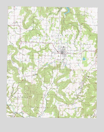
Lincoln, AR USGS Topographic Map
Click on map above to begin viewing in our Map Viewer.

This topographic map contains these locations and features:
Feature Name Type Latitude Longitude GNIS ID View Map
Bean CemeteryCemeteryN35.9487°W94.4172°46188View Map
Beatty BranchStreamN35.9981°W94.4288°70584View Map
Beatty CemeteryCemeteryN35.9856°W94.4527°46254View Map
Bethesda CemeteryCemeteryN35.8784°W94.4538°46464View Map
Bush CreekStreamN35.9079°W94.4394°76473View Map
Cane Hill College (historical)SchoolN35.9109°W94.3977°65297View Map
CanehillPopulated PlaceN35.9087°W94.3966°76520View Map
Canehill CemeteryCemeteryN35.9126°W94.3991°65299View Map
Canehill Post OfficePost OfficeN35.9092°W94.3967°84299View Map
Cantrell LakeReservoirN35.9344°W94.4192°80124View Map
Cantrell Lake DamDamN35.9334°W94.4185°80123View Map
Cheatham CemeteryCemeteryN35.9509°W94.4077°47716View Map
City of LincolnCivilN35.9487°W94.4174°2404930View Map
ClydePopulated PlaceN35.8915°W94.4066°76643View Map
Clyde Post Office (historical)Post OfficeN35.8909°W94.4072°84300View Map
Cove SpringSpringN35.9220°W94.3877°48110View Map
Drake CemeteryCemeteryN35.8979°W94.4491°48598View Map
Dutch MillsPopulated PlaceN35.8756°W94.4916°71480View Map
Glendale BranchStreamN35.8984°W94.4938°49447View Map
Jordan CreekStreamN35.9079°W94.4394°50746View Map
Kidd CemeteryCemeteryN35.9004°W94.4041°50835View Map
LincolnPopulated PlaceN35.9495°W94.4235°77500View Map
Lincoln Elementary SchoolSchoolN35.9557°W94.4185°65379View Map
Lincoln High SchoolSchoolN35.9465°W94.4050°65380View Map
Lincoln LakeReservoirN35.9942°W94.4175°75759View Map
Lincoln Middle SchoolSchoolN35.9550°W94.4224°65381View Map
Lincoln Police DepartmentBuildingN35.9494°W94.4226°2118940View Map
Lincoln Volunteer Fire DepartmentBuildingN35.9497°W94.4226°2116714View Map
Luginbuel Farm AirportAirportN35.9342°W94.4165°2770239View Map
McClellan CemeteryCemeteryN35.9015°W94.4063°51791View Map
Price CreekStreamN35.9781°W94.4991°53793View Map
Reese CemeteryCemeteryN35.8784°W94.3830°53974View Map
Rodgers LakeReservoirN35.9422°W94.3932°79746View Map
Rodgers Lake DamDamN35.9417°W94.3935°79745View Map
Russell CemeteryCemeteryN35.8912°W94.4185°54286View Map
Salem SpringsSpringN35.9023°W94.4927°65440View Map
Starr Hill School (historical)SchoolN35.9554°W94.4252°65459View Map
Sugar HillSummitN35.8995°W94.4619°55303View Map
Sugar HillLocaleN35.9234°W94.4616°81899View Map
Sugar Hill CemeteryCemeteryN35.9215°W94.4688°55304View Map
Sugartree MountainSummitN35.9365°W94.4924°78488View Map
SummersPopulated PlaceN35.9812°W94.4916°78496View Map
Summers Post OfficePost OfficeN35.9787°W94.4916°84320View Map
SuttlePopulated PlaceN35.9762°W94.3983°58718View Map
Township of Cane HillCivilN35.9038°W94.3827°69781View Map
Township of Dutch MillsCivilN35.8899°W94.4925°69786View Map
Township of LincolnCivilN35.9487°W94.4174°2406956View Map
Township of Price (historical)CivilN35.9709°W94.4961°69799View Map
Township of Starr HillCivilN35.9634°W94.4661°69804View Map
United Presbyterian Church of CanehillChurchN35.9101°W94.3963°65469View Map
White Rock CemeteryCemeteryN35.8984°W94.4897°56305View Map
Yates CemeteryCemeteryN35.8851°W94.4130°56584View Map

Note: Coordinates in the location and feature list above are referenced to NAD83 datum.


Copyright (C) 2008-2024 Ryan Niemi / Sunset Dynamics ... All Rights Reserved