TopoQuest Logo
Do you find TopoQuest useful?
Help keep TopoQuest running and adding new maps/features by donating!
Bitcoin:  19c7KJd3qBynnjoSw5npx9KScwjBe4ifkT
Litecoin:  LXs6TkuXGGXo1vDsWCkWVdjQX94eUKd6ui
Home View Maps Find Maps Find Places Resources & Links


Wheeler, Arkansas Topographic Map

USGS Map Title: Wheeler, AR
USGS Map MRC: 36094A3
DRG (GeoTIFF) Download: o36094a3.tif


Neighboring USGS Topographic Map Quads:


  Gallatin, AR  
36094B4
 

  Robinson, AR  
36094B3
 

  Springdale, AR  
36094B2
 

  Rhea, AR  
36094A4
 

  Wheeler, AR  
36094A3
 

  Fayetteville, AR  
36094A2
 

  Lincoln, AR  
35094H4
 

  Prairie Grove, AR  
35094H3
 

  West Fork, AR  
35094H2


Map MRC Location:

N37°
W95°
N37°
W94°
H8 H7 H6 H5 H4 H3 H2 H1
G8 G7 G6 G5 G4 G3 G2 G1
F8 F7 F6 F5 F4 F3 F2 F1
E8 E7 E6 E5 E4 E3 E2 E1
D8 D7 D6 D5 D4 D3 D2 D1
C8 C7 C6 C5 C4 C3 C2 C1
B8 B7 B6 B5 B4 B3 B2 B1
A8 A7 A6 A5 A4 A3 A2 A1
N36°
W95°
N36°
W94°

Wheeler, AR USGS 1:24K Topographic Map Preview:
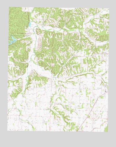
Wheeler, AR USGS Topographic Map
Click on map above to begin viewing in our Map Viewer.

This topographic map contains these locations and features:
Feature Name Type Latitude Longitude GNIS ID View Map
Bell CemeteryCemeteryN36.0573°W94.3352°70617View Map
Bethel Grove Church (historical)ChurchN36.0270°W94.2985°65286View Map
City of FarmingtonCivilN36.0370°W94.2537°2403598View Map
Clear CreekStreamN36.1062°W94.3394°71166View Map
Cooks Chapel (historical)ChurchN36.1054°W94.3160°65314View Map
Ebenezer Church (historical)ChurchN36.0431°W94.2555°65321View Map
Elkhorn SpringsSpringN36.0676°W94.3077°71549View Map
Farmington BranchStreamN36.0556°W94.2594°71596View Map
Farmington Fire DepartmentBuildingN36.0380°W94.2570°2116424View Map
Farmington High SchoolSchoolN36.0409°W94.2531°65334View Map
Farmington Police DepartmentBuildingN36.0385°W94.2569°2118945View Map
Free Holiness ChurchChurchN36.1190°W94.2666°71677View Map
George R Ledbetter Elementary SchoolSchoolN36.0438°W94.2529°2039062View Map
Goose CreekStreamN36.0506°W94.3169°71788View Map
Hamestring CreekStreamN36.1012°W94.2877°71885View Map
Highland ChurchChurchN36.0654°W94.2980°72015View Map
Howe-Savoy ChurchChurchN36.0987°W94.3505°72098View Map
Jabur (historical)Populated PlaceN36.0590°W94.3113°65372View Map
Lake WeddingtonReservoirN36.0894°W94.3712°77321View Map
Lake Weddington CampgroundLocaleN36.0915°W94.3708°74391View Map
Lake Weddington Picnic AreaLocaleN36.0881°W94.3688°74392View Map
Lake Wedington DamDamN36.0917°W94.3655°79752View Map
Lake Wedington Recreation AreaParkN36.0892°W94.3733°65375View Map
Little Elm ChurchChurchN36.0254°W94.2860°72389View Map
Moores CreekStreamN36.0290°W94.3663°72726View Map
Muddy ForkStreamN36.0740°W94.3469°77777View Map
Owl CreekStreamN36.0595°W94.2755°72969View Map
Providence Baptist ChurchChurchN36.0762°W94.2694°78107View Map
Randall G. Lynch Middle SchoolSchoolN36.0417°W94.2571°2039046View Map
Rickert (historical)Populated PlaceN36.0373°W94.3433°84314View Map
Rickert Post Office (historical)Post OfficeN36.0612°W94.3447°84315View Map
Rose CemeteryCemeteryN36.0345°W94.3560°73378View Map
Ruby SpringSpringN36.0242°W94.3019°73432View Map
SavoyPopulated PlaceN36.1056°W94.3327°78300View Map
StarksPopulated PlaceN36.0284°W94.2666°65458View Map
Sycamore Springs School (historical)SchoolN36.1190°W94.2672°65465View Map
Township of CenterCivilN36.0358°W94.2913°69782View Map
Township of FarmingtonCivilN36.0370°W94.2537°2406951View Map
Township of LitteralCivilN36.0941°W94.3055°69794View Map
Township of Marrs HillCivilN36.0380°W94.3407°69795View Map
Township of WheelerCivilN36.1104°W94.2517°2407403View Map
Township of Wheeler (historical)CivilN36.1112°W94.3377°70215View Map
University of Arkansas Experimental FarmLocaleN36.0806°W94.2897°82579View Map
Viney GrovePopulated PlaceN36.0084°W94.3302°78661View Map
Viney Grove Post Office (historical)Post OfficeN36.0090°W94.3313°84324View Map
Viney Grove United Methodist ChurchChurchN36.0084°W94.3305°65471View Map
Walnut GrovePopulated PlaceN36.0037°W94.2672°73997View Map
Walnut Grove ChurchChurchN36.0023°W94.2677°65474View Map
Weaver HillSummitN36.0562°W94.3410°74032View Map
Wedington Fire Department Station 1BuildingN36.0767°W94.2910°2117282View Map
Wedington Fire Department Station 2BuildingN36.1086°W94.3331°2117283View Map
Wedington WoodsPopulated PlaceN36.0945°W94.3102°65485View Map
Wedington Woods AirportAirportN36.0930°W94.3079°83696View Map
WheelerPopulated PlaceN36.1142°W94.2591°81904View Map
Wheeler Volunteer Fire DepartmentBuildingN36.1148°W94.2604°2117310View Map
White RockPopulated PlaceN36.0795°W94.2524°74125View Map

Note: Coordinates in the location and feature list above are referenced to NAD83 datum.


Copyright (C) 2008-2025 Ryan Niemi / Sunset Dynamics ... All Rights Reserved