TopoQuest Logo
Do you find TopoQuest useful?
Help keep TopoQuest running and adding new maps/features by donating!
Bitcoin:  19c7KJd3qBynnjoSw5npx9KScwjBe4ifkT
Litecoin:  LXs6TkuXGGXo1vDsWCkWVdjQX94eUKd6ui
Home View Maps Find Maps Find Places Resources & Links


Batavia, Arkansas Topographic Map

USGS Map Title: Batavia, AR
USGS Map MRC: 36093C2
DRG (GeoTIFF) Download: o36093c2.tif


Neighboring USGS Topographic Map Quads:


  Denver, AR  
36093D3
 

  Omaha, AR  
36093D2
 

  Omaha NE, AR  
36093D1
 

  Alpena, AR  
36093C3
 

  Batavia, AR  
36093C2
 

  Bergman, AR  
36093C1
 

  Osage NE, AR  
36093B3
 

  Gaither, AR  
36093B2
 

  Harrison, AR  
36093B1


Map MRC Location:

N37°
W94°
N37°
W93°
H8 H7 H6 H5 H4 H3 H2 H1
G8 G7 G6 G5 G4 G3 G2 G1
F8 F7 F6 F5 F4 F3 F2 F1
E8 E7 E6 E5 E4 E3 E2 E1
D8 D7 D6 D5 D4 D3 D2 D1
C8 C7 C6 C5 C4 C3 C2 C1
B8 B7 B6 B5 B4 B3 B2 B1
A8 A7 A6 A5 A4 A3 A2 A1
N36°
W94°
N36°
W93°

Batavia, AR USGS 1:24K Topographic Map Preview:
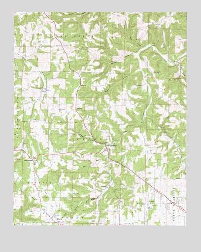
Batavia, AR USGS Topographic Map
Click on map above to begin viewing in our Map Viewer.

This topographic map contains these locations and features:
Feature Name Type Latitude Longitude GNIS ID View Map
Air - Evacuation Lifeteam 40BuildingN36.3376°W93.2036°2119194View Map
Arkansas State Police Troop IBuildingN36.2682°W93.1501°2118850View Map
Auman ChurchChurchN36.3278°W93.2493°45974View Map
BataviaPopulated PlaceN36.2551°W93.2227°57339View Map
Bear Creek SpringsPopulated PlaceN36.2976°W93.1832°57346View Map
Bear Creek Springs Baptist ChurchChurchN36.2967°W93.1843°69254View Map
Boone County AirportAirportN36.2629°W93.1531°83714View Map
Capps - Batavia Fire Department Station 3BuildingN36.2979°W93.1843°2116233View Map
Capps - Batavia Fire StationBuildingN36.2596°W93.2292°2116234View Map
Cottonwood Fire Department Station 2BuildingN36.3487°W93.1384°2116315View Map
Denning CemeteryCemeteryN36.2724°W93.1863°48469View Map
Denning CreekStreamN36.2981°W93.1818°48470View Map
Dry ForkStreamN36.2909°W93.1818°48657View Map
Evangel Bible ChurchChurchN36.2678°W93.1438°69281View Map
FrancisPopulated PlaceN36.2920°W93.1816°69288View Map
Gass CemeteryCemeteryN36.3553°W93.2135°49355View Map
Gifford CemeteryCemeteryN36.2587°W93.2357°49402View Map
Harrison Country ClubLocaleN36.2648°W93.1313°82441View Map
Harrison Fire Department Station 3BuildingN36.2631°W93.1512°2116539View Map
John Paul Hammerschmidt Post Office BuildingPost OfficeN36.2503°W93.1292°2098013View Map
Kendall HollowValleyN36.3506°W93.1605°50805View Map
Keys HollowValleyN36.3542°W93.1571°50832View Map
Liberty Assembly of God ChurchChurchN36.3462°W93.2096°77488View Map
Lick BranchPopulated PlaceN36.3301°W93.2288°77494View Map
Little ArkansawPopulated PlaceN36.2892°W93.2366°77508View Map
Loback CemeteryCemeteryN36.2925°W93.2160°51355View Map
Markley CemeteryCemeteryN36.2512°W93.2446°51676View Map
Mill HollowValleyN36.3448°W93.1302°52045View Map
ProsperityPopulated PlaceN36.3328°W93.2010°58438View Map
RidgewayPopulated PlaceN36.3178°W93.2046°58489View Map
Ridgeway Church of ChristChurchN36.3167°W93.2041°69322View Map
Ridgeway FieldAirportN36.3231°W93.2042°2650756View Map
Rock SpringsSpringN36.2662°W93.1905°54110View Map
Rock Springs BranchStreamN36.2684°W93.1855°54111View Map
Rolands ForkStreamN36.2990°W93.1891°54170View Map
Sanders CemeteryCemeteryN36.2690°W93.2074°54555View Map
Shady Grove ChurchChurchN36.3551°W93.2141°54722View Map
Shawnee Valley Boys RanchLocaleN36.3398°W93.1485°54752View Map
Sweet HollowValleyN36.3431°W93.1599°55380View Map
Thomason CemeteryCemeteryN36.3317°W93.1563°55530View Map
Township of BataviaCivilN36.2644°W93.2309°69604View Map
Township of JacksonCivilN36.2998°W93.1863°69612View Map
Upland ChurchChurchN36.2781°W93.1291°55849View Map
Wolf CreekStreamN36.3151°W93.1552°56484View Map
Younes Shopping CenterLocaleN36.2634°W93.1357°69333View Map

Note: Coordinates in the location and feature list above are referenced to NAD83 datum.


Copyright (C) 2008-2025 Ryan Niemi / Sunset Dynamics ... All Rights Reserved