TopoQuest Logo
Do you find TopoQuest useful?
Help keep TopoQuest running and adding new maps/features by donating!
Bitcoin:  19c7KJd3qBynnjoSw5npx9KScwjBe4ifkT
Litecoin:  LXs6TkuXGGXo1vDsWCkWVdjQX94eUKd6ui
Home View Maps Find Maps Find Places Resources & Links


Bergman, Arkansas Topographic Map

USGS Map Title: Bergman, AR
USGS Map MRC: 36093C1
DRG (GeoTIFF) Download: o36093c1.tif


Neighboring USGS Topographic Map Quads:


  Omaha, AR  
36093D2
 

  Omaha NE, AR  
36093D1
 

  Diamond City, AR  
36092D8
 

  Batavia, AR  
36093C2
 

  Bergman, AR  
36093C1
 

  Zinc, AR  
36092C8
 

  Gaither, AR  
36093B2
 

  Harrison, AR  
36093B1
 

  Everton, AR  
36092B8


Map MRC Location:

N37°
W94°
N37°
W93°
H8 H7 H6 H5 H4 H3 H2 H1
G8 G7 G6 G5 G4 G3 G2 G1
F8 F7 F6 F5 F4 F3 F2 F1
E8 E7 E6 E5 E4 E3 E2 E1
D8 D7 D6 D5 D4 D3 D2 D1
C8 C7 C6 C5 C4 C3 C2 C1
B8 B7 B6 B5 B4 B3 B2 B1
A8 A7 A6 A5 A4 A3 A2 A1
N36°
W94°
N36°
W93°

Bergman, AR USGS 1:24K Topographic Map Preview:
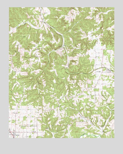
Bergman, AR USGS Topographic Map
Click on map above to begin viewing in our Map Viewer.

This topographic map contains these locations and features:
Feature Name Type Latitude Longitude GNIS ID View Map
BergmanPopulated PlaceN36.3162°W93.0077°76306View Map
Bergman Assembly of God ChurchChurchN36.3131°W93.0074°69256View Map
Bergman Elementary SchoolSchoolN36.3147°W93.0177°69257View Map
Bergman Fire Department Station 2BuildingN36.3362°W93.0088°2116141View Map
Bergman Fire Station 1BuildingN36.3008°W93.0236°2116142View Map
Bergman High SchoolSchoolN36.3143°W93.0172°83396View Map
Bergman Post OfficePost OfficeN36.3124°W93.0126°84450View Map
Bethany CemeteryCemeteryN36.2890°W93.0491°46420View Map
Bog HollowValleyN36.3573°W93.0952°46793View Map
Boone CountyCivilN36.3086°W93.0916°69897View Map
Cheatham CreekStreamN36.3623°W93.0832°47717View Map
Cottonwood Fire Department Station 1BuildingN36.3142°W93.1174°2116314View Map
Evans BranchStreamN36.3495°W93.0602°48929View Map
Gooch HollowValleyN36.2577°W93.0029°49488View Map
Harrison Christian AcademySchoolN36.2528°W93.1193°69294View Map
Harrison Fire Department Station 2BuildingN36.2503°W93.1225°2116538View Map
HopewellPopulated PlaceN36.3351°W93.0924°57942View Map
Hopewell Baptist ChurchChurchN36.3278°W93.0907°77221View Map
KCWD-FM (Harrison)TowerN36.2767°W93.0910°85187View Map
Marble ForkStreamN36.3395°W93.0593°51664View Map
MyrtlePopulated PlaceN36.3615°W93.0846°58235View Map
Northvale Shopping CenterLocaleN36.2553°W93.1238°69312View Map
Norvell SpringSpringN36.2701°W93.0366°52849View Map
Oak Grove SchoolSchoolN36.2567°W93.0941°52923View Map
Open Door Baptist ChurchChurchN36.2570°W93.1177°69316View Map
Oregon (historical)Populated PlaceN36.3020°W93.0210°69317View Map
Oregon Flat Baptist ChurchChurchN36.3270°W93.0221°77922View Map
Ozark Mall Shopping CenterLocaleN36.2506°W93.1196°69318View Map
Sandsing HollowValleyN36.2576°W93.0166°54560View Map
Summers CemeteryCemeteryN36.2740°W93.1166°55332View Map
Town of BergmanCivilN36.3129°W93.0115°2405247View Map
Township of ElixirCivilN36.3194°W93.0074°69609View Map
Township of LeeCivilN36.3352°W93.1012°69614View Map
Township of Washington (historical)CivilN36.2542°W93.0168°69329View Map
Wesleyan ChurchChurchN36.2803°W93.0655°69331View Map
White Oak CreekStreamN36.2531°W93.0163°78758View Map
Wooden HillsPopulated PlaceN36.3370°W93.0605°58909View Map
York CemeteryCemeteryN36.3195°W93.0238°56607View Map

Note: Coordinates in the location and feature list above are referenced to NAD83 datum.


Copyright (C) 2008-2024 Ryan Niemi / Sunset Dynamics ... All Rights Reserved