TopoQuest Logo
Do you find TopoQuest useful?
Help keep TopoQuest running and adding new maps/features by donating!
Bitcoin:  19c7KJd3qBynnjoSw5npx9KScwjBe4ifkT
Litecoin:  LXs6TkuXGGXo1vDsWCkWVdjQX94eUKd6ui
Home View Maps Find Maps Find Places Resources & Links


White Oak, Alabama Topographic Map

USGS Map Title: White Oak, AL
USGS Map MRC: 31085H3
DRG (GeoTIFF) Download: o31085h3.tif


Neighboring USGS Topographic Map Quads:


  Comer, AL  
32085A4
 

  Batesville, AL  
32085A3
 

  Howe, AL  
32085A2
 

  Clayton North, AL  
31085H4
 

  White Oak, AL  
31085H3
 

  Eufaula North, AL  
31085H2
 

  Clayton South, AL  
31085G4
 

  Baker Hill, AL  
31085G3
 

  Eufaula South, AL  
31085G2


Map MRC Location:

N32°
W86°
N32°
W85°
H8 H7 H6 H5 H4 H3 H2 H1
G8 G7 G6 G5 G4 G3 G2 G1
F8 F7 F6 F5 F4 F3 F2 F1
E8 E7 E6 E5 E4 E3 E2 E1
D8 D7 D6 D5 D4 D3 D2 D1
C8 C7 C6 C5 C4 C3 C2 C1
B8 B7 B6 B5 B4 B3 B2 B1
A8 A7 A6 A5 A4 A3 A2 A1
N31°
W86°
N31°
W85°

White Oak, AL USGS 1:24K Topographic Map Preview:
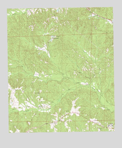
White Oak, AL USGS Topographic Map
Click on map above to begin viewing in our Map Viewer.

This topographic map contains these locations and features:
Feature Name Type Latitude Longitude GNIS ID View Map
Academy CemeteryCemeteryN31.9655°W85.3275°2576284View Map
Beauchamp Family CemeteryCemeteryN31.9058°W85.3364°2576285View Map
Bethlehem ChurchChurchN31.9690°W85.3230°134757View Map
Claytons PondReservoirN31.9719°W85.3211°134768View Map
Cooper BranchStreamN31.9202°W85.2785°116568View Map
Cunningham CemeteryCemeteryN31.8960°W85.3080°116968View Map
Dowdy CreekStreamN31.9085°W85.2669°117444View Map
Eufaula Air Force Station (historical)MilitaryN31.8817°W85.2558°2087527View Map
Gilmore Hill Lookout TowerTowerN31.8779°W85.2655°164332View Map
Knowlton (historical)Populated PlaceN31.9107°W85.2644°1805332View Map
Leak CreekStreamN31.9213°W85.2894°121447View Map
Mount Hope Church (historical)ChurchN31.9654°W85.3699°1805339View Map
Mount Serene CemeteryCemeteryN31.8793°W85.3385°152507View Map
Palmyra ChurchChurchN31.8860°W85.3160°124395View Map
Perkins-Evans CemeteryCemeteryN31.9104°W85.3374°124609View Map
Shiloh ChurchChurchN31.8838°W85.3210°153419View Map
Smithville Church (historical)ChurchN31.9852°W85.3144°134825View Map
TabernacleChurchN31.9149°W85.3402°1805355View Map
Tabernacle ChurchChurchN31.9146°W85.3397°127623View Map
White OakPopulated PlaceN31.9004°W85.3391°157248View Map
White Oak Chapel (historical)ChurchN31.9204°W85.3477°1805359View Map
White Oak ChurchChurchN31.8835°W85.3316°128883View Map
Wilsonville ChurchChurchN31.9346°W85.2916°129102View Map
Wyecott LakeReservoirN31.9802°W85.3266°130043View Map
Wyecott Lake DamDamN31.9802°W85.3266°130042View Map
Wyecott PlantationLocaleN31.9699°W85.3216°129254View Map
Zion ChapelChurchN31.9099°W85.3372°134843View Map
Zion Hill ChurchChurchN31.9715°W85.3158°129349View Map

Note: Coordinates in the location and feature list above are referenced to NAD83 datum.


Copyright (C) 2008-2025 Ryan Niemi / Sunset Dynamics ... All Rights Reserved