TopoQuest Logo
Do you find TopoQuest useful?
Help keep TopoQuest running and adding new maps/features by donating!
Bitcoin:  19c7KJd3qBynnjoSw5npx9KScwjBe4ifkT
Litecoin:  LXs6TkuXGGXo1vDsWCkWVdjQX94eUKd6ui
Home View Maps Find Maps Find Places Resources & Links


Rackerby, California Topographic Map

USGS Map Title: Rackerby, CA
USGS Map MRC: 39121D3
DRG (GeoTIFF) Download: o39121d3.tif


Neighboring USGS Topographic Map Quads:


  Oroville Dam, CA  
39121E4
 

  Forbestown, CA  
39121E3
 

  Clipper Mills, CA  
39121E2
 

  Bangor, CA  
39121D4
 

  Rackerby, CA  
39121D3
 

  Challenge, CA  
39121D2
 

  Loma Rica, CA  
39121C4
 

  Oregon House, CA  
39121C3
 

  French Corral, CA  
39121C2


Map MRC Location:

N40°
W122°
N40°
W121°
H8 H7 H6 H5 H4 H3 H2 H1
G8 G7 G6 G5 G4 G3 G2 G1
F8 F7 F6 F5 F4 F3 F2 F1
E8 E7 E6 E5 E4 E3 E2 E1
D8 D7 D6 D5 D4 D3 D2 D1
C8 C7 C6 C5 C4 C3 C2 C1
B8 B7 B6 B5 B4 B3 B2 B1
A8 A7 A6 A5 A4 A3 A2 A1
N39°
W122°
N39°
W121°

Rackerby, CA USGS 1:24K Topographic Map Preview:
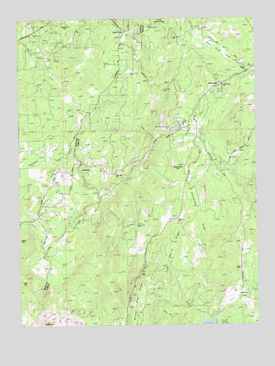
Rackerby, CA USGS Topographic Map
Click on map above to begin viewing in our Map Viewer.

This topographic map contains these locations and features:
Feature Name Type Latitude Longitude GNIS ID View Map
Aero Pines Mobile Home ParkPopulated PlaceN39.4572°W121.2892°2507944View Map
Bennett MineMineN39.4985°W121.2989°1670467View Map
Big Valley CreekStreamN39.3877°W121.2600°257040View Map
Bootjack MineMineN39.4952°W121.2964°1670468View Map
Bootjack MineMineN39.4999°W121.2997°257353View Map
Brown RavineValleyN39.4488°W121.3455°257496View Map
BrownsvillePopulated PlaceN39.4732°W121.2691°257518View Map
Brownsville AirportAirportN39.4559°W121.2918°1653288View Map
Brownsville Fire StationLocaleN39.4649°W121.2719°276824View Map
Brownsville Lutheran ChurchChurchN39.4729°W121.2691°1703532View Map
Brownsville Post OfficePost OfficeN39.4517°W121.2826°1703471View Map
California Department of Forestry and Fire Protection Station 54 Robinson MillBuildingN39.4947°W121.3205°2622348View Map
Central Pacific MineMineN39.4782°W121.3180°258175View Map
Challenge-Brownsville Census Designated PlaceCensusN39.4646°W121.2632°2408008View Map
Chittenden RidgeRidgeN39.4194°W121.2792°2778585View Map
Chitterden RidgeRidgeN39.4185°W121.2789°258341View Map
Daken FlatFlatN39.4574°W121.2841°259017View Map
Day MeadowFlatN39.4977°W121.2861°259103View Map
Finley RanchLocaleN39.3960°W121.3136°260115View Map
Foothill Volunteer Fire DepartmentBuildingN39.4567°W121.2828°2621911View Map
FrenchtownPopulated PlaceN39.3879°W121.2550°1658586View Map
Hansonville HillSummitN39.4399°W121.2933°1658707View Map
Hansonville SchoolSchoolN39.4366°W121.3261°261069View Map
Hedge HillAreaN39.4168°W121.3189°261225View Map
High Spring RidgeRidgeN39.4104°W121.2939°261336View Map
Hurleton Fire StationBuildingN39.4921°W121.3608°276822View Map
Lamb HillSummitN39.3802°W121.3000°1658936View Map
Long Valley CreekStreamN39.3943°W121.2777°262886View Map
Manzanita MineMineN39.4704°W121.3014°263162View Map
Natchez CreekStreamN39.4293°W121.3352°264004View Map
Negro CreekStreamN39.4538°W121.3436°276823View Map
New York CreekStreamN39.4793°W121.2533°264066View Map
New York FlatSwampN39.4874°W121.2752°264067View Map
New York Flat (historical)Populated PlaceN39.4960°W121.2789°1703501View Map
Parks HillSummitN39.3943°W121.3739°1659347View Map
Pinewood Mobile Home ParkPopulated PlaceN39.4550°W121.2831°2507941View Map
Portuguese Ranch (historical)LocaleN39.4024°W121.2594°1703508View Map
Prince Albert CreekStreamN39.4277°W121.2552°265040View Map
RackerbyPopulated PlaceN39.4396°W121.3414°1659452View Map
Rackerby Census Designated PlaceCensusN39.4261°W121.3542°2612485View Map
Rackerby Post OfficePost OfficeN39.4410°W121.3355°1703510View Map
Robinson Mill Census Designated PlaceCensusN39.4856°W121.3202°2612487View Map
Robinson MillsPopulated PlaceN39.4949°W121.3208°265465View Map
Robinson RavineValleyN39.4102°W121.3580°265468View Map
Rose RanchLocaleN39.3979°W121.2600°265575View Map
Ruff HillSummitN39.4638°W121.2577°265661View Map
Saddle Spring PassGapN39.4154°W121.3150°265712View Map
Sharon Valley SchoolSchoolN39.4713°W121.2716°266046View Map
Smoky RavineValleyN39.3768°W121.2794°267280View Map
Sommey FlatFlatN39.4974°W121.3491°267392View Map
Sowell RavineValleyN39.4054°W121.3622°267544View Map
Swedes FlatFlatN39.4427°W121.3627°268021View Map
Swedes Flat (historical)Populated PlaceN39.4466°W121.3747°1724007View Map
Three in One MineMineN39.4924°W121.2964°268254View Map
Upham CemeteryCemeteryN39.4332°W121.3577°268597View Map
Washington Mill (historical)LocaleN39.4438°W121.2758°1703521View Map
Weiss HillSummitN39.4968°W121.3089°1660141View Map
Wildcat RavineValleyN39.4521°W121.3061°269098View Map
Willow Glen RanchLocaleN39.4171°W121.2947°269169View Map
Willow Glen RidgeRidgeN39.3807°W121.3111°269170View Map

Note: Coordinates in the location and feature list above are referenced to NAD83 datum.


Copyright (C) 2008-2024 Ryan Niemi / Sunset Dynamics ... All Rights Reserved