TopoQuest Logo
Do you find TopoQuest useful?
Help keep TopoQuest running and adding new maps/features by donating!
Bitcoin:  19c7KJd3qBynnjoSw5npx9KScwjBe4ifkT
Litecoin:  LXs6TkuXGGXo1vDsWCkWVdjQX94eUKd6ui
Home View Maps Find Maps Find Places Resources & Links


Tabor City West, North Carolina Topographic Map

USGS Map Title: Tabor City West, NC
USGS Map MRC: 34078B8
DRG (GeoTIFF) Download: o34078b8.tif


Neighboring USGS Topographic Map Quads:


  Fair Bluff, NC  
34079C1
 

  Cerro Gordo, NC  
34078C8
 

  Chadbourn, NC  
34078C7
 

  Duford, SC  
34079B1
 

  Tabor City West, NC  
34078B8
 

  Tabor City East, NC  
34078B7
 

  Bayboro, SC  
34079A1
 

  Loris, SC  
34078A8
 

  Goretown, SC  
34078A7


Map MRC Location:

N35°
W79°
N35°
W78°
H8 H7 H6 H5 H4 H3 H2 H1
G8 G7 G6 G5 G4 G3 G2 G1
F8 F7 F6 F5 F4 F3 F2 F1
E8 E7 E6 E5 E4 E3 E2 E1
D8 D7 D6 D5 D4 D3 D2 D1
C8 C7 C6 C5 C4 C3 C2 C1
B8 B7 B6 B5 B4 B3 B2 B1
A8 A7 A6 A5 A4 A3 A2 A1
N34°
W79°
N34°
W78°

Tabor City West, NC USGS 1:24K Topographic Map Preview:
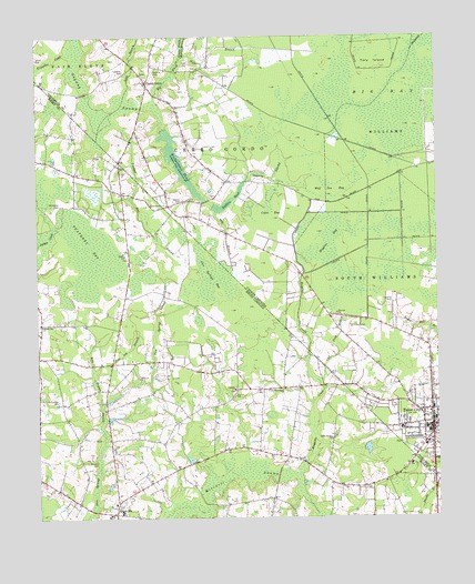
Tabor City West, NC USGS Topographic Map
Click on map above to begin viewing in our Map Viewer.

This topographic map contains these locations and features:
Feature Name Type Latitude Longitude GNIS ID View Map
Big BaySwampN34.2338°W78.8909°981312View Map
Big Fresh Water BranchStreamN34.2335°W78.9631°981394View Map
Blanton CemeteryCemeteryN34.1402°W78.9817°1220798View Map
Bobs BranchStreamN34.1552°W78.9798°1220843View Map
Buffkin CemeteryCemeteryN34.2066°W78.9925°1221091View Map
Buffkin PondReservoirN34.2074°W78.9399°982186View Map
Calf Ford BranchStreamN34.1588°W78.9109°982422View Map
Carolina School (historical)SchoolN34.1588°W78.9367°1243634View Map
Carolinas Medical ResponseBuildingN34.2083°W78.9163°2720622View Map
Caroline ChurchChurchN34.1588°W78.9381°1247170View Map
Central School (historical)SchoolN34.1663°W78.9706°1706216View Map
Cherry GrovePopulated PlaceN34.2385°W78.9656°1006160View Map
Cherry Grove Baptist ChurchChurchN34.2401°W78.9672°2505938View Map
Coleman CemeteryCemeteryN34.2410°W78.9725°983363View Map
Crooked Run BranchStreamN34.2254°W78.9714°983775View Map
Crooked Run BranchStreamN34.2285°W78.9759°1221842View Map
Cross BaySwampN34.2052°W78.9267°983779View Map
Fair Bluff Fire and RescueBuildingN34.2407°W78.9716°2638845View Map
Feathery BaySwampN34.1960°W78.9828°1222363View Map
Field CemeteryCemeteryN34.2429°W78.9522°985064View Map
Fowler School (historical)SchoolN34.1335°W78.8953°1243727View Map
Gapway CemeteryCemeteryN34.2077°W78.9545°985544View Map
Gapway SwampStreamN34.2127°W78.9353°985547View Map
Godwin CemeteryCemeteryN34.2410°W78.9631°985761View Map
Grassy Bay ChurchChurchN34.1752°W78.9984°1245814View Map
Grassy Bay Missionary Baptist ChurchChurchN34.1259°W78.9770°2490254View Map
Grassy Bay School (historical)SchoolN34.1746°W78.9989°1243748View Map
Green SeaPopulated PlaceN34.1263°W78.9756°1231343View Map
Green Sea CemeteryCemeteryN34.1296°W78.9734°1243751View Map
Green Sea ChurchChurchN34.1288°W78.9759°1243752View Map
Green Sea-Floyds Middle SchoolSchoolN34.1268°W78.9739°1243755View Map
Horry County Fire Department Station 41BuildingN34.1749°W78.9738°2368255View Map
Huggins BaySwampN34.1968°W78.9081°987223View Map
Huggins CreekStreamN34.1393°W78.9164°987225View Map
Iron Springs BaySwampN34.1868°W78.9459°1223462View Map
Iron Springs BaySwampN34.1966°W78.9467°987399View Map
Little Bethel ChurchChurchN34.1457°W78.9081°1223956View Map
Little Fresh Water BranchStreamN34.2449°W78.9545°1025477View Map
Long BranchStreamN34.2368°W78.9711°988920View Map
Lovett CemeteryCemeteryN34.2446°W78.9995°989071View Map
Mill BranchStreamN34.1352°W78.9186°1224522View Map
Mill BranchStreamN34.2043°W78.9442°989859View Map
Norton (historical)Populated PlaceN34.2102°W78.9761°1243864View Map
Norton School (historical)SchoolN34.2099°W78.9764°1243865View Map
Pine Log BranchStreamN34.1638°W78.9817°1225464View Map
Richardson PondReservoirN34.2178°W78.9554°993313View Map
Strickland CemeteryCemeteryN34.2066°W78.9925°1226930View Map
Tabor CityPopulated PlaceN34.1488°W78.8767°995822View Map
Tabor City Fire DepartmentBuildingN34.1475°W78.8786°2638808View Map
Tabor City West Junior High SchoolSchoolN34.1482°W78.8864°1006498View Map
Tabor Correctional InstitutionBuildingN34.1875°W78.9120°2769871View Map
Tabor Industrial ParkLocaleN34.1598°W78.8847°2505185View Map
The County Farm MuseumBuildingN34.1491°W78.9771°2490435View Map
Tory IslandIslandN34.2432°W78.8945°996173View Map
Trippiloo CreekStreamN34.2454°W78.9900°996262View Map
Turbeville AirportAirportN34.2102°W78.9576°997846View Map
Union Missionary ChurchChurchN34.1579°W78.9231°1251272View Map
Williamson CemeteryCemeteryN34.1560°W78.9934°1227617View Map
Wolf Pen BaySwampN34.2113°W78.9086°997537View Map

Note: Coordinates in the location and feature list above are referenced to NAD83 datum.


Copyright (C) 2008-2024 Ryan Niemi / Sunset Dynamics ... All Rights Reserved