TopoQuest Logo
Do you find TopoQuest useful?
Help keep TopoQuest running and adding new maps/features by donating!
Bitcoin:  19c7KJd3qBynnjoSw5npx9KScwjBe4ifkT
Litecoin:  LXs6TkuXGGXo1vDsWCkWVdjQX94eUKd6ui
Home View Maps Find Maps Find Places Resources & Links


Louin, Mississippi Topographic Map

USGS Map Title: Louin, MS
USGS Map MRC: 32089A3
DRG (GeoTIFF) Download: o32089a3.tif


Neighboring USGS Topographic Map Quads:


  Pineville, MS  
32089B4
 

  Clear Springs, MS  
32089B3
 

  Montrose North, MS  
32089B2
 

  Louin SW, MS  
32089A4
 

  Louin, MS  
32089A3
 

  Montrose South, MS  
32089A2
 

  Center Ridge, MS  
31089H4
 

  Bay Springs, MS  
31089H3
 

  Lake Como, MS  
31089H2


Map MRC Location:

N33°
W90°
N33°
W89°
H8 H7 H6 H5 H4 H3 H2 H1
G8 G7 G6 G5 G4 G3 G2 G1
F8 F7 F6 F5 F4 F3 F2 F1
E8 E7 E6 E5 E4 E3 E2 E1
D8 D7 D6 D5 D4 D3 D2 D1
C8 C7 C6 C5 C4 C3 C2 C1
B8 B7 B6 B5 B4 B3 B2 B1
A8 A7 A6 A5 A4 A3 A2 A1
N32°
W90°
N32°
W89°

Louin, MS USGS 1:24K Topographic Map Preview:
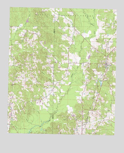
Louin, MS USGS Topographic Map
Click on map above to begin viewing in our Map Viewer.

This topographic map contains these locations and features:
Feature Name Type Latitude Longitude GNIS ID View Map
Bethany CemeteryCemeteryN32.0282°W89.3745°692545View Map
Bethel CemeteryCemeteryN32.0485°W89.2712°692552View Map
Bethel Primitive Baptist ChurchChurchN32.0254°W89.2745°692558View Map
Boykin (historical)LocaleN32.0813°W89.3731°707239View Map
Buchanan BranchStreamN32.0468°W89.3212°692739View Map
Burns (historical)Populated PlaceN32.1057°W89.2515°707787View Map
Dillard School (historical)SchoolN32.0571°W89.3653°704923View Map
Floyd BranchStreamN32.0227°W89.3206°693236View Map
Gammage CreekStreamN32.0824°W89.2931°693282View Map
Greentree ReservoirReservoirN32.1125°W89.3540°711523View Map
Hamlet (historical)Populated PlaceN32.0246°W89.2767°705246View Map
Hill ChapelChurchN32.0663°W89.3226°693479View Map
Holden CemeteryCemeteryN32.0085°W89.2936°693499View Map
Hopewell ChurchChurchN32.0479°W89.3698°693525View Map
Jerusalem Baptist ChurchChurchN32.0543°W89.2601°693613View Map
Joe BranchStreamN32.0032°W89.3487°693619View Map
LouinPopulated PlaceN32.0713°W89.2609°693834View Map
Louin Baptist ChurchChurchN32.0699°W89.2595°705248View Map
Louin CemeteryCemeteryN32.0704°W89.2595°707808View Map
Louin Post OfficePost OfficeN32.0693°W89.2606°712809View Map
Louin Volunteer Fire DepartmentBuildingN32.0688°W89.2605°2668050View Map
Otak CreekStreamN32.1107°W89.2753°694280View Map
Phaltie ChurchChurchN32.0143°W89.3065°694353View Map
Pineview LakeReservoirN32.0515°W89.2673°694394View Map
Pineview Lake DamDamN32.0535°W89.2667°695416View Map
Rosson BranchStreamN32.0352°W89.3128°694618View Map
StevensPopulated PlaceN32.0310°W89.2756°705252View Map
TedLocaleN32.0440°W89.3231°694952View Map
Thompson BranchStreamN32.0102°W89.3345°694966View Map
Town of LouinCivilN32.0722°W89.2627°2406046View Map
Triumph ChurchChurchN32.0765°W89.3298°695007View Map
Ward Lake DamDamN32.1002°W89.2584°695419View Map
Warren Hill ChurchChurchN32.0679°W89.3601°695096View Map

Note: Coordinates in the location and feature list above are referenced to NAD83 datum.


Copyright (C) 2008-2024 Ryan Niemi / Sunset Dynamics ... All Rights Reserved