TopoQuest Logo
Do you find TopoQuest useful?
Help keep TopoQuest running and adding new maps/features by donating!
Bitcoin:  19c7KJd3qBynnjoSw5npx9KScwjBe4ifkT
Litecoin:  LXs6TkuXGGXo1vDsWCkWVdjQX94eUKd6ui
Home View Maps Find Maps Find Places Resources & Links


Clear Springs, Mississippi Topographic Map

USGS Map Title: Clear Springs, MS
USGS Map MRC: 32089B3
DRG (GeoTIFF) Download: o32089b3.tif


Neighboring USGS Topographic Map Quads:


  Forest, MS  
32089C4
 

  Lake, MS  
32089C3
 

  Newton, MS  
32089C2
 

  Pineville, MS  
32089B4
 

  Clear Springs, MS  
32089B3
 

  Montrose North, MS  
32089B2
 

  Louin SW, MS  
32089A4
 

  Louin, MS  
32089A3
 

  Montrose South, MS  
32089A2


Map MRC Location:

N33°
W90°
N33°
W89°
H8 H7 H6 H5 H4 H3 H2 H1
G8 G7 G6 G5 G4 G3 G2 G1
F8 F7 F6 F5 F4 F3 F2 F1
E8 E7 E6 E5 E4 E3 E2 E1
D8 D7 D6 D5 D4 D3 D2 D1
C8 C7 C6 C5 C4 C3 C2 C1
B8 B7 B6 B5 B4 B3 B2 B1
A8 A7 A6 A5 A4 A3 A2 A1
N32°
W90°
N32°
W89°

Clear Springs, MS USGS 1:24K Topographic Map Preview:
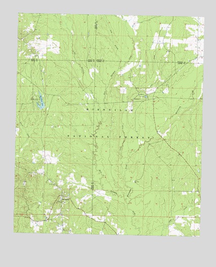
Clear Springs, MS USGS Topographic Map
Click on map above to begin viewing in our Map Viewer.

This topographic map contains these locations and features:
Feature Name Type Latitude Longitude GNIS ID View Map
Bienville Forest Oil FieldOilfieldN32.1854°W89.3503°707237View Map
Burnett CemeteryCemeteryN32.1529°W89.3477°692773View Map
Cedar CreekStreamN32.1582°W89.3023°692863View Map
Clear SpringsPopulated PlaceN32.1440°W89.3440°692930View Map
Clear Springs Baptist Church CemeteryCemeteryN32.1437°W89.3439°2766931View Map
Clear Springs ChurchChurchN32.1438°W89.3434°704921View Map
Decedar Baptist Church CemeteryCemeteryN32.2052°W89.2927°710176View Map
Decedar Missionary Baptist ChurchChurchN32.2054°W89.2928°693072View Map
Little Tallahala CreekStreamN32.1896°W89.3173°693787View Map
Long BranchStreamN32.2199°W89.3067°693820View Map
Marathon LakeReservoirN32.1993°W89.3581°693870View Map
Marathon Lake DamDamN32.1968°W89.3567°695424View Map
Marathon Lake Recreation AreaLocaleN32.2010°W89.3603°693871View Map
McCormick Lake DamDamN32.1468°W89.3567°695423View Map
Montrose Box (historical)LocaleN32.1354°W89.3265°704930View Map
Mount Calvary ChurchChurchN32.2024°W89.2962°694051View Map
Quarterliah CreekStreamN32.1432°W89.2987°694495View Map
Success (historical)Populated PlaceN32.2026°W89.2834°705253View Map
SunPopulated PlaceN32.2263°W89.3612°705009View Map
Tallahala State Wildlife Management AreaParkN32.1835°W89.3001°705254View Map

Note: Coordinates in the location and feature list above are referenced to NAD83 datum.


Copyright (C) 2008-2025 Ryan Niemi / Sunset Dynamics ... All Rights Reserved