TopoQuest Logo
Do you find TopoQuest useful?
Help keep TopoQuest running and adding new maps/features by donating!
Bitcoin:  19c7KJd3qBynnjoSw5npx9KScwjBe4ifkT
Litecoin:  LXs6TkuXGGXo1vDsWCkWVdjQX94eUKd6ui
Home View Maps Find Maps Find Places Resources & Links


Lower Lake, California Topographic Map

USGS Map Title: Lower Lake, CA
USGS Map MRC: 38122H5
DRG (GeoTIFF) Download: o38122h5.tif


Neighboring USGS Topographic Map Quads:


  Clearlake Oaks, CA  
39122A6
 

  Benmore Canyon, CA  
39122A5
 

  Wilbur Springs, CA  
39122A4
 

  Clearlake Highlands, CA  
38122H6
 

  Lower Lake, CA  
38122H5
 

  Wilson Valley, CA  
38122H4
 

  Whispering Pines, CA  
38122G6
 

  Middletown, CA  
38122G5
 

  Jericho Valley, CA  
38122G4


Map MRC Location:

N39°
W123°
N39°
W122°
H8 H7 H6 H5 H4 H3 H2 H1
G8 G7 G6 G5 G4 G3 G2 G1
F8 F7 F6 F5 F4 F3 F2 F1
E8 E7 E6 E5 E4 E3 E2 E1
D8 D7 D6 D5 D4 D3 D2 D1
C8 C7 C6 C5 C4 C3 C2 C1
B8 B7 B6 B5 B4 B3 B2 B1
A8 A7 A6 A5 A4 A3 A2 A1
N38°
W123°
N38°
W122°

Lower Lake, CA USGS 1:24K Topographic Map Preview:
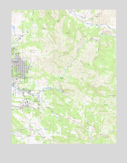
Lower Lake, CA USGS Topographic Map
Click on map above to begin viewing in our Map Viewer.

This topographic map contains these locations and features:
Feature Name Type Latitude Longitude GNIS ID View Map
Al SlidesSlopeN38.9877°W122.5297°218041View Map
Anderson FlatFlatN38.9218°W122.6205°218256View Map
Anderson Flats TrailTrailN38.9213°W122.6219°1766081View Map
Anderson Ranch (historical)LocaleN38.9043°W122.6139°1766080View Map
Baker MineMineN38.8877°W122.5297°218549View Map
Bally PeakSummitN38.9774°W122.5597°218636View Map
Baton FlatFlatN38.9766°W122.5178°218733View Map
Blackeye CanyonValleyN38.9841°W122.6011°219416View Map
Blue Heron SchoolSchoolN38.9123°W122.6082°2516084View Map
Brushy Sky HighSummitN38.9182°W122.5055°219960View Map
Cache Creek School (historical)SchoolN38.9930°W122.5489°1702842View Map
Cache Creek TrailTrailN38.9257°W122.6211°1766084View Map
Church of ChristChurchN38.9463°W122.6172°1766086View Map
Church of the NazareneChurchN38.9635°W122.6205°1766087View Map
Clayton CreekStreamN38.8996°W122.5986°221182View Map
Clear Lake Imp 1080 DamDamN38.9232°W122.5661°1664233View Map
Clear Lake Shopping CenterLocaleN38.9274°W122.6150°1766090View Map
Clear Lake Water Company DamDamN38.9232°W122.5664°1702843View Map
Clearlake DivisionCivilN38.9782°W122.5615°2583190View Map
Copsey CreekStreamN38.9218°W122.5944°221548View Map
Deadman CanyonValleyN38.9721°W122.5222°222110View Map
Deeper Life Christian Fellowship ChurchChurchN38.9105°W122.6058°1766094View Map
Dry CreekStreamN38.9402°W122.5636°222609View Map
Eastlake LandfillLocaleN38.9531°W122.6011°2726383View Map
Excelsior ValleyBasinN38.8807°W122.6017°223308View Map
Ferris CanyonValleyN38.9224°W122.5669°223475View Map
Grizzly CanyonValleyN38.9899°W122.5372°266782View Map
Grizzly CreekStreamN38.9885°W122.5400°266783View Map
Herndon CreekStreamN38.9232°W122.5925°225207View Map
Highlands High SchoolSchoolN38.9142°W122.6077°2516085View Map
Highlands Shopping CenterLocaleN38.9505°W122.6228°1766104View Map
Hrutky Egg RanchLocaleN38.9731°W122.6156°2677543View Map
Indian CreekStreamN38.9974°W122.5522°261730View Map
Kingdom Hall of Jehovahs WitnessesChurchN38.9560°W122.6219°1766112View Map
Konocti Adult SchoolSchoolN38.9143°W122.6080°2516086View Map
Lake Company Sanitation District 1081 DamDamN38.9799°W122.6211°1664235View Map
Lake County Fire Protection District Station 65BuildingN38.9106°W122.6066°2622093View Map
Lake County Fire Protection District Station 72BuildingN38.9335°W122.6239°2622006View Map
Lake County Sheriff's Office Clearlake SubstationBuildingN38.9339°W122.6197°2751014View Map
Lower LakePopulated PlaceN38.9105°W122.6103°277549View Map
Lower Lake CemeteryCemeteryN38.9166°W122.6047°1766124View Map
Lower Lake Census Designated PlaceCensusN38.9118°W122.6085°2408146View Map
Lower Lake Community United Methodist ChurchChurchN38.9113°W122.6089°1766125View Map
Lower Lake DivisionCivilN38.8764°W122.5213°2583197View Map
Lower Lake Elementary SchoolSchoolN38.9123°W122.6079°1766126View Map
Lower Lake High SchoolSchoolN38.9144°W122.6071°236812View Map
Lower Lake Post OfficePost OfficeN38.9101°W122.6105°1766127View Map
Lower Lake Schoolhouse Historic SiteParkN38.9091°W122.6058°1766128View Map
Lower Lake Stone JailBuildingN38.9105°W122.6097°1766129View Map
Lower Lake WineryLocaleN38.8966°W122.6133°1766130View Map
McVicar TrailTrailN38.9191°W122.6242°1766134View Map
Middle CreekStreamN38.9885°W122.5400°263504View Map
North Fork Cache CreekStreamN38.9810°W122.5033°234369View Map
Oak Hill Middle SchoolSchoolN38.9333°W122.6152°1657210View Map
Ogulin CanyonValleyN38.9841°W122.6011°264308View Map
Peachtree CrossingLocaleN38.9366°W122.5691°1659357View Map
Pearce AirportAirportN38.9343°W122.6233°1657243View Map
Pearce Field (historical)AirportN38.9343°W122.6242°1653351View Map
Perkins CreekStreamN38.9843°W122.5211°230529View Map
Perkins Creek RidgeRidgeN38.9618°W122.5536°230530View Map
Phipps CreekStreamN38.9993°W122.5555°230602View Map
Quackenbush MountainSummitN38.9616°W122.5947°1659442View Map
Redbank GorgeValleyN38.9199°W122.5969°231397View Map
Redbud Community HospitalHospitalN38.9355°W122.6199°1766144View Map
Richard H Lewis Alternative SchoolSchoolN38.9121°W122.6096°2516041View Map
Schoolteacher HillSummitN38.9580°W122.6186°1659608View Map
Seigler Canyon CreekStreamN38.9255°W122.6125°253836View Map
Sky HighSummitN38.9118°W122.5122°233217View Map
Soda CanyonValleyN38.9882°W122.5741°267359View Map
Stag CanyonValleyN38.9543°W122.5500°235344View Map
The PeninsulaRidgeN38.9791°W122.5103°236210View Map
Twin LakesPopulated PlaceN38.8843°W122.6180°1766153View Map
Weiper MineMineN38.8893°W122.5391°1702847View Map
William C Carle High SchoolSchoolN38.9147°W122.6046°1766156View Map
Yuba CollegeSchoolN38.9325°W122.6142°1657209View Map

Note: Coordinates in the location and feature list above are referenced to NAD83 datum.


Copyright (C) 2008-2024 Ryan Niemi / Sunset Dynamics ... All Rights Reserved