TopoQuest Logo
Do you find TopoQuest useful?
Help keep TopoQuest running and adding new maps/features by donating!
Bitcoin:  19c7KJd3qBynnjoSw5npx9KScwjBe4ifkT
Litecoin:  LXs6TkuXGGXo1vDsWCkWVdjQX94eUKd6ui
Home View Maps Find Maps Find Places Resources & Links


Agricola, Mississippi Topographic Map

USGS Map Title: Agricola, MS
USGS Map MRC: 30088G5
DRG (GeoTIFF) Download: o30088g5.tif


Neighboring USGS Topographic Map Quads:


  Merrill, MS  
30088H6
 

  Lucedale, MS  
30088H5
 

  Earlville, AL  
30088H4
 

  Basin, MS  
30088G6
 

  Agricola, MS  
30088G5
 

  Howell, MS  
30088G4
 

  Easen Hill, MS  
30088F6
 

  Harleston, MS  
30088F5
 

  Hurley, MS  
30088F4


Map MRC Location:

N31°
W89°
N31°
W88°
H8 H7 H6 H5 H4 H3 H2 H1
G8 G7 G6 G5 G4 G3 G2 G1
F8 F7 F6 F5 F4 F3 F2 F1
E8 E7 E6 E5 E4 E3 E2 E1
D8 D7 D6 D5 D4 D3 D2 D1
C8 C7 C6 C5 C4 C3 C2 C1
B8 B7 B6 B5 B4 B3 B2 B1
A8 A7 A6 A5 A4 A3 A2 A1
N30°
W89°
N30°
W88°

Agricola, MS USGS 1:24K Topographic Map Preview:
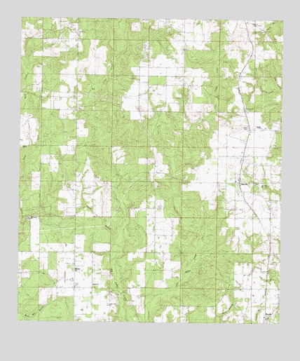
Agricola, MS USGS Topographic Map
Click on map above to begin viewing in our Map Viewer.

This topographic map contains these locations and features:
Feature Name Type Latitude Longitude GNIS ID View Map
AgricolaPopulated PlaceN30.8077°W88.5200°666164View Map
Agricola Baptist ChurchChurchN30.8085°W88.5222°712620View Map
Agricola CemeteryCemeteryN30.8063°W88.5217°709174View Map
Agricola High SchoolSchoolN30.8163°W88.5189°666165View Map
Agricola Volunteer Fire DepartmentBuildingN30.8187°W88.5186°2667760View Map
BartonPopulated PlaceN30.7710°W88.5981°690689View Map
Barton Baptist ChurchChurchN30.7710°W88.5975°709176View Map
Barton CemeteryCemeteryN30.7710°W88.5967°709177View Map
Barton ChurchChurchN30.7705°W88.5978°666551View Map
Barton Volunteer Fire DepartmentBuildingN30.7652°W88.6010°2332861View Map
Basin Temple Church of GodChurchN30.7715°W88.6109°668485View Map
Blue Spring BranchStreamN30.8466°W88.5014°667320View Map
Bond Lake DamDamN30.7502°W88.6217°680484View Map
Cedar Creek Air Ranch AirportAirportN30.8048°W88.5483°2676411View Map
Cedar Creek ChurchChurchN30.7571°W88.5814°690705View Map
E W Smith Lake DamDamN30.8635°W88.6067°680527View Map
Evangel TempleChurchN30.8305°W88.5097°690716View Map
Farmco Field (historical)AirportN30.7669°W88.6000°680305View Map
Finch CemeteryCemeteryN30.7896°W88.5211°690720View Map
Finch CemeteryCemeteryN30.8302°W88.5164°690721View Map
Heritage Baptist ChurchChurchN30.8582°W88.5475°2596443View Map
James Farmer Lake DamDamN30.7519°W88.5467°680485View Map
Lee CemeteryCemeteryN30.8230°W88.5036°690732View Map
Lucedale Country ClubLocaleN30.8713°W88.6028°2596319View Map
Lucedale Country Club Lake DamDamN30.8702°W88.6034°680529View Map
Marshall Smith Lake DamDamN30.8352°W88.5684°680515View Map
Mount Pleasant CemeteryCemeteryN30.7919°W88.6195°709196View Map
Mount Pleasant ChurchChurchN30.7921°W88.6200°690740View Map
MovellaPopulated PlaceN30.7641°W88.5064°674419View Map
Movella CemeteryCemeteryN30.7527°W88.5067°709197View Map
Movella Missionary Baptist ChurchChurchN30.7519°W88.5064°709199View Map
Movella Volunteer Fire DepartmentBuildingN30.7504°W88.5057°2332865View Map
New Hope CemeteryCemeteryN30.8077°W88.5083°709200View Map
New Hope Missionary Baptist ChurchChurchN30.8080°W88.5089°690744View Map
Old Mount Pleasant CemeteryCemeteryN30.7674°W88.6206°709202View Map
Old Mount Pleasant Methodist Church (historical)ChurchN30.7677°W88.6195°709203View Map
Parker LookoutLocaleN30.8177°W88.5600°675463View Map
Pine View CemeteryCemeteryN30.8377°W88.5164°709204View Map
Pine View Missionary Baptist ChurchChurchN30.8377°W88.5170°690752View Map
Refuge CemeteryCemeteryN30.8221°W88.6242°709206View Map
Refuge ChurchChurchN30.8219°W88.6236°676592View Map
Shipman Lookout TowerTowerN30.8738°W88.5145°690761View Map
Sky LandingsAirportN30.8378°W88.5704°2676410View Map
Sprout BranchStreamN30.7810°W88.5770°678192View Map
Union CemeteryCemeteryN30.8746°W88.5642°690764View Map
VaughanPopulated PlaceN30.8591°W88.5156°692290View Map
Vernon Howell Lake DamDamN30.8602°W88.5634°680523View Map
Vernon Howell Lake DamDamN30.8635°W88.5634°680526View Map
WardPopulated PlaceN30.8669°W88.5472°709214View Map
Ward SchoolSchoolN30.8721°W88.5553°679336View Map
Ward Volunteer Fire DepartmentBuildingN30.8454°W88.5634°2332862View Map
White Creek SchoolSchoolN30.7863°W88.6192°679584View Map

Note: Coordinates in the location and feature list above are referenced to NAD83 datum.


Copyright (C) 2008-2024 Ryan Niemi / Sunset Dynamics ... All Rights Reserved