TopoQuest Logo
Do you find TopoQuest useful?
Help keep TopoQuest running and adding new maps/features by donating!
Bitcoin:  19c7KJd3qBynnjoSw5npx9KScwjBe4ifkT
Litecoin:  LXs6TkuXGGXo1vDsWCkWVdjQX94eUKd6ui
Home View Maps Find Maps Find Places Resources & Links


Hurley, Mississippi Topographic Map

USGS Map Title: Hurley, MS
USGS Map MRC: 30088F4
DRG (GeoTIFF) Download: o30088f4.tif


Neighboring USGS Topographic Map Quads:


  Agricola, MS  
30088G5
 

  Howell, MS  
30088G4
 

  Semmes, AL  
30088G3
 

  Harleston, MS  
30088F5
 

  Hurley, MS  
30088F4
 

  Tanner Williams, AL  
30088F3
 

  Three Rivers, MS  
30088E5
 

  Big Point, MS  
30088E4
 

  Saint Elmo, AL  
30088E3


Map MRC Location:

N31°
W89°
N31°
W88°
H8 H7 H6 H5 H4 H3 H2 H1
G8 G7 G6 G5 G4 G3 G2 G1
F8 F7 F6 F5 F4 F3 F2 F1
E8 E7 E6 E5 E4 E3 E2 E1
D8 D7 D6 D5 D4 D3 D2 D1
C8 C7 C6 C5 C4 C3 C2 C1
B8 B7 B6 B5 B4 B3 B2 B1
A8 A7 A6 A5 A4 A3 A2 A1
N30°
W89°
N30°
W88°

Hurley, MS USGS 1:24K Topographic Map Preview:
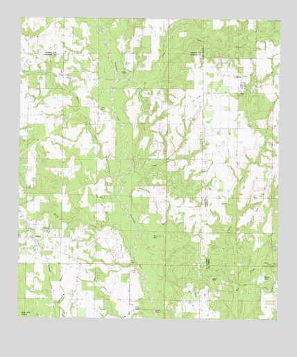
Hurley, MS USGS Topographic Map
Click on map above to begin viewing in our Map Viewer.

This topographic map contains these locations and features:
Feature Name Type Latitude Longitude GNIS ID View Map
Aerohead AirportAirportN30.7080°W88.4301°2676412View Map
Arena (historical)LocaleN30.6294°W88.4431°688890View Map
Blessed Hope Baptist ChurchChurchN30.6545°W88.4916°2596451View Map
Brown's Bridge Boat RampLocaleN30.6292°W88.4339°2596807View Map
Browns BridgeBridgeN30.6288°W88.4353°667640View Map
Devils Den BaySwampN30.6582°W88.4346°669240View Map
Dickens Ferry (historical)CrossingN30.6280°W88.4342°688949View Map
East Central Volunteer Fire Department Station 1BuildingN30.6580°W88.4925°2668086View Map
East Central Volunteer Fire Department Station 2BuildingN30.6589°W88.4924°2332724View Map
First United Pentecostal ChurchChurchN30.6425°W88.4645°2597012View Map
Flat CreekStreamN30.6932°W88.4475°118372View Map
Holiness ChurchChurchN30.7191°W88.3950°120225View Map
HurleyPopulated PlaceN30.6610°W88.4942°671597View Map
Hurley Census Designated PlaceCensusN30.6638°W88.4994°2402606View Map
Hurley Church of ChristChurchN30.6467°W88.4695°2596897View Map
Hurley Post OfficePost OfficeN30.6526°W88.4905°2768794View Map
Hurley United Methodist ChurchChurchN30.6611°W88.4953°2596574View Map
Huyley Baptist ChurchChurchN30.6580°W88.4953°689029View Map
Joyner CemeteryCemeteryN30.7199°W88.3928°143455View Map
Magnolia Springs Assembly of God ChurchChurchN30.6621°W88.4875°2597015View Map
Page CreekStreamN30.6875°W88.4448°124372View Map
Pasture CreekStreamN30.6388°W88.3964°152852View Map
Pierce BranchStreamN30.6619°W88.4436°675716View Map
Pine Grove ChurchChurchN30.6349°W88.4139°689121View Map
Red BluffCliffN30.6760°W88.4595°676515View Map
Roberts ChapelChurchN30.6419°W88.4070°153167View Map
Spring CreekStreamN30.6524°W88.4456°678084View Map
Spring LakeLakeN30.6422°W88.3830°153541View Map
Tanner Williams ChurchChurchN30.7227°W88.3864°1730035View Map
Tanners CemeteryCemeteryN30.7146°W88.4495°689183View Map
Tanners ChapelChurchN30.7271°W88.4489°689184View Map
Tanners Ferry (historical)CrossingN30.7096°W88.4545°689185View Map
Toms BranchStreamN30.7314°W88.4306°128015View Map
Wallace CreekStreamN30.6855°W88.4533°679289View Map
White BluffCliffN30.6435°W88.4433°679566View Map
Wolf BranchStreamN30.6488°W88.3828°154014View Map
Yellow BluffCliffN30.7132°W88.4636°679933View Map

Note: Coordinates in the location and feature list above are referenced to NAD83 datum.


Copyright (C) 2008-2025 Ryan Niemi / Sunset Dynamics ... All Rights Reserved