TopoQuest Logo
Do you find TopoQuest useful?
Help keep TopoQuest running and adding new maps/features by donating!
Bitcoin:  19c7KJd3qBynnjoSw5npx9KScwjBe4ifkT
Litecoin:  LXs6TkuXGGXo1vDsWCkWVdjQX94eUKd6ui
Home View Maps Find Maps Find Places Resources & Links


Harleston, Mississippi Topographic Map

USGS Map Title: Harleston, MS
USGS Map MRC: 30088F5
DRG (GeoTIFF) Download: o30088f5.tif


Neighboring USGS Topographic Map Quads:


  Basin, MS  
30088G6
 

  Agricola, MS  
30088G5
 

  Howell, MS  
30088G4
 

  Easen Hill, MS  
30088F6
 

  Harleston, MS  
30088F5
 

  Hurley, MS  
30088F4
 

  Vancleave, MS  
30088E6
 

  Three Rivers, MS  
30088E5
 

  Big Point, MS  
30088E4


Map MRC Location:

N31°
W89°
N31°
W88°
H8 H7 H6 H5 H4 H3 H2 H1
G8 G7 G6 G5 G4 G3 G2 G1
F8 F7 F6 F5 F4 F3 F2 F1
E8 E7 E6 E5 E4 E3 E2 E1
D8 D7 D6 D5 D4 D3 D2 D1
C8 C7 C6 C5 C4 C3 C2 C1
B8 B7 B6 B5 B4 B3 B2 B1
A8 A7 A6 A5 A4 A3 A2 A1
N30°
W89°
N30°
W88°

Harleston, MS USGS 1:24K Topographic Map Preview:
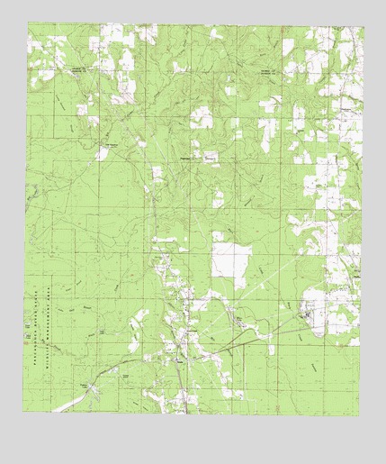
Harleston, MS USGS Topographic Map
Click on map above to begin viewing in our Map Viewer.

This topographic map contains these locations and features:
Feature Name Type Latitude Longitude GNIS ID View Map
Abundant Grace ChurchChurchN30.6487°W88.5372°2596984View Map
Americus Courthouse (historical)LocaleN30.7130°W88.5947°688920View Map
Bethany CemeteryCemeteryN30.6982°W88.5172°688903View Map
Betsy BranchStreamN30.7371°W88.5459°667035View Map
Black Creek SloughGutN30.6852°W88.5975°667219View Map
Camp Ground SloughGutN30.7246°W88.6167°667979View Map
Carter CemeteryCemeteryN30.7352°W88.6170°690704View Map
Cowerts BranchStreamN30.7277°W88.5234°668900View Map
East Central High SchoolSchoolN30.6556°W88.5153°688955View Map
East Central Volunteer Fire Department Station 5BuildingN30.7228°W88.5041°2667718View Map
Ellick LakeLakeN30.6498°W88.6241°669730View Map
Files Pond (historical)LakeN30.6663°W88.6070°688972View Map
First Church of GodChurchN30.6345°W88.5651°2596731View Map
Good Hope ChurchChurchN30.7077°W88.5595°670466View Map
Gopher IslandIslandN30.6257°W88.5128°670529View Map
HarlestonPopulated PlaceN30.7227°W88.5089°670919View Map
Howell Lake DamDamN30.7335°W88.5000°680481View Map
Hurley LookoutLocaleN30.6605°W88.5009°671598View Map
Hurley Lookout TowerTowerN30.6777°W88.5003°689030View Map
Jackson Courthouse (historical)LocaleN30.7130°W88.6175°689040View Map
John Goff SloughGutN30.6752°W88.6070°689043View Map
Johnson BranchStreamN30.6616°W88.5756°671916View Map
Johnson ChapelChurchN30.6510°W88.5647°689044View Map
Kenedy BranchStreamN30.6544°W88.5772°672097View Map
Lices LakeLakeN30.6535°W88.6235°690629View Map
Little Cedar CreekStreamN30.7396°W88.5742°672568View Map
Mile BranchStreamN30.6288°W88.5378°673564View Map
Milstead BranchStreamN30.6871°W88.5520°673663View Map
Movella CemeteryCemeteryN30.7496°W88.5083°709198View Map
Movella ChurchChurchN30.7496°W88.5086°674420View Map
Oak Grove CemeteryCemeteryN30.6752°W88.5733°689094View Map
Oak Grove SchoolSchoolN30.6802°W88.5784°675068View Map
Old AmericusPopulated PlaceN30.7094°W88.5959°692124View Map
Parker's Lake Boat RampLocaleN30.6339°W88.5991°2597134View Map
Parkers IslandIslandN30.6344°W88.5914°675466View Map
Parkers LakeLakeN30.6299°W88.5979°675467View Map
PopetownPopulated PlaceN30.7071°W88.5625°689125View Map
Rosedale ChurchChurchN30.7160°W88.5247°676872View Map
Salem ChurchChurchN30.7332°W88.6095°677269View Map
Sally LakeReservoirN30.6513°W88.5980°689153View Map
Steede CemeteryCemeteryN30.7105°W88.5947°689179View Map
Straw IslandIslandN30.6252°W88.5825°678344View Map
Three Rivers Volunteer Fire Department NorthBuildingN30.6979°W88.5803°2667820View Map
WadePopulated PlaceN30.6424°W88.5697°692298View Map
Wade Baptist ChurchChurchN30.6427°W88.5695°689198View Map
Wade Census Designated PlaceCensusN30.6401°W88.5579°2402976View Map
Wade SchoolSchoolN30.6430°W88.5595°679237View Map
Wilson LakeLakeN30.6561°W88.5471°689204View Map

Note: Coordinates in the location and feature list above are referenced to NAD83 datum.


Copyright (C) 2008-2025 Ryan Niemi / Sunset Dynamics ... All Rights Reserved